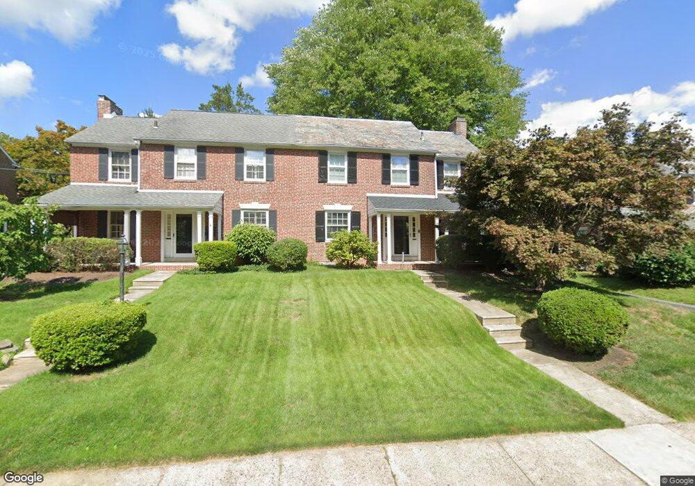
2121 Chestnut Ave Ardmore, PA 19003
Estimated Value: $479,428 - $522,000
3
Beds
1
Bath
1,540
Sq Ft
$326/Sq Ft
Est. Value
About This Home
This home is located at 2121 Chestnut Ave, Ardmore, PA 19003 and is currently estimated at $502,107, approximately $326 per square foot. 2121 Chestnut Ave is a home located in Delaware County with nearby schools including Chestnutwold Elementary School, Haverford Middle School, and Haverford Senior High School.
Ownership History
Date
Name
Owned For
Owner Type
Purchase Details
Closed on
Aug 12, 1994
Sold by
Atlee William A
Bought by
Colleran Maureen
Current Estimated Value
Home Financials for this Owner
Home Financials are based on the most recent Mortgage that was taken out on this home.
Original Mortgage
$85,000
Interest Rate
8.61%
Create a Home Valuation Report for This Property
The Home Valuation Report is an in-depth analysis detailing your home's value as well as a comparison with similar homes in the area
Home Values in the Area
Average Home Value in this Area
Purchase History
| Date | Buyer | Sale Price | Title Company |
|---|---|---|---|
| Colleran Maureen | $150,000 | Commonwealth Land Title Ins |
Source: Public Records
Mortgage History
| Date | Status | Borrower | Loan Amount |
|---|---|---|---|
| Closed | Colleran Maureen | $85,000 |
Source: Public Records
Tax History Compared to Growth
Tax History
| Year | Tax Paid | Tax Assessment Tax Assessment Total Assessment is a certain percentage of the fair market value that is determined by local assessors to be the total taxable value of land and additions on the property. | Land | Improvement |
|---|---|---|---|---|
| 2025 | $6,719 | $261,300 | $97,820 | $163,480 |
| 2024 | $6,719 | $261,300 | $97,820 | $163,480 |
| 2023 | $6,528 | $261,300 | $97,820 | $163,480 |
| 2022 | $6,375 | $261,300 | $97,820 | $163,480 |
| 2021 | $10,386 | $261,300 | $97,820 | $163,480 |
| 2020 | $6,204 | $133,490 | $49,540 | $83,950 |
| 2019 | $6,090 | $133,490 | $49,540 | $83,950 |
| 2018 | $5,986 | $133,490 | $0 | $0 |
| 2017 | $5,859 | $133,490 | $0 | $0 |
| 2016 | $733 | $133,490 | $0 | $0 |
| 2015 | $733 | $133,490 | $0 | $0 |
| 2014 | $733 | $133,490 | $0 | $0 |
Source: Public Records
Map
Nearby Homes
- 442 E Spring Ave
- 1525 W Wynnewood Rd
- 2222 Bryn Mawr Ave
- 2321 Bryn Mawr Ave
- 2313 Haverford Rd
- 2409 Belmont Ave
- 2528 Rosemont Ave
- 101 Grandview Rd
- 421 E Eagle Rd
- 433 Haverford Rd
- 754 Oak View Rd
- 2418 Rosewood Ln
- 761 Hathaway Ln
- 400 Witley Rd
- 1219 W Wynnewood Rd Unit 311
- 383 Lakeside Rd Unit G2
- 383 Lakeside Rd Unit 105
- 64 E Spring Ave
- 2814 Saint Marys Rd
- 140 Walnut Ave
- 2117 Chestnut Ave
- 2125 Chestnut Ave
- 2113 Chestnut Ave
- 2129 Chestnut Ave
- 2116 E County Line Rd
- 2109 Chestnut Ave
- 2120 E County Line Rd
- 2133 Chestnut Ave
- 2126 E County Line Rd
- 2110 E County Line Rd
- 2105 Chestnut Ave
- 2118 Chestnut Ave
- 2114 Chestnut Ave
- 2122 Chestnut Ave
- 2137 Chestnut Ave
- 2110 Chestnut Ave
- 2126 Chestnut Ave
- 2104 E County Line Rd
- 2101 Chestnut Ave
- 2106 Chestnut Ave