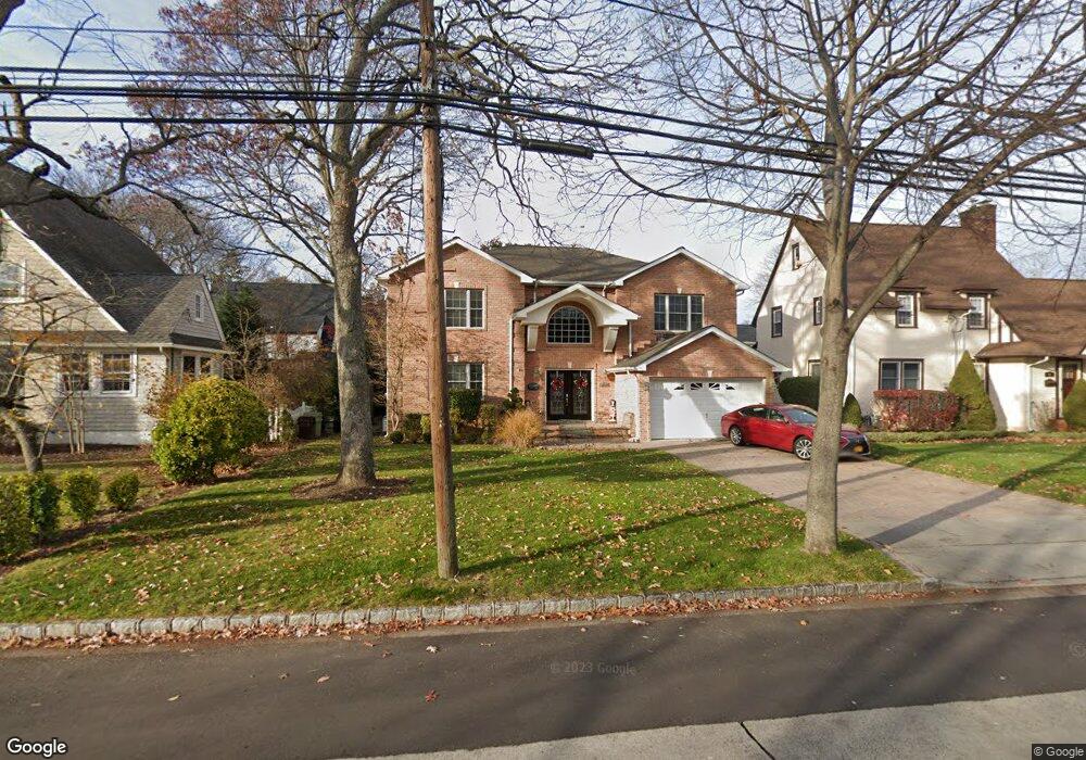
2121 Loines Ave Merrick, NY 11566
Estimated Value: $1,120,437 - $1,188,000
4
Beds
3
Baths
2,732
Sq Ft
$422/Sq Ft
Est. Value
About This Home
This home is located at 2121 Loines Ave, Merrick, NY 11566 and is currently estimated at $1,154,219, approximately $422 per square foot. 2121 Loines Ave is a home located in Nassau County with nearby schools including Merrick Avenue Middle School, Sanford H Calhoun High School, and Grace Christian Academy.
Ownership History
Date
Name
Owned For
Owner Type
Purchase Details
Closed on
May 12, 2015
Sold by
Colasuonno Linda and Colasuonno Louis
Bought by
Colasuonno Linda Diekroger and Calasuonno Louis
Current Estimated Value
Purchase Details
Closed on
Mar 9, 2006
Sold by
Fox Celia
Bought by
Colasuonno Linda
Purchase Details
Closed on
Apr 1, 2005
Sold by
Lemek Denis
Bought by
J & R Renovations Inc
Purchase Details
Closed on
Oct 27, 2003
Sold by
Weigand Christine
Bought by
Lemek Denis
Purchase Details
Closed on
Feb 5, 1997
Sold by
Haviland Joseph
Bought by
Weigand Christopher and Weigand Christine
Create a Home Valuation Report for This Property
The Home Valuation Report is an in-depth analysis detailing your home's value as well as a comparison with similar homes in the area
Home Values in the Area
Average Home Value in this Area
Purchase History
| Date | Buyer | Sale Price | Title Company |
|---|---|---|---|
| Colasuonno Linda Diekroger | -- | None Available | |
| Colasuonno Linda | $875,000 | -- | |
| J & R Renovations Inc | $470,000 | -- | |
| Lemek Denis | $415,000 | -- | |
| Weigand Christopher | $160,000 | -- |
Source: Public Records
Tax History
| Year | Tax Paid | Tax Assessment Tax Assessment Total Assessment is a certain percentage of the fair market value that is determined by local assessors to be the total taxable value of land and additions on the property. | Land | Improvement |
|---|---|---|---|---|
| 2025 | $21,947 | $723 | $197 | $526 |
| 2024 | $4,833 | $733 | $200 | $533 |
Source: Public Records
Map
Nearby Homes
- 138 Hewlett Ave
- 24 Loines Ave
- 18 Helene Ave
- 19 Margaret Blvd
- 70 Nancy Blvd
- 204 Margaret Blvd
- 1931 Miller Place
- 1911 Carroll Ave
- 43 Wynsum Ave
- 2 Garfield St
- 204 Howell St
- 1680 Lake Ave
- 1715 Remson Ave
- 2203 Washington St
- 132 Webster St
- 2009 Newbridge Rd
- TBD Camp Ave
- 2434 Martin Ave
- 20 Kenneth Ave
- 1811 Bedford Ave
Your Personal Tour Guide
Ask me questions while you tour the home.