Estimated Value: $197,000 - $226,000
3
Beds
2
Baths
1,081
Sq Ft
$197/Sq Ft
Est. Value
About This Home
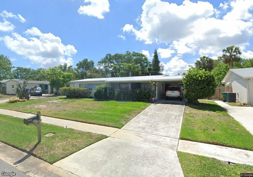
This home is located at 2121 Muskingum Ave, Cocoa, FL 32926 and is currently estimated at $212,831, approximately $196 per square foot. 2121 Muskingum Ave is a home located in Brevard County with nearby schools including Cambridge Elementary Magnet School, Cocoa High School, and Emma Jewel Charter Academy.
Ownership History
Date
Name
Owned For
Owner Type
Purchase Details
Closed on
Mar 5, 2020
Sold by
Mock Susan M
Bought by
Mock Susan M and Stafford Brian L
Current Estimated Value
Purchase Details
Closed on
Jul 11, 2005
Sold by
Stafford Susan M
Bought by
Mock Susan M
Home Financials for this Owner
Home Financials are based on the most recent Mortgage that was taken out on this home.
Original Mortgage
$83,000
Interest Rate
5.54%
Mortgage Type
Fannie Mae Freddie Mac
Create a Home Valuation Report for This Property
The Home Valuation Report is an in-depth analysis detailing your home's value as well as a comparison with similar homes in the area
Home Values in the Area
Average Home Value in this Area
Purchase History
| Date | Buyer | Sale Price | Title Company |
|---|---|---|---|
| Mock Susan M | -- | Attorney | |
| Mock Susan M | -- | Nations Title Agency |
Source: Public Records
Mortgage History
| Date | Status | Borrower | Loan Amount |
|---|---|---|---|
| Closed | Mock Susan M | $83,000 |
Source: Public Records
Tax History Compared to Growth
Tax History
| Year | Tax Paid | Tax Assessment Tax Assessment Total Assessment is a certain percentage of the fair market value that is determined by local assessors to be the total taxable value of land and additions on the property. | Land | Improvement |
|---|---|---|---|---|
| 2025 | $738 | $66,160 | -- | -- |
| 2024 | $703 | $64,300 | -- | -- |
| 2023 | $703 | $60,140 | $0 | $0 |
| 2022 | $649 | $58,390 | $0 | $0 |
| 2021 | $636 | $56,690 | $0 | $0 |
| 2020 | $865 | $55,910 | $0 | $0 |
| 2019 | $852 | $54,660 | $0 | $0 |
| 2018 | $740 | $53,650 | $0 | $0 |
| 2017 | $741 | $52,550 | $0 | $0 |
| 2016 | $740 | $51,470 | $19,000 | $32,470 |
| 2015 | $746 | $51,120 | $19,000 | $32,120 |
| 2014 | $698 | $50,720 | $19,000 | $31,720 |
Source: Public Records
Map
Nearby Homes
- 00 N Unknown
- 0000 Unknown
- 00000 Unknown
- 2111 Otterbein Ave
- 2523 Auburn Dr
- 1933 Quail Ridge Ct Unit 1101
- 1627 Calvados Dr
- 2426 Granville Dr
- 1954 Quail Ridge Ct Unit 1704
- 2411 Stanford Dr
- 2413 Cherbourg Rd
- 2314 Mercer Dr
- 2713 Winchester Dr
- 3004 Winchester Dr
- 2702 Winchester Dr
- 2221 Catawba Dr
- 3104 Winchester Dr
- 3116 Winchester Dr
- 1556 University Ln Unit 406
- 3057 Skyline Dr
- 2117 Muskingum Ave
- 2125 Muskingum Ave
- 2113 Muskingum Ave
- 2122 Muskingum Ave
- 2129 Muskingum Ave
- 2126 Muskingum Ave
- 2118 Muskingum Ave
- 2109 Muskingum Ave
- 2134 Muskingum Ave
- 2809 Denison Ct
- 2133 Muskingum Ave
- 2813 Denison Ct
- 2805 Denison Ct
- 2105 Muskingum Ave
- 2106 Muskingum Ave
- 3 Vacant Lots Satellite Blv
- 0 Brothy Unit 507540
- 0 0000 Unit 520165
- 0 Brothy Unit 543106
- 0 Ardelle Lane and Pioneer Unit 555933