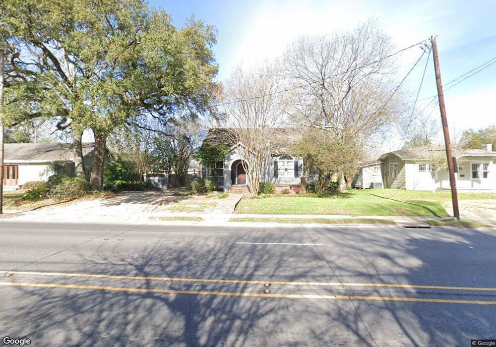
2121 Stanford Ave Baton Rouge, LA 70808
Highlands/Perkins NeighborhoodEstimated Value: $499,000 - $566,000
4
Beds
3
Baths
2,503
Sq Ft
$213/Sq Ft
Est. Value
About This Home
This home is located at 2121 Stanford Ave, Baton Rouge, LA 70808 and is currently estimated at $533,017, approximately $212 per square foot. 2121 Stanford Ave is a home located in East Baton Rouge Parish with nearby schools including Buchanan Elementary School, Glasgow Middle School, and Mckinley Senior High School.
Ownership History
Date
Name
Owned For
Owner Type
Purchase Details
Closed on
Oct 30, 2007
Sold by
Holden Micah P
Bought by
Futch Landon T
Current Estimated Value
Home Financials for this Owner
Home Financials are based on the most recent Mortgage that was taken out on this home.
Original Mortgage
$410,000
Outstanding Balance
$258,606
Interest Rate
6.32%
Mortgage Type
New Conventional
Estimated Equity
$274,411
Purchase Details
Closed on
Apr 29, 2005
Sold by
Well Clay
Bought by
Holden Micah
Home Financials for this Owner
Home Financials are based on the most recent Mortgage that was taken out on this home.
Original Mortgage
$175,100
Interest Rate
5.93%
Mortgage Type
New Conventional
Create a Home Valuation Report for This Property
The Home Valuation Report is an in-depth analysis detailing your home's value as well as a comparison with similar homes in the area
Home Values in the Area
Average Home Value in this Area
Purchase History
| Date | Buyer | Sale Price | Title Company |
|---|---|---|---|
| Futch Landon T | $410,000 | -- | |
| Holden Micah | $218,900 | -- |
Source: Public Records
Mortgage History
| Date | Status | Borrower | Loan Amount |
|---|---|---|---|
| Open | Futch Landon T | $410,000 | |
| Previous Owner | Holden Micah | $175,100 |
Source: Public Records
Tax History Compared to Growth
Tax History
| Year | Tax Paid | Tax Assessment Tax Assessment Total Assessment is a certain percentage of the fair market value that is determined by local assessors to be the total taxable value of land and additions on the property. | Land | Improvement |
|---|---|---|---|---|
| 2024 | $4,465 | $44,856 | $7,500 | $37,356 |
| 2023 | $4,465 | $43,610 | $7,500 | $36,110 |
| 2022 | $5,207 | $43,610 | $7,500 | $36,110 |
| 2021 | $5,088 | $43,610 | $7,500 | $36,110 |
| 2020 | $5,054 | $43,610 | $7,500 | $36,110 |
| 2019 | $5,268 | $43,500 | $7,500 | $36,000 |
| 2018 | $5,203 | $43,500 | $7,500 | $36,000 |
| 2017 | $5,203 | $43,500 | $7,500 | $36,000 |
| 2016 | $4,296 | $43,500 | $7,500 | $36,000 |
| 2015 | $4,300 | $43,500 | $7,500 | $36,000 |
| 2014 | $4,285 | $43,500 | $7,500 | $36,000 |
| 2013 | -- | $43,500 | $7,500 | $36,000 |
Source: Public Records
Map
Nearby Homes
- 2182 Stanford Ave
- 2024 Myrtledale Ave
- 1824 Myrtledale Ave
- 1828 Cloverdale Ave
- 2267 Cedardale Ave
- 1937 Cedardale Ave
- 2237 Perkins Ln
- 4025 Perkins Lane Alley
- 2212 Idle Oaks Dr
- 3109 E Lakeshore Dr
- 3381 E Lakeshore Dr
- 3147 E Lakeshore Dr
- 1509 Stanford Ave Unit A3
- 2198 Christian St
- 2192 Christian St
- 2434 Honeysuckle Ave
- 2854 Yazoo St
- 1525 Hood Ave
- 4243 Poplar St
- 4013 Hyacinth Ave
- 2107 Stanford Ave
- 2137 Stanford Ave
- 2108 Cherrydale Ave
- 2151 Stanford Ave
- 2122 Cherrydale Ave
- 2138 Cherrydale Ave
- 2069 Stanford Ave
- 2154 Cherrydale Ave
- 2165 Stanford Ave
- 2120 Stanford Ave
- 2070 Cherrydale Ave
- 2138 Stanford Ave
- 2106 Stanford Ave
- 2152 Stanford Ave
- 2047 Stanford Ave
- 2168 Cherrydale Ave
- 2148 Stanford Ave
- 2181 Stanford Ave
- 2181 Stanford Ave Unit REAR APT
- 2060 Cherrydale Ave