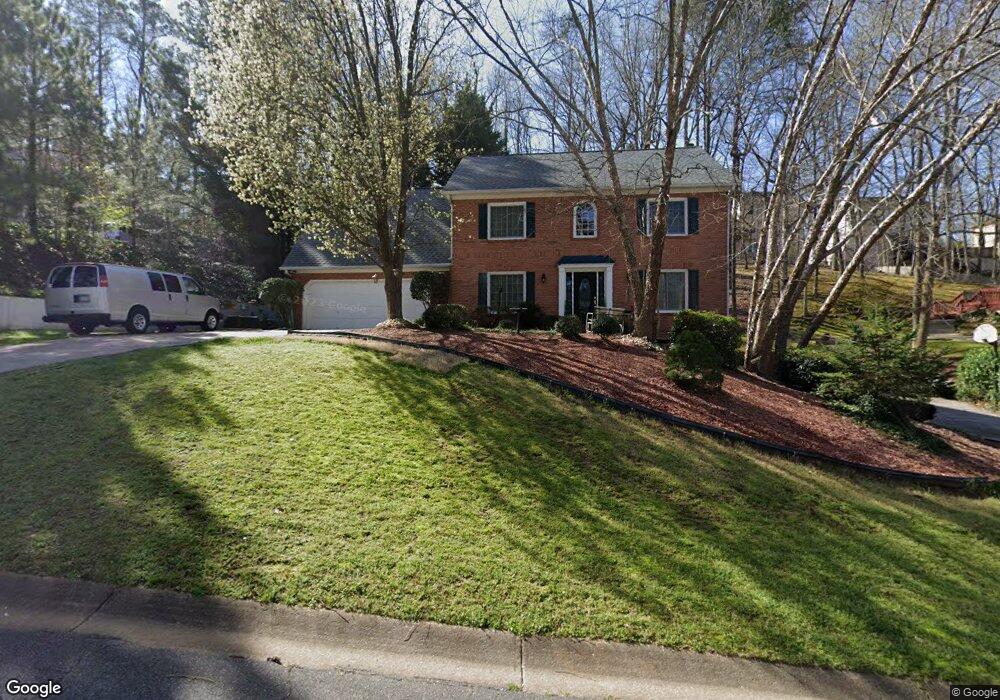
2121 Yorkshire Ct Woodstock, GA 30189
Oak Grove NeighborhoodEstimated Value: $459,000 - $510,738
4
Beds
3
Baths
2,492
Sq Ft
$195/Sq Ft
Est. Value
About This Home
This home is located at 2121 Yorkshire Ct, Woodstock, GA 30189 and is currently estimated at $484,869, approximately $194 per square foot. 2121 Yorkshire Ct is a home located in Cherokee County with nearby schools including Carmel Elementary School, Woodstock Middle School, and Woodstock High School.
Ownership History
Date
Name
Owned For
Owner Type
Purchase Details
Closed on
Jun 24, 2011
Sold by
Home Equity Mtg
Bought by
Brown James
Current Estimated Value
Home Financials for this Owner
Home Financials are based on the most recent Mortgage that was taken out on this home.
Original Mortgage
$130,603
Outstanding Balance
$93,620
Interest Rate
5.5%
Mortgage Type
FHA
Estimated Equity
$391,249
Purchase Details
Closed on
Sep 7, 2010
Sold by
Moody Billy and Moody Regina
Bought by
Deutsche Bank Inabs 2007-B
Purchase Details
Closed on
Jun 15, 2007
Sold by
Anytime Bail Bonding Inc
Bought by
Moody Regina
Home Financials for this Owner
Home Financials are based on the most recent Mortgage that was taken out on this home.
Original Mortgage
$144,300
Interest Rate
6.1%
Mortgage Type
New Conventional
Create a Home Valuation Report for This Property
The Home Valuation Report is an in-depth analysis detailing your home's value as well as a comparison with similar homes in the area
Home Values in the Area
Average Home Value in this Area
Purchase History
| Date | Buyer | Sale Price | Title Company |
|---|---|---|---|
| Brown James | $134,000 | -- | |
| Deutsche Bank Inabs 2007-B | $147,790 | -- | |
| Moody Regina | -- | -- |
Source: Public Records
Mortgage History
| Date | Status | Borrower | Loan Amount |
|---|---|---|---|
| Open | Brown James | $130,603 | |
| Previous Owner | Moody Regina | $144,300 |
Source: Public Records
Tax History Compared to Growth
Tax History
| Year | Tax Paid | Tax Assessment Tax Assessment Total Assessment is a certain percentage of the fair market value that is determined by local assessors to be the total taxable value of land and additions on the property. | Land | Improvement |
|---|---|---|---|---|
| 2024 | $4,229 | $186,724 | $32,000 | $154,724 |
| 2023 | $3,487 | $172,132 | $32,000 | $140,132 |
| 2022 | $3,432 | $146,932 | $24,000 | $122,932 |
| 2021 | $3,095 | $119,932 | $16,800 | $103,132 |
| 2020 | $3,048 | $117,812 | $16,800 | $101,012 |
| 2019 | $2,758 | $105,320 | $16,800 | $88,520 |
| 2018 | $2,650 | $100,160 | $16,800 | $83,360 |
| 2017 | $2,523 | $234,800 | $16,800 | $77,120 |
| 2016 | $2,326 | $211,400 | $14,400 | $70,160 |
| 2015 | $2,295 | $205,700 | $14,400 | $67,880 |
| 2014 | $2,196 | $194,800 | $14,000 | $63,920 |
Source: Public Records
Map
Nearby Homes
- 4992 Shallow Ridge Rd NE
- 1816 Yorkshire Dr
- 2111 Yorkshire Ct
- 2108 Yorkshire Ct
- 1502 Lake Koinonia Dr
- 4904 Shallow Creek Trail NW
- 414 Delancy Dr
- 221 Ellis Ln
- 510 Cooper Ln
- 209 Ellis Ln
- 4903 Shallow Creek Trail NW
- 4978 Thornwood Cove NW
- 4825 Shallow Creek Dr NW
- 163 Castleair Ct NE
- 221 Holden Way
- 150 Holden Way
- 2119 Yorkshire Ct
- 2123 Yorkshire Ct
- 4980 Shallow Ridge Rd NE
- 4982 Shallow Ridge Rd NE
- 4982 Shallow Ridge Rd NE
- 2120 Yorkshire Ct
- 2122 Yorkshire Ct
- 2125 Yorkshire Ct
- 0 Shallow Ridge Rd NE Unit 8727260
- 0 Shallow Ridge Rd NE Unit 8619684
- 0 Shallow Ridge Rd NE Unit 8520827
- 0 Shallow Ridge Rd NE Unit 8481974
- 0 Shallow Ridge Rd NE Unit 8471496
- 0 Shallow Ridge Rd NE Unit 8408601
- 0 Shallow Ridge Rd NE Unit 8387201
- 0 Shallow Ridge Rd NE Unit 8251909
- 0 Shallow Ridge Rd NE Unit 8183012
- 0 Shallow Ridge Rd NE Unit 8137346
- 0 Shallow Ridge Rd NE Unit 8083300
- 0 Shallow Ridge Rd NE Unit 8039823