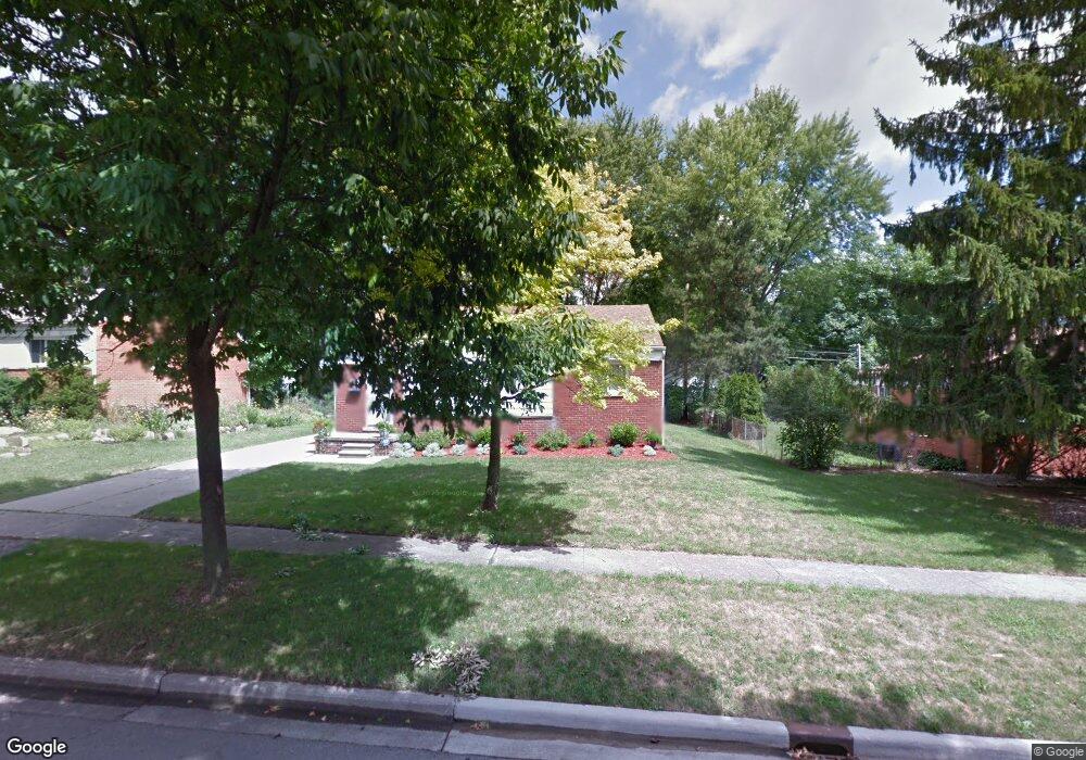
2122 Barstow Rd Lansing, MI 48906
Northwestside NeighborhoodEstimated Value: $152,757 - $198,000
Studio
--
Bath
1,008
Sq Ft
$175/Sq Ft
Est. Value
About This Home
This home is located at 2122 Barstow Rd, Lansing, MI 48906 and is currently estimated at $176,689, approximately $175 per square foot. 2122 Barstow Rd is a home located in Ingham County with nearby schools including Cumberland Elementary School, Pattengill Academy, and J.W. Sexton High School.
Ownership History
Date
Name
Owned For
Owner Type
Purchase Details
Closed on
Oct 7, 2013
Sold by
Morrissey Brenda K and Muth Linda S
Bought by
Luks Karen S and Luks Karen
Current Estimated Value
Home Financials for this Owner
Home Financials are based on the most recent Mortgage that was taken out on this home.
Original Mortgage
$60,000
Outstanding Balance
$45,085
Interest Rate
4.5%
Mortgage Type
New Conventional
Estimated Equity
$131,604
Purchase Details
Closed on
Jul 3, 2004
Sold by
Sparks Norma Jean
Bought by
Sparks Family Trust
Create a Home Valuation Report for This Property
The Home Valuation Report is an in-depth analysis detailing your home's value as well as a comparison with similar homes in the area
Home Values in the Area
Average Home Value in this Area
Purchase History
| Date | Buyer | Sale Price | Title Company |
|---|---|---|---|
| Luks Karen S | $75,000 | None Available | |
| Sparks Family Trust | -- | None Available |
Source: Public Records
Mortgage History
| Date | Status | Borrower | Loan Amount |
|---|---|---|---|
| Open | Luks Karen S | $60,000 |
Source: Public Records
Tax History
| Year | Tax Paid | Tax Assessment Tax Assessment Total Assessment is a certain percentage of the fair market value that is determined by local assessors to be the total taxable value of land and additions on the property. | Land | Improvement |
|---|---|---|---|---|
| 2025 | $3,060 | $67,600 | $10,100 | $57,500 |
| 2024 | $24 | $64,100 | $10,100 | $54,000 |
| 2023 | $2,869 | $56,700 | $10,100 | $46,600 |
| 2022 | $2,587 | $55,800 | $9,500 | $46,300 |
| 2021 | $2,533 | $52,400 | $7,900 | $44,500 |
| 2020 | $2,517 | $49,300 | $7,900 | $41,400 |
| 2019 | $2,413 | $42,900 | $7,900 | $35,000 |
| 2018 | $2,261 | $41,400 | $7,900 | $33,500 |
| 2017 | $2,165 | $41,400 | $7,900 | $33,500 |
| 2016 | $2,070 | $37,800 | $7,900 | $29,900 |
| 2015 | $2,070 | $37,400 | $15,750 | $21,650 |
| 2014 | $2,070 | $36,700 | $18,900 | $17,800 |
Source: Public Records
Map
Nearby Homes
- 2800 Tecumseh River Rd
- 2302 Northwest Ave
- 3116 Colchester Rd
- 2300 Byrnes Rd
- 2206 Kuerbitz Dr
- 2313 Kuerbitz Dr
- 2111 Delta River Dr
- 3336 Tecumseh River Rd
- 3601 N Grand River Ave
- 4005 N Grand River Ave
- 2817 W Willow St
- 2601 Newport Dr
- 4221 N Grand River Ave
- 3500 Colchester Rd
- 1425 Muskegon Ave
- 3021 N Grand River Ave
- 3017 Alfred Ave
- 1421 Lamont St
- 1805 Boynton Dr
- 1413 N Jenison Ave
- 2202 Barstow Rd
- 2116 Barstow Rd
- 2119 Westbury Rd
- 2113 Westbury Rd
- 2203 Westbury Rd
- 2110 Barstow Rd
- 2210 Barstow Rd
- 2121 Barstow Rd
- 2203 Barstow Rd
- 2209 Westbury Rd
- 2115 Barstow Rd
- 2214 Barstow Rd
- 2104 Barstow Rd
- 2103 Westbury Rd
- 2215 Westbury Rd
- 2107 Barstow Rd
- 2215 Barstow Rd
- 2220 Barstow Rd
- 2128 Dillingham Ave
- 2116 Westbury Rd
Your Personal Tour Guide
Ask me questions while you tour the home.