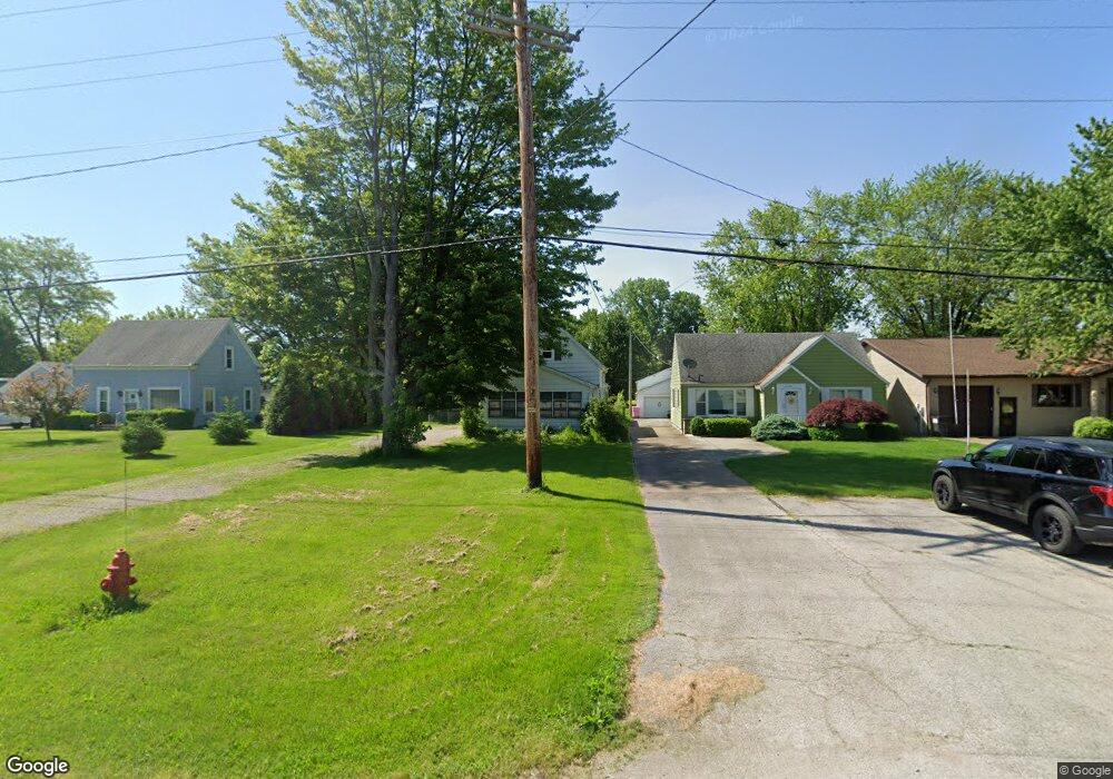
2122 E State Rd Port Clinton, OH 43452
Estimated Value: $98,000 - $171,000
2
Beds
3
Baths
988
Sq Ft
$137/Sq Ft
Est. Value
About This Home
This home is located at 2122 E State Rd, Port Clinton, OH 43452 and is currently estimated at $135,632, approximately $137 per square foot. 2122 E State Rd is a home located in Ottawa County with nearby schools including Bataan Memorial Primary School, Bataan Memorial Intermediate School, and Port Clinton Middle School.
Ownership History
Date
Name
Owned For
Owner Type
Purchase Details
Closed on
Oct 24, 2016
Sold by
Stocker Jacquelynn
Bought by
Elliott Jessica and Elliott Charles
Current Estimated Value
Home Financials for this Owner
Home Financials are based on the most recent Mortgage that was taken out on this home.
Original Mortgage
$40,000
Outstanding Balance
$29,461
Interest Rate
3.44%
Mortgage Type
VA
Estimated Equity
$106,171
Purchase Details
Closed on
Aug 9, 2016
Sold by
Holman Robert J Trustee
Bought by
Stocker Jacquelyn Succ Trustee
Purchase Details
Closed on
Aug 3, 2015
Sold by
Holman Robert J
Bought by
Holman Robert J and The Revocable Living Trust Agreement Of
Purchase Details
Closed on
Jun 10, 2002
Sold by
Trst Theresa C Holman
Bought by
Holman Robert J
Purchase Details
Closed on
Nov 19, 1992
Sold by
Holman Joseph
Bought by
Holman Joseph and Holman Theresa S
Create a Home Valuation Report for This Property
The Home Valuation Report is an in-depth analysis detailing your home's value as well as a comparison with similar homes in the area
Home Values in the Area
Average Home Value in this Area
Purchase History
| Date | Buyer | Sale Price | Title Company |
|---|---|---|---|
| Elliott Jessica | $40,000 | Hartung Title | |
| Stocker Jacquelyn Succ Trustee | -- | -- | |
| Holman Robert J | -- | Attorney | |
| Holman Robert J | $68,900 | -- | |
| Holman Joseph | -- | -- |
Source: Public Records
Mortgage History
| Date | Status | Borrower | Loan Amount |
|---|---|---|---|
| Open | Elliott Jessica | $40,000 | |
| Closed | Holman Robert J | -- |
Source: Public Records
Tax History
| Year | Tax Paid | Tax Assessment Tax Assessment Total Assessment is a certain percentage of the fair market value that is determined by local assessors to be the total taxable value of land and additions on the property. | Land | Improvement |
|---|---|---|---|---|
| 2024 | $949 | $28,217 | $4,375 | $23,842 |
| 2023 | $1,326 | $20,598 | $2,188 | $18,410 |
| 2022 | $1,127 | $20,598 | $2,188 | $18,410 |
| 2021 | $1,126 | $20,600 | $2,190 | $18,410 |
| 2020 | $1,158 | $20,600 | $2,190 | $18,410 |
| 2019 | $1,145 | $20,600 | $2,190 | $18,410 |
| 2018 | $1,120 | $20,600 | $2,190 | $18,410 |
| 2017 | $1,131 | $20,580 | $2,190 | $18,390 |
| 2016 | $792 | $20,580 | $2,190 | $18,390 |
| 2015 | $794 | $20,580 | $2,190 | $18,390 |
| 2014 | $358 | $18,410 | $2,190 | $16,220 |
| 2013 | $718 | $18,410 | $2,190 | $16,220 |
Source: Public Records
Map
Nearby Homes
- 19 N Beach St
- 2650 E Harbor Rd
- 0 E Harbor Rd
- 1807 E Perry St Unit 69
- 111 Morningside Dr
- 188 Driftwood Dr
- 164 Driftwood Dr
- 183 Driftwood Dr
- 1801 E Perry St Unit 22
- 1801 E Perry St Unit 28
- 1990 E Lockwood Rd
- 2350 E Sand Rd
- 1630 Waters Edge Dr
- 311 Walnut St
- 1506 E Perry St
- 116 Walnut St
- 35 N Beach St
- 29 N Beach St
- 232 Beech St
- 1011 E 2nd St
- 2120 E State Rd
- 2126 E State Rd
- 2118 E State Rd
- 2118 E State Rd
- 2114 E State Rd
- 2123 E State Rd
- 2110 E State Rd
- 2121 E State Rd
- 2140 E State Rd
- 2117 E State Rd
- 2133 E State Rd
- 2144 E State Rd
- 2145 E State Rd
- 2160 E State Rd
- 2157 E State Rd
- 2162 E State Rd
- 2169 E State Rd
- 2143 E State Rd
- 2032 E State Rd
- 2015 E State Rd
Your Personal Tour Guide
Ask me questions while you tour the home.