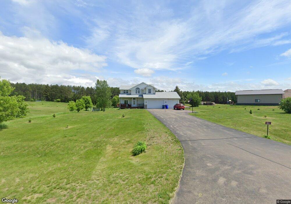
2123 62nd St Somerset, WI 54025
Estimated Value: $416,725 - $468,000
4
Beds
2
Baths
2,254
Sq Ft
$196/Sq Ft
Est. Value
About This Home
This home is located at 2123 62nd St, Somerset, WI 54025 and is currently estimated at $441,181, approximately $195 per square foot. 2123 62nd St is a home located in St. Croix County with nearby schools including Somerset Elementary School, Somerset Middle School, and Somerset High School.
Ownership History
Date
Name
Owned For
Owner Type
Purchase Details
Closed on
Aug 31, 2020
Sold by
Berrey Mindy and Berrey Brandon
Bought by
Persells Jeremy and Persells Ashley
Current Estimated Value
Home Financials for this Owner
Home Financials are based on the most recent Mortgage that was taken out on this home.
Original Mortgage
$268,000
Outstanding Balance
$238,269
Interest Rate
3%
Mortgage Type
New Conventional
Estimated Equity
$202,912
Purchase Details
Closed on
Dec 14, 2007
Sold by
Emc Mortgage Corp
Bought by
Berrey Mindy and Berrey Brandon
Home Financials for this Owner
Home Financials are based on the most recent Mortgage that was taken out on this home.
Original Mortgage
$170,096
Interest Rate
6.39%
Mortgage Type
Purchase Money Mortgage
Purchase Details
Closed on
Jul 31, 2007
Sold by
Freese Troy E
Bought by
Emc Mortgage Corp
Create a Home Valuation Report for This Property
The Home Valuation Report is an in-depth analysis detailing your home's value as well as a comparison with similar homes in the area
Home Values in the Area
Average Home Value in this Area
Purchase History
| Date | Buyer | Sale Price | Title Company |
|---|---|---|---|
| Persells Jeremy | $335,000 | St Croix County Abstract & T | |
| Berrey Mindy | $172,500 | None Available | |
| Emc Mortgage Corp | -- | None Available |
Source: Public Records
Mortgage History
| Date | Status | Borrower | Loan Amount |
|---|---|---|---|
| Open | Persells Jeremy | $268,000 | |
| Previous Owner | Berrey Mindy | $170,096 |
Source: Public Records
Tax History Compared to Growth
Tax History
| Year | Tax Paid | Tax Assessment Tax Assessment Total Assessment is a certain percentage of the fair market value that is determined by local assessors to be the total taxable value of land and additions on the property. | Land | Improvement |
|---|---|---|---|---|
| 2024 | $32 | $324,100 | $90,200 | $233,900 |
| 2023 | $3,169 | $324,100 | $90,200 | $233,900 |
| 2022 | $3,201 | $324,100 | $90,200 | $233,900 |
| 2021 | $3,208 | $219,400 | $55,200 | $164,200 |
| 2020 | $3,219 | $219,400 | $55,200 | $164,200 |
| 2019 | $2,863 | $219,400 | $55,200 | $164,200 |
| 2018 | $2,912 | $219,400 | $55,200 | $164,200 |
| 2017 | $2,816 | $219,400 | $55,200 | $164,200 |
| 2016 | $2,816 | $169,900 | $25,100 | $144,800 |
| 2015 | $2,696 | $169,900 | $25,100 | $144,800 |
| 2014 | $2,557 | $169,900 | $25,100 | $144,800 |
| 2013 | $2,564 | $169,900 | $25,100 | $144,800 |
Source: Public Records
Map
Nearby Homes
- 2136 62nd St
- 6XX 205th Ave
- 1986 57th St
- 462 210th Ave
- 1932 64th St
- 2113 80th St
- Lot #1 xxx 74th St
- Lot #19 xxx 74th St
- Lot #14 xxx 74th St
- 357 Harriman St
- 315 Harriman St
- 481 Martin Way
- 413 210th Ave
- 441 Charles Ln
- 316 Evergreen Dr
- 441 White Pine Ln
- 206 Red Pine Dr
- The Rockport Plan at Pine Vale
- The Newport Plan at Pine Vale
- The Brook View Plan at Pine Vale