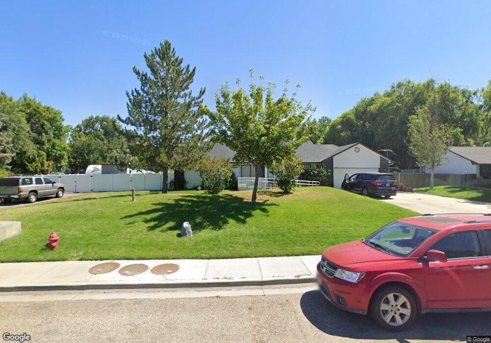
2123 Brookside Dr Caldwell, ID 83605
Estimated Value: $427,000 - $469,000
2
Beds
2
Baths
2,158
Sq Ft
$209/Sq Ft
Est. Value
About This Home
This home is located at 2123 Brookside Dr, Caldwell, ID 83605 and is currently estimated at $451,431, approximately $209 per square foot. 2123 Brookside Dr is a home located in Canyon County with nearby schools including Wilson Elementary School, Jefferson Middle School, and Caldwell Senior High School.
Ownership History
Date
Name
Owned For
Owner Type
Purchase Details
Closed on
Nov 19, 2025
Sold by
Baxter Gene R and Baxter Phyllis M
Bought by
Martinez James Patrick and Rife Tiana Cherie
Current Estimated Value
Home Financials for this Owner
Home Financials are based on the most recent Mortgage that was taken out on this home.
Original Mortgage
$197,500
Outstanding Balance
$196,937
Interest Rate
6.27%
Mortgage Type
New Conventional
Estimated Equity
$254,494
Create a Home Valuation Report for This Property
The Home Valuation Report is an in-depth analysis detailing your home's value as well as a comparison with similar homes in the area
Home Values in the Area
Average Home Value in this Area
Purchase History
| Date | Buyer | Sale Price | Title Company |
|---|---|---|---|
| Martinez James Patrick | -- | Venture Title |
Source: Public Records
Mortgage History
| Date | Status | Borrower | Loan Amount |
|---|---|---|---|
| Open | Martinez James Patrick | $197,500 |
Source: Public Records
Tax History
| Year | Tax Paid | Tax Assessment Tax Assessment Total Assessment is a certain percentage of the fair market value that is determined by local assessors to be the total taxable value of land and additions on the property. | Land | Improvement |
|---|---|---|---|---|
| 2025 | $1,801 | $481,000 | $117,000 | $364,000 |
| 2024 | $1,801 | $467,800 | $104,000 | $363,800 |
| 2023 | $1,825 | $456,100 | $104,000 | $352,100 |
| 2022 | $2,685 | $480,700 | $104,000 | $376,700 |
| 2021 | $2,845 | $355,200 | $65,000 | $290,200 |
| 2020 | $2,740 | $283,600 | $48,800 | $234,800 |
| 2019 | $2,711 | $266,700 | $35,000 | $231,700 |
| 2018 | $2,515 | $0 | $0 | $0 |
| 2017 | $2,235 | $0 | $0 | $0 |
| 2016 | $1,928 | $0 | $0 | $0 |
| 2015 | $1,775 | $0 | $0 | $0 |
| 2014 | $1,837 | $169,700 | $21,000 | $148,700 |
Source: Public Records
Map
Nearby Homes
- 2102 Washington Ave
- 1912 Oregon Ave
- 1915 Oregon Ave
- 1903 Oregon Ave
- 1902 Oregon Ave
- 1908 Oregon Ave
- 1911 Oregon Ave
- 1906 Oregon Ave
- 1907 Oregon Ave
- 0 Tbd Lot 11 Oregon Ave
- 1915 S Montana Ave
- 1415 E Oak St
- 506 E Linden St
- 1615 Fillmore St
- 1523 Walnut St
- 1922 Everett St
- 2205 S Kimball Ave
- 103 & 105 W Oak St
- 1909 Dearborn St
- 1802 S Kimball Ave
- 11431 Aspen Hill Dr
- 2924 Stallworth St Unit Lot 3 Block 1 Snowbr
- 3011 Stallworth St Unit Lot 9 Block 2
- 11360 Spring Falls Dr
- 11440 Aspen Hill Dr
- 3011 Stallworth St
- 4917 Fire Opal St
- 4911 Fire Opal St
- 4905 Fire Opal St
- 11326 Spring Falls Dr
- 11302 Spring Falls Dr
- 11314 Spring Falls Dr
- 2924 Stallworth St
- 11324 Nora Dr Unit Lot 3 Block 9
- 11304 Nora Dr Unit Lot 1 Block 9 Shadow
- 912 Madlock Place Unit Lot 5 Block 1 Huntin
- 921 Madlock Place Unit lot 13 block 1
- 3014 Tannehill St Unit Lot 7 Block 2
- 11319 Spring Falls Dr
- 11331 Spring Falls Dr
Your Personal Tour Guide
Ask me questions while you tour the home.