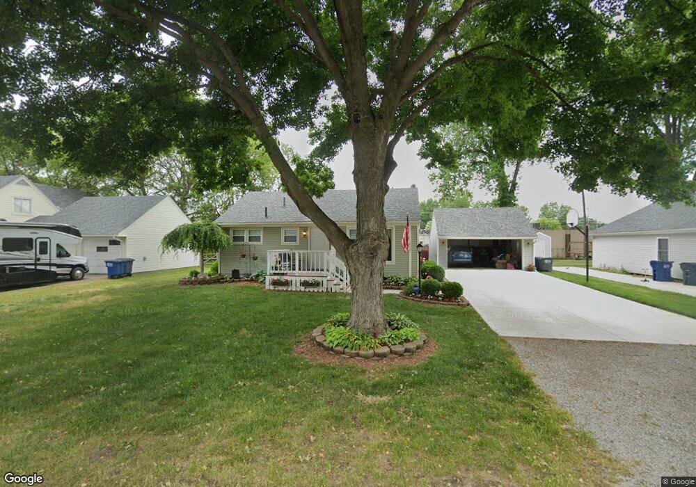
2123 Stoneham Rd Toledo, OH 43615
Reynolds Corners NeighborhoodEstimated Value: $186,000 - $248,000
3
Beds
2
Baths
1,596
Sq Ft
$131/Sq Ft
Est. Value
About This Home
This home is located at 2123 Stoneham Rd, Toledo, OH 43615 and is currently estimated at $209,581, approximately $131 per square foot. 2123 Stoneham Rd is a home located in Lucas County with nearby schools including Hawkins Elementary School, Rogers High School, and St. Benedict Catholic School.
Ownership History
Date
Name
Owned For
Owner Type
Purchase Details
Closed on
Jan 23, 2003
Sold by
Smith Christine M and Smith Christine M
Bought by
Bollinger Frederick M and Bollinger Jennifer L
Current Estimated Value
Home Financials for this Owner
Home Financials are based on the most recent Mortgage that was taken out on this home.
Original Mortgage
$129,800
Outstanding Balance
$54,298
Interest Rate
6.13%
Estimated Equity
$155,283
Purchase Details
Closed on
Jun 29, 2001
Sold by
Smith Thomas A
Bought by
Smith Christine M
Home Financials for this Owner
Home Financials are based on the most recent Mortgage that was taken out on this home.
Original Mortgage
$105,500
Interest Rate
7.27%
Purchase Details
Closed on
Jun 30, 1989
Sold by
Harder Arthur J and Harder Cora B
Create a Home Valuation Report for This Property
The Home Valuation Report is an in-depth analysis detailing your home's value as well as a comparison with similar homes in the area
Home Values in the Area
Average Home Value in this Area
Purchase History
| Date | Buyer | Sale Price | Title Company |
|---|---|---|---|
| Bollinger Frederick M | $129,800 | Northwest Title Agency Of Oh | |
| Smith Christine M | -- | -- | |
| -- | $58,500 | -- |
Source: Public Records
Mortgage History
| Date | Status | Borrower | Loan Amount |
|---|---|---|---|
| Open | Bollinger Frederick M | $129,800 | |
| Closed | Smith Christine M | $105,500 |
Source: Public Records
Tax History
| Year | Tax Paid | Tax Assessment Tax Assessment Total Assessment is a certain percentage of the fair market value that is determined by local assessors to be the total taxable value of land and additions on the property. | Land | Improvement |
|---|---|---|---|---|
| 2025 | -- | $54,635 | $6,965 | $47,670 |
| 2024 | $1,711 | $54,635 | $6,965 | $47,670 |
| 2023 | $2,718 | $40,810 | $6,160 | $34,650 |
| 2022 | $2,698 | $40,810 | $6,160 | $34,650 |
| 2021 | $2,790 | $40,810 | $6,160 | $34,650 |
| 2020 | $2,663 | $33,950 | $5,075 | $28,875 |
| 2019 | $2,575 | $33,950 | $5,075 | $28,875 |
| 2018 | $2,561 | $33,950 | $5,075 | $28,875 |
| 2017 | $2,508 | $31,745 | $5,600 | $26,145 |
| 2016 | $2,520 | $90,700 | $16,000 | $74,700 |
| 2015 | $2,537 | $90,700 | $16,000 | $74,700 |
| 2014 | $2,002 | $31,750 | $5,600 | $26,150 |
| 2013 | $2,002 | $31,750 | $5,600 | $26,150 |
Source: Public Records
Map
Nearby Homes
- 405 N Holland Sylvania Rd
- 1950 Devinci Dr Unit A203
- 1966 Devinci Dr
- 2015 Oakside Rd
- 2010 Oakside Rd
- 5925 Haefner Rd
- 2004 Oakside Rd
- 1911 N Holland Sylvania Rd
- 5665 Camberley Dr
- 1809 Birdie Dr
- 1207 Vanderbilt Rd
- 1137 Bedford Woods Dr
- 5331 Fleet Rd
- 2812 Quail Run Dr
- 2714 Sweetbriar Ct Unit 2714
- 2720 Westcastle Dr
- 2757 Sweetbriar Ct Unit 2757
- 914 Sawyer Rd
- 605 Koch Dr
- 5123 Regency Dr
- 2111 Stoneham Rd
- 2131 Stoneham Rd
- 2127 Stoneham Rd
- 2103 Stoneham Rd
- 2118 Stoneham Rd
- 2128 Stoneham Rd
- 2112 Stoneham Rd
- 2134 Stoneham Rd
- 2136 Stoneham Rd
- 5837 W Bancroft St
- 2108 Stoneham Rd
- 2104 Stoneham Rd
- 5841 Parkstone Dr
- 5825 W Bancroft St
- 2039 Stoneham Rd
- 5815 W Bancroft St
- 2115 Sandown Rd
- 2111 Sandown Rd
- 2044 Stoneham Rd
- 2131 Sandown Rd
Your Personal Tour Guide
Ask me questions while you tour the home.