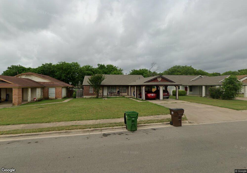
2124 Andover Dr Unit 2126 Round Rock, TX 78664
Stony Point NeighborhoodEstimated Value: $336,710 - $454,000
--
Bed
4
Baths
1,880
Sq Ft
$208/Sq Ft
Est. Value
About This Home
This home is located at 2124 Andover Dr Unit 2126, Round Rock, TX 78664 and is currently estimated at $390,178, approximately $207 per square foot. 2124 Andover Dr Unit 2126 is a home located in Williamson County with nearby schools including Union Hill Elementary School, Hernandez Middle School, and Stony Point High IB World School.
Ownership History
Date
Name
Owned For
Owner Type
Purchase Details
Closed on
May 17, 2019
Sold by
Alamo City Financial Llc
Bought by
Austini Living Llc
Current Estimated Value
Purchase Details
Closed on
Mar 25, 2010
Sold by
Wiseman Robert J and Wiseman Janet S
Bought by
Arnold Jean E
Home Financials for this Owner
Home Financials are based on the most recent Mortgage that was taken out on this home.
Original Mortgage
$80,000
Interest Rate
4.93%
Mortgage Type
New Conventional
Purchase Details
Closed on
Jul 13, 2000
Sold by
Bishop Adale Jean and Bishop Joseph C
Bought by
Amaya Oscar E
Create a Home Valuation Report for This Property
The Home Valuation Report is an in-depth analysis detailing your home's value as well as a comparison with similar homes in the area
Home Values in the Area
Average Home Value in this Area
Purchase History
| Date | Buyer | Sale Price | Title Company |
|---|---|---|---|
| Austini Living Llc | -- | Independence Title Company | |
| Alamo City Financial Llc | -- | Itc | |
| Arnold Jean E | -- | Georgetown Title Company Inc | |
| Amaya Oscar E | -- | Atc |
Source: Public Records
Mortgage History
| Date | Status | Borrower | Loan Amount |
|---|---|---|---|
| Previous Owner | Arnold Jean E | $80,000 |
Source: Public Records
Tax History Compared to Growth
Tax History
| Year | Tax Paid | Tax Assessment Tax Assessment Total Assessment is a certain percentage of the fair market value that is determined by local assessors to be the total taxable value of land and additions on the property. | Land | Improvement |
|---|---|---|---|---|
| 2025 | $6,541 | $369,798 | $77,000 | $292,798 |
| 2024 | $6,541 | $369,229 | $77,000 | $292,229 |
| 2023 | $6,794 | $387,330 | $77,000 | $310,330 |
| 2022 | $7,955 | $419,489 | $77,000 | $342,489 |
| 2021 | $7,076 | $315,216 | $59,000 | $256,216 |
| 2020 | $6,233 | $276,121 | $53,278 | $222,843 |
| 2019 | $5,985 | $259,247 | $48,600 | $210,647 |
| 2018 | $5,083 | $220,166 | $41,730 | $178,436 |
| 2017 | $4,758 | $201,971 | $39,000 | $162,971 |
| 2016 | $4,243 | $180,110 | $39,000 | $141,110 |
| 2015 | $3,155 | $174,110 | $33,000 | $141,110 |
| 2014 | $3,155 | $134,088 | $0 | $0 |
Source: Public Records
Map
Nearby Homes
- 2104 Andover Dr
- 2006 Heathwood Cir
- 609 Clearwater Trail
- 800 Saunders Dr
- 509 Andover Cove
- 712 Clearwater Trail
- 310 Barrhall Dr
- 510 Heather Dr
- 214 Barrhall Dr
- 2407 Curry Loop Unit A
- 1008 Ridgeline Dr
- 903 Rolling Green Cir
- 1481 E Old Settlers Blvd Unit 1503
- 504 Virginia Dr
- 1604 Wildflower Dr
- 1800 Nicole Cir Unit B
- 2123 Jester Farms
- 902 Virginia Dr
- 1301 Wayne Dr
- 3000 Sunrise Rd
- 2126 Andover Dr
- 2120 Andover Dr Unit 2122
- 2122 Andover Dr
- 2128 Andover Dr Unit 2130
- 2130 Andover Dr
- 521 Gregory Ct
- 520 Gregory Ct Unit 521
- 2118 Andover Dr
- 2134 Andover Dr
- 2132 Andover Dr Unit 2134
- 519 Gregory Ct
- 2125 Andover Dr
- 2125 Andover Dr Unit 2127
- 2121 Andover Dr Unit 2123
- 516 Gregory Ct Unit 518
- 2129 Andover Dr
- 522 Edwards Dr
- 518 Gregory Ct
- 2119 Andover Dr