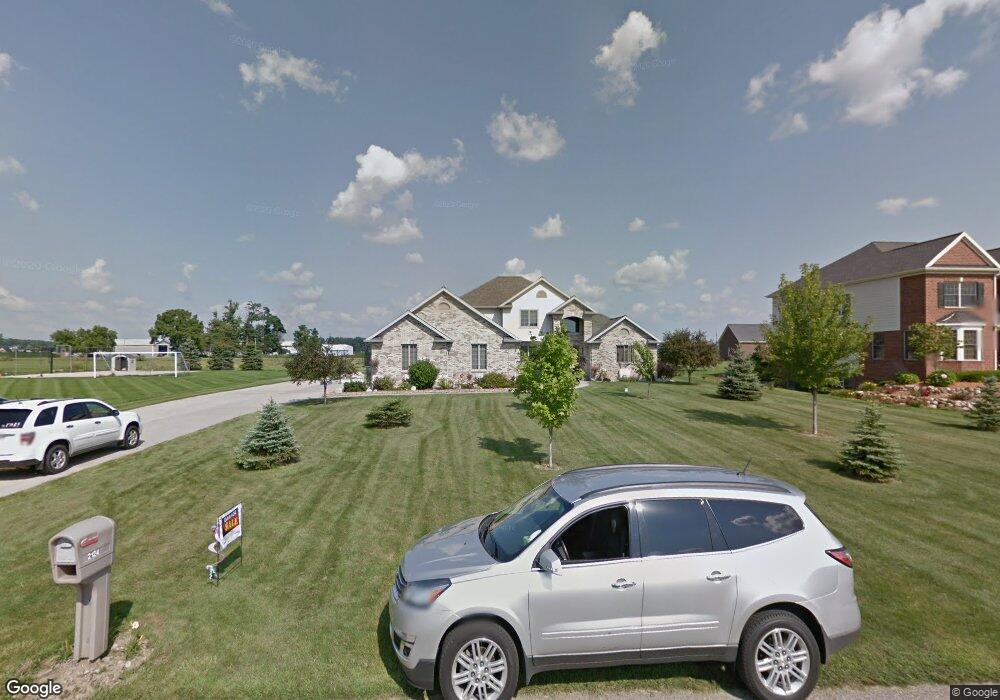
2124 Burning Tree Cir Owosso, MI 48867
Estimated Value: $339,445 - $410,000
Studio
--
Bath
--
Sq Ft
26,964
Sq Ft Lot
About This Home
This home is located at 2124 Burning Tree Cir, Owosso, MI 48867 and is currently estimated at $385,611. 2124 Burning Tree Cir is a home located in Shiawassee County with nearby schools including Owosso High School, Owosso Sda School, and St. Paul School.
Ownership History
Date
Name
Owned For
Owner Type
Purchase Details
Closed on
Apr 24, 2023
Sold by
Ardelean Daniel R
Bought by
Patrick C Selleck And Michelle M Collison Liv
Current Estimated Value
Purchase Details
Closed on
May 1, 2003
Sold by
Ardelean Ardelean L and Ardelean Arlene M
Bought by
Ardelean Daniel R and Ardelean Erin K
Home Financials for this Owner
Home Financials are based on the most recent Mortgage that was taken out on this home.
Original Mortgage
$214,400
Interest Rate
5.9%
Mortgage Type
Construction
Create a Home Valuation Report for This Property
The Home Valuation Report is an in-depth analysis detailing your home's value as well as a comparison with similar homes in the area
Home Values in the Area
Average Home Value in this Area
Purchase History
| Date | Buyer | Sale Price | Title Company |
|---|---|---|---|
| Patrick C Selleck And Michelle M Collison Liv | $5,000 | None Listed On Document | |
| Ardelean Daniel R | $30,000 | First American Title |
Source: Public Records
Mortgage History
| Date | Status | Borrower | Loan Amount |
|---|---|---|---|
| Previous Owner | Ardelean Daniel R | $214,400 |
Source: Public Records
Tax History
| Year | Tax Paid | Tax Assessment Tax Assessment Total Assessment is a certain percentage of the fair market value that is determined by local assessors to be the total taxable value of land and additions on the property. | Land | Improvement |
|---|---|---|---|---|
| 2025 | $3,968 | $172,100 | $0 | $0 |
| 2024 | $4,047 | $162,900 | $0 | $0 |
| 2023 | $1,481 | $152,200 | $0 | $0 |
| 2022 | $1,411 | $140,400 | $0 | $0 |
| 2021 | $3,577 | $136,600 | $0 | $0 |
| 2020 | $3,523 | $131,600 | $0 | $0 |
| 2019 | $3,458 | $127,000 | $0 | $0 |
| 2018 | $3,493 | $120,800 | $0 | $0 |
| 2017 | $2,821 | $112,300 | $0 | $0 |
| 2016 | -- | $112,300 | $0 | $0 |
| 2015 | -- | $111,700 | $0 | $0 |
| 2014 | $13 | $107,600 | $0 | $0 |
Source: Public Records
Map
Nearby Homes
- 2445 N Hickory Rd
- 570 W Wildwood Dr
- 553 W Wildwood Dr
- 2145 N M 52
- 502 Dean Dr
- 914 Chipman Ln
- 1218 N Water St
- 1200 N Dewey St
- 1119 Dingwall Dr
- 1473 Mallard Cir
- 1430 Mallard Cir
- 1021 Dingwall Dr
- 1431 Pintail Ct
- 210 Stratford Dr
- 1270 N Chipman St
- 1193 Hanover St
- 1475 N Water St
- 916 N Shiawassee St
- 775 Riverbend Dr
- 815 Pine St
- 2112 Burning Tree Cir
- 2112 Burning
- 2100 Burning Tree Cir
- 2175 Burning Tree Cir
- 2148 Burning Tree Cir
- 2121 Burning Tree Cir
- 118 Clover Brook Dr
- 134 Clover Brook Dr
- 118 Cloverbrook Dr
- 2183 Burning Tree Cir
- 138 Clover Brook Dr
- 138 Clover Brook Dr
- 138 Clover Brook Dr
- 2160 Burning Tree Cir
- 2172 Burning Tree Cir
- 117 Clover Brook Dr
- 117 Clover Brook Dr
- 123 Clover Brook Dr
- 2195 Burning Tree Cir
- 152 Clover Brook Dr
Your Personal Tour Guide
Ask me questions while you tour the home.