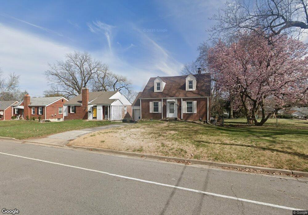
2124 Lackland Rd Saint Louis, MO 63114
Estimated Value: $180,485 - $198,000
3
Beds
2
Baths
1,345
Sq Ft
$139/Sq Ft
Est. Value
About This Home
This home is located at 2124 Lackland Rd, Saint Louis, MO 63114 and is currently estimated at $187,371, approximately $139 per square foot. 2124 Lackland Rd is a home located in St. Louis County with nearby schools including Iveland Elementary School, Hoech Middle School, and Ritenour Senior High School.
Ownership History
Date
Name
Owned For
Owner Type
Purchase Details
Closed on
Nov 21, 2000
Sold by
Crosby Lisa W & William K Trustees
Bought by
Farazi Azizur Rahman and Khatum Josna
Current Estimated Value
Home Financials for this Owner
Home Financials are based on the most recent Mortgage that was taken out on this home.
Original Mortgage
$40,000
Interest Rate
7.84%
Purchase Details
Closed on
Mar 30, 1998
Sold by
Crosby Lisa Watson
Bought by
Crosby William K and Crosby Lisa W
Create a Home Valuation Report for This Property
The Home Valuation Report is an in-depth analysis detailing your home's value as well as a comparison with similar homes in the area
Home Values in the Area
Average Home Value in this Area
Purchase History
We collect this data history from publicly available records. To have your information removed, we recommend requesting removal directly through your county’s website.
| Date | Buyer | Sale Price | Title Company |
|---|---|---|---|
| Farazi Azizur Rahman | $59,500 | -- | |
| Farazi Azizur Rahman | -- | -- | |
| Crosby William K | -- | -- |
Source: Public Records
Mortgage History
We collect this data history from publicly available records. To have your information removed, we recommend requesting removal directly through your county’s website.
| Date | Status | Borrower | Loan Amount |
|---|---|---|---|
| Previous Owner | Farazi Azizur Rahman | $40,000 |
Source: Public Records
Tax History
| Year | Tax Paid | Tax Assessment Tax Assessment Total Assessment is a certain percentage of the fair market value that is determined by local assessors to be the total taxable value of land and additions on the property. | Land | Improvement |
|---|---|---|---|---|
| 2025 | $2,174 | $31,220 | $6,350 | $24,870 |
| 2024 | $2,174 | $25,390 | $2,910 | $22,480 |
| 2023 | $2,126 | $25,390 | $2,910 | $22,480 |
| 2022 | $2,200 | $23,070 | $2,550 | $20,520 |
| 2021 | $2,200 | $23,070 | $2,550 | $20,520 |
| 2020 | $1,707 | $16,460 | $2,890 | $13,570 |
| 2019 | $1,690 | $16,460 | $2,890 | $13,570 |
| 2018 | $1,962 | $17,240 | $2,550 | $14,690 |
| 2017 | $1,871 | $17,240 | $2,550 | $14,690 |
| 2016 | $1,433 | $13,400 | $2,890 | $10,510 |
| 2015 | $1,465 | $13,400 | $2,890 | $10,510 |
| 2014 | $1,327 | $12,320 | $1,960 | $10,360 |
Source: Public Records
Map
Nearby Homes
- 2239 Wismer Ave
- 10107 Niblic Dr
- 9826 Lullaby Ln
- 10111 Niblic Dr
- 2339 Dawes Place
- 1912 Overland Dr
- 2000 Wismer Ave
- 2436 Pinehurst Dr
- 2413 Leslie Ave
- 1735 O Connell Ave
- 9822 Zykan Dr
- 10025 Pebble Beach Dr
- 2417 Sunnybrook Dr
- 2217 Hood Ave
- 9546 Theodosia Ave
- 2536 Sims Ave
- 2507 Gass Ave
- 10330 Oak Ave
- 1947 Spencer Ave
- 9604 Ridge Ave
- 2128 Lackland Rd
- 2116 Lackland Rd
- 2136 Lackland Rd
- 2138 Lackland Rd
- 2219 Sims Ave
- 2217 Sims Ave
- 2223 Sims Ave
- 2112 Lackland Rd
- 2213 Sims Ave
- 2227 Sims Ave
- 2125 Lackland Rd
- 2140 Lackland Rd
- 2211 Sims Ave
- 2229 Sims Ave
- 2150 Lackland Rd
- 2113 Lackland Rd
- 2209 Sims Ave
- 2135 Lackland Rd
- 9911 Driver Ave
- 2139 Lackland Rd
Your Personal Tour Guide
Ask me questions while you tour the home.