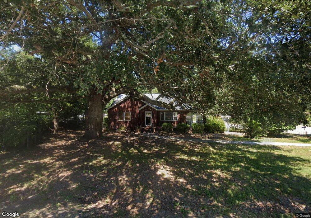
2124 Leaphart Rd West Columbia, SC 29169
Estimated Value: $143,000 - $198,000
2
Beds
1
Bath
1,271
Sq Ft
$137/Sq Ft
Est. Value
About This Home
This home is located at 2124 Leaphart Rd, West Columbia, SC 29169 and is currently estimated at $174,536, approximately $137 per square foot. 2124 Leaphart Rd is a home located in Lexington County with nearby schools including Riverbank Elementary, Northside Middle, and Brookland-Cayce High School.
Ownership History
Date
Name
Owned For
Owner Type
Purchase Details
Closed on
Jun 14, 2021
Sold by
Benson William J and Benson Janice L
Bought by
Wallace Lisa
Current Estimated Value
Home Financials for this Owner
Home Financials are based on the most recent Mortgage that was taken out on this home.
Original Mortgage
$101,850
Outstanding Balance
$92,011
Interest Rate
2.9%
Mortgage Type
New Conventional
Estimated Equity
$82,525
Purchase Details
Closed on
Aug 21, 2020
Sold by
Benson William J
Bought by
Benson William J
Purchase Details
Closed on
Nov 13, 1998
Sold by
Shelby Yvonne D
Bought by
Benson William J
Create a Home Valuation Report for This Property
The Home Valuation Report is an in-depth analysis detailing your home's value as well as a comparison with similar homes in the area
Home Values in the Area
Average Home Value in this Area
Purchase History
| Date | Buyer | Sale Price | Title Company |
|---|---|---|---|
| Wallace Lisa | $105,000 | None Available | |
| Benson William J | -- | None Listed On Document | |
| Benson William J | $96,500 | -- |
Source: Public Records
Mortgage History
| Date | Status | Borrower | Loan Amount |
|---|---|---|---|
| Open | Wallace Lisa | $101,850 |
Source: Public Records
Tax History Compared to Growth
Tax History
| Year | Tax Paid | Tax Assessment Tax Assessment Total Assessment is a certain percentage of the fair market value that is determined by local assessors to be the total taxable value of land and additions on the property. | Land | Improvement |
|---|---|---|---|---|
| 2024 | $890 | $4,200 | $1,232 | $2,968 |
| 2023 | $803 | $4,200 | $1,232 | $2,968 |
| 2022 | $810 | $4,200 | $1,232 | $2,968 |
| 2020 | $2,714 | $6,963 | $1,848 | $5,115 |
| 2019 | $356 | $4,411 | $1,540 | $2,871 |
| 2018 | $354 | $4,411 | $1,540 | $2,871 |
| 2017 | $329 | $4,411 | $1,540 | $2,871 |
| 2016 | $349 | $4,411 | $1,540 | $2,871 |
| 2014 | $249 | $4,433 | $1,288 | $3,145 |
| 2013 | -- | $4,430 | $1,290 | $3,140 |
Source: Public Records
Map
Nearby Homes
- 215 Sandel Ln
- 207 Woodhaven Dr
- 2004 Dew Ave
- 116 Silver Run Place
- 339 Gum Swamp Trail
- 135 Silver Run Place
- 349 Gum Swamp Trail
- 0 Platt Springs Rd Unit 606355
- 212 Alexandria St
- 623 Hook Ave
- 309 Hammond Ave
- 165 Cavendish Dr
- 1802 D Ave
- 529 Finnegan Ln
- 1734 C Ave
- 500 Finnegan Ln
- 106 Earl Ct
- 913 Harper Rose Ct
- 1615 Holland St
- 617 Holland Cir
- 2128 Leaphart Rd
- 0 Woodhaven Dr
- 2112 Leaphart Rd
- 105 Woodhaven Dr
- 102 Woodhaven Dr
- 2132 Leaphart Rd
- 106 Woodhaven Dr
- 107 Woodhaven Dr
- 2110 Leaphart Rd
- 110 Woodhaven Dr
- 115 Hook Ave
- 111 Hook Ave
- 205 Sandel Ln
- 201 Hook Ave
- 107 Hook Ave
- 115 Woodhaven Dr
- 2134 Leaphart Rd
- 204 Sandel Ln
- 205 Hook Ave
- 114 Woodhaven Dr