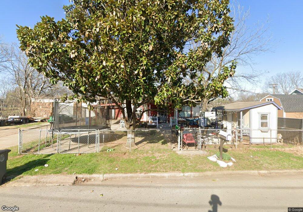
2124 N Birmingham Ave Tulsa, OK 74110
North Evanston Place NeighborhoodEstimated Value: $53,142 - $116,000
--
Bed
1
Bath
860
Sq Ft
$100/Sq Ft
Est. Value
About This Home
This home is located at 2124 N Birmingham Ave, Tulsa, OK 74110 and is currently estimated at $85,786, approximately $99 per square foot. 2124 N Birmingham Ave is a home located in Tulsa County with nearby schools including Celia Clinton Elementary School, Monroe Demonstration Academy, and McLain High School of Science and Technology.
Ownership History
Date
Name
Owned For
Owner Type
Purchase Details
Closed on
Dec 16, 2021
Sold by
Larry Morgan Richard and Larry Magdalena
Bought by
Melendez Magda M
Current Estimated Value
Purchase Details
Closed on
Dec 23, 1998
Sold by
Morgan Richard L and Morgan Magdalena
Bought by
Morgan Richard L and Morgan Magdalena
Home Financials for this Owner
Home Financials are based on the most recent Mortgage that was taken out on this home.
Original Mortgage
$24,000
Interest Rate
6.74%
Mortgage Type
Purchase Money Mortgage
Create a Home Valuation Report for This Property
The Home Valuation Report is an in-depth analysis detailing your home's value as well as a comparison with similar homes in the area
Home Values in the Area
Average Home Value in this Area
Purchase History
| Date | Buyer | Sale Price | Title Company |
|---|---|---|---|
| Melendez Magda M | -- | None Listed On Document | |
| Morgan Richard L | -- | -- |
Source: Public Records
Mortgage History
| Date | Status | Borrower | Loan Amount |
|---|---|---|---|
| Previous Owner | Morgan Richard L | $24,000 |
Source: Public Records
Tax History Compared to Growth
Tax History
| Year | Tax Paid | Tax Assessment Tax Assessment Total Assessment is a certain percentage of the fair market value that is determined by local assessors to be the total taxable value of land and additions on the property. | Land | Improvement |
|---|---|---|---|---|
| 2024 | $353 | $2,923 | $451 | $2,472 |
| 2023 | $353 | $2,783 | $472 | $2,311 |
| 2022 | $353 | $2,651 | $495 | $2,156 |
| 2021 | $350 | $2,651 | $495 | $2,156 |
| 2020 | $345 | $2,651 | $495 | $2,156 |
| 2019 | $363 | $2,651 | $495 | $2,156 |
| 2018 | $364 | $2,651 | $495 | $2,156 |
| 2017 | $363 | $2,651 | $495 | $2,156 |
| 2016 | $356 | $2,651 | $495 | $2,156 |
| 2015 | $357 | $2,651 | $495 | $2,156 |
| 2014 | $353 | $2,651 | $495 | $2,156 |
Source: Public Records
Map
Nearby Homes
- 1828 N Birmingham Ave
- 1901 N Atlanta Ave
- 1825 N Delaware Ave
- 2901 E Virgin St
- 2910 E Woodrow St
- 1931 N Lewis Ave
- 2413 N Yorktown Ave
- 2918 E Woodrow St
- 2142 E Seminole St
- 1547 N Columbia Place
- 2429 E Apache St
- 2401 E Apache St
- 2425 E Apache St
- 2017 N College Ave
- 2240 E Apache St
- 2222 N Xanthus Ave
- 0 N Columbia Place
- 0 N Columbia Ave Unit 2527759
- 1645 N College Ave
- 1607 N Yorktown Ave
- 2132 N Birmingham Ave
- 2123 N Atlanta Ct
- 2117 N Atlanta Ct
- 2112 N Birmingham Ave
- 2125 N Birmingham Ave
- 2129 N Atlanta Ct
- 1620 N Birmingham Ave
- 2121 N Birmingham Ave
- 2125 N Birmingham Ave
- 2108 N Birmingham Ave
- 2117 N Birmingham Ave
- 2131 N Birmingham Ave
- 2120 N Atlanta Ct
- 2208 N Birmingham Ave
- 2104 N Birmingham Ave
- 2603 E Virgin St
- 2124 N Atlanta Ct
- 2128 N Atlanta Ct
- 2203 N Birmingham Ave
- 2205 N Atlanta Ct