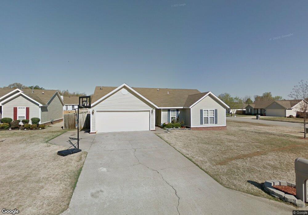
2125 Bristol Dr Jonesboro, AR 72401
Estimated Value: $212,593 - $230,000
--
Bed
2
Baths
1,768
Sq Ft
$126/Sq Ft
Est. Value
About This Home
This home is located at 2125 Bristol Dr, Jonesboro, AR 72401 and is currently estimated at $223,398, approximately $126 per square foot. 2125 Bristol Dr is a home located in Craighead County with nearby schools including Brookland Elementary School, Brookland Middle School, and Brookland Junior High School.
Ownership History
Date
Name
Owned For
Owner Type
Purchase Details
Closed on
Oct 28, 2009
Sold by
Regions Bank
Bought by
Federal National Mortgage Association
Current Estimated Value
Purchase Details
Closed on
Oct 23, 2009
Sold by
Baxter Jeffery K
Bought by
Redions Bank
Purchase Details
Closed on
Jun 16, 2005
Sold by
Chastain Development Llc
Bought by
Baxter Jeffery K
Purchase Details
Closed on
May 5, 1999
Bought by
Ray
Create a Home Valuation Report for This Property
The Home Valuation Report is an in-depth analysis detailing your home's value as well as a comparison with similar homes in the area
Home Values in the Area
Average Home Value in this Area
Purchase History
| Date | Buyer | Sale Price | Title Company |
|---|---|---|---|
| Federal National Mortgage Association | -- | None Available | |
| Redions Bank | $129,061 | None Available | |
| Baxter Jeffery K | $115,000 | None Available | |
| Ray | $98,000 | -- |
Source: Public Records
Tax History Compared to Growth
Tax History
| Year | Tax Paid | Tax Assessment Tax Assessment Total Assessment is a certain percentage of the fair market value that is determined by local assessors to be the total taxable value of land and additions on the property. | Land | Improvement |
|---|---|---|---|---|
| 2025 | $1,469 | $34,145 | $4,000 | $30,145 |
| 2024 | $1,469 | $34,145 | $4,000 | $30,145 |
| 2023 | $938 | $34,145 | $4,000 | $30,145 |
| 2022 | $926 | $34,145 | $4,000 | $30,145 |
| 2021 | $903 | $28,180 | $4,000 | $24,180 |
| 2020 | $844 | $28,180 | $4,000 | $24,180 |
| 2019 | $786 | $28,180 | $4,000 | $24,180 |
| 2018 | $811 | $28,180 | $4,000 | $24,180 |
| 2017 | $811 | $28,180 | $4,000 | $24,180 |
| 2016 | $811 | $24,140 | $3,700 | $20,440 |
| 2015 | $811 | $24,140 | $3,700 | $20,440 |
| 2014 | $811 | $24,140 | $3,700 | $20,440 |
Source: Public Records
Map
Nearby Homes
- 2010 Greenway Ln
- 2316 Sheffield Dr
- 5710 E Johnson Ave
- 6033 Spencer Dr
- 5600 E Johnson Ave
- 0 Rd Unit 25030173
- 6024 Whitecliff Dr
- 4561 Plymouth St
- 6060 Whitecliff Dr
- 2218 Clinton School Rd
- 1000 Oriole Dr
- 5003 Lynette Dr
- 2505 Paradise Hills Ln
- 231 County Road 7452
- 828 Laura Lea
- 5016 Deliverance Dr
- 5001 Deliverance Dr
- 5000 Shipley Ln
- 2720 Paradise Hills Ln
- 809 Gloucester Close
- 2121 Bristol Dr
- 2125 Sheffield Dr
- 2117 Bristol Dr
- 2124 Sheffield Dr
- 2112 Bristol Dr
- 2128 Sheffield Dr
- 2120 Sheffield Dr
- 0 Sheffield Dr
- 2120 Manchester Dr
- 2132 Sheffield Dr
- 2108 Bristol Dr
- 0 Bristol Dr
- 2113 Bristol Dr
- 2116 Sheffield Dr
- 2117 Sheffield Dr
- 2116 Manchester Dr
- 5905 Chastain Cove
- 2204 Manchester Dr
- 2104 Bristol Dr
- 2114 Sheffield Dr