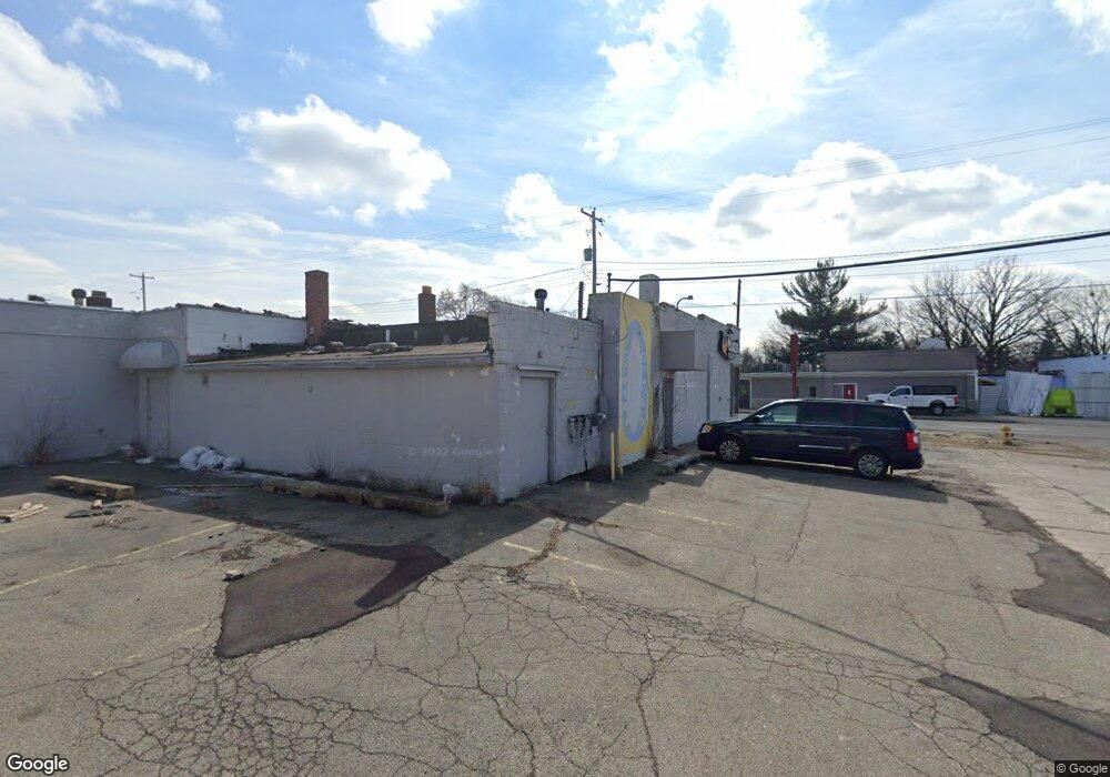
2125 Davison Rd Flint, MI 48506
Eastside Neighborhood
Studio
--
Bath
2,067
Sq Ft
6,970
Sq Ft Lot
About This Home
This home is located at 2125 Davison Rd, Flint, MI 48506. 2125 Davison Rd is a home located in Genesee County with nearby schools including Potter School and Flint Cultural Center Academy.
Ownership History
Date
Name
Owned For
Owner Type
Purchase Details
Closed on
Dec 16, 2024
Sold by
Genesee County Treasurer
Bought by
Genesee County Land Bank Authority
Purchase Details
Closed on
Mar 27, 2019
Sold by
Genesee County Land Bank Authority
Bought by
Flint Free Phone Inc
Purchase Details
Closed on
Oct 8, 2014
Sold by
The Genesee County Land Bank Authority
Bought by
Flint Free Phone Inc
Home Financials for this Owner
Home Financials are based on the most recent Mortgage that was taken out on this home.
Original Mortgage
$5,760
Interest Rate
7%
Mortgage Type
Seller Take Back
Purchase Details
Closed on
Dec 20, 2013
Sold by
Genesee County Treasurer
Bought by
Genesee County Land Bank
Purchase Details
Closed on
Jan 23, 2004
Sold by
Heller Harry H and Heller Juanita G
Bought by
Molina Frank
Create a Home Valuation Report for This Property
The Home Valuation Report is an in-depth analysis detailing your home's value as well as a comparison with similar homes in the area
Home Values in the Area
Average Home Value in this Area
Purchase History
| Date | Buyer | Sale Price | Title Company |
|---|---|---|---|
| Genesee County Land Bank Authority | -- | None Listed On Document | |
| Flint Free Phone Inc | $7,200 | None Available | |
| Flint Free Phone Inc | $7,200 | None Available | |
| Genesee County Land Bank | -- | None Available | |
| Molina Frank | $129,500 | Metropolitan Title Company |
Source: Public Records
Mortgage History
| Date | Status | Borrower | Loan Amount |
|---|---|---|---|
| Previous Owner | Flint Free Phone Inc | $5,760 |
Source: Public Records
Tax History Compared to Growth
Tax History
| Year | Tax Paid | Tax Assessment Tax Assessment Total Assessment is a certain percentage of the fair market value that is determined by local assessors to be the total taxable value of land and additions on the property. | Land | Improvement |
|---|---|---|---|---|
| 2025 | $1,887 | $0 | $0 | $0 |
| 2024 | $1,711 | $46,100 | $0 | $0 |
| 2023 | $1,651 | $44,900 | $0 | $0 |
| 2022 | $0 | $40,000 | $0 | $0 |
| 2021 | $1,722 | $31,400 | $0 | $0 |
| 2020 | $1,549 | $30,900 | $0 | $0 |
| 2019 | $2,373 | $31,900 | $0 | $0 |
| 2018 | $1,549 | $29,000 | $0 | $0 |
| 2017 | $1,429 | $0 | $0 | $0 |
| 2016 | $1,416 | $0 | $0 | $0 |
| 2015 | -- | $0 | $0 | $0 |
| 2014 | -- | $0 | $0 | $0 |
| 2012 | -- | $20,200 | $0 | $0 |
Source: Public Records
Map
Nearby Homes
- 1622 Arlington Ave
- 1501 Arlington Ave
- 2601 Illinois Ave
- 2301 Missouri Ave
- 1318 Cronk Ave
- 1805 Bennett Ave
- 1814 Mabel Ave
- 2610 Pennsylvania Ave
- 2321 Levern St
- 2211 Torrance St
- 1216 Minnesota Ave
- 1609 Ohio Ave
- 2506 Arlington Ave
- 2605 Nebraska Ave
- 2426 Hoff St
- 1529 Broadway Blvd
- 1721 New York Ave
- 1629 New York Ave
- 1513 Jane Ave
- 406 S Lynch St
- 2209 Davison Rd
- 2215 Davison Rd
- 1916 N Vernon Ave
- 1911 N Vernon Ave
- 1915 Burns St
- 1915 N Vernon Ave
- 1924 N Vernon Ave
- 1919 N Vernon Ave
- 1923 Burns St
- 1928 N Vernon Ave
- 1923 N Vernon Ave
- 2112 Davison Rd
- 2131 Colladay Ct
- 2123 Colladay Ct
- 1912 Arlington Ave
- 2001 N Vernon Ave
- 2119 Colladay Ct
- 1932 N Vernon Ave
- 2115 Colladay Ct
- 2100 Davison Rd