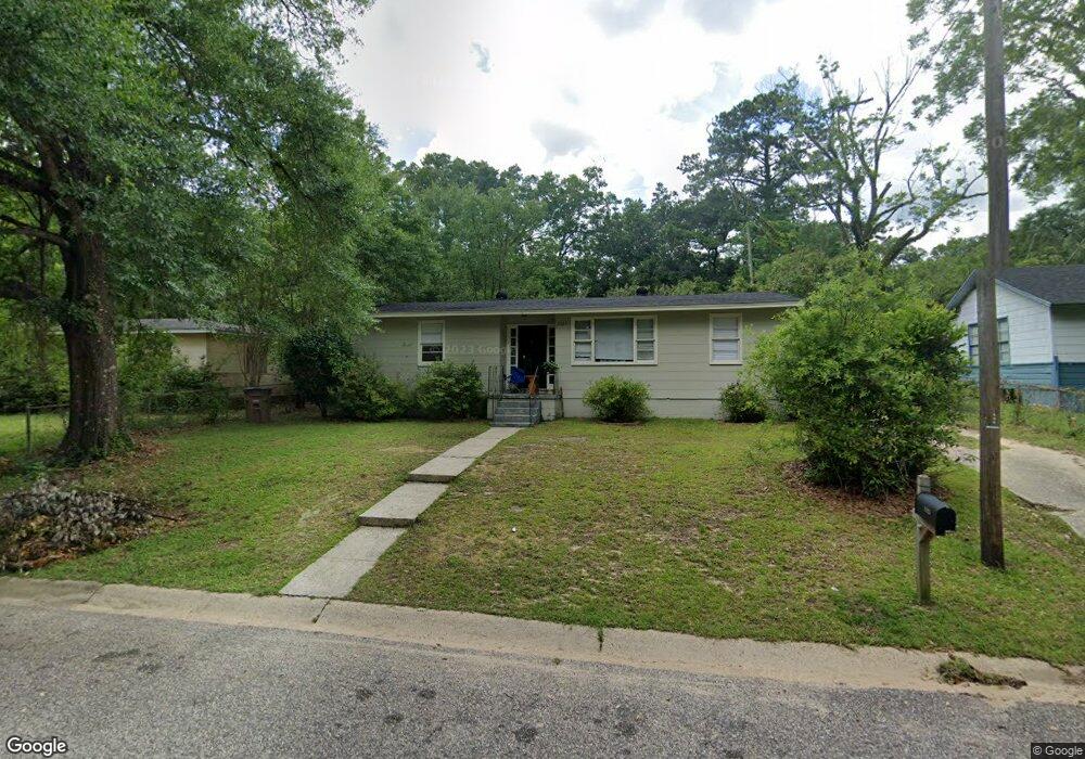
2125 Hamilton Rd Mobile, AL 36618
Autumndale NeighborhoodEstimated Value: $92,605 - $133,000
3
Beds
1
Bath
1,068
Sq Ft
$103/Sq Ft
Est. Value
About This Home
This home is located at 2125 Hamilton Rd, Mobile, AL 36618 and is currently estimated at $109,651, approximately $102 per square foot. 2125 Hamilton Rd is a home located in Mobile County with nearby schools including Forest Hill Elementary School, CL Scarborough Middle School, and Mattie T Blount High School.
Ownership History
Date
Name
Owned For
Owner Type
Purchase Details
Closed on
Aug 2, 2016
Sold by
Fannie Mae
Bought by
Plan C Llc
Current Estimated Value
Purchase Details
Closed on
Apr 19, 2016
Sold by
Hamilton Paul R and Hamilton Charlene R
Bought by
Federal National Mortgage Association
Purchase Details
Closed on
Oct 18, 2002
Sold by
Midtown Investments Inc
Bought by
Hamilton Paul R and Hamilton Charlene R
Home Financials for this Owner
Home Financials are based on the most recent Mortgage that was taken out on this home.
Original Mortgage
$45,000
Interest Rate
5.62%
Purchase Details
Closed on
Aug 20, 2002
Sold by
Cowden Mary Ann and Elmore Mary Ann
Bought by
Midtown Investments Inc
Home Financials for this Owner
Home Financials are based on the most recent Mortgage that was taken out on this home.
Original Mortgage
$45,000
Interest Rate
5.62%
Create a Home Valuation Report for This Property
The Home Valuation Report is an in-depth analysis detailing your home's value as well as a comparison with similar homes in the area
Home Values in the Area
Average Home Value in this Area
Purchase History
| Date | Buyer | Sale Price | Title Company |
|---|---|---|---|
| Plan C Llc | $15,100 | None Available | |
| Federal National Mortgage Association | $22,900 | None Available | |
| Hamilton Paul R | -- | -- | |
| Midtown Investments Inc | -- | -- |
Source: Public Records
Mortgage History
| Date | Status | Borrower | Loan Amount |
|---|---|---|---|
| Previous Owner | Hamilton Paul R | $45,000 |
Source: Public Records
Tax History
| Year | Tax Paid | Tax Assessment Tax Assessment Total Assessment is a certain percentage of the fair market value that is determined by local assessors to be the total taxable value of land and additions on the property. | Land | Improvement |
|---|---|---|---|---|
| 2025 | $649 | $10,060 | $2,000 | $8,060 |
| 2024 | $649 | $9,460 | $2,000 | $7,460 |
| 2023 | $592 | $9,320 | $2,000 | $7,320 |
| 2022 | $566 | $8,920 | $2,000 | $6,920 |
| 2021 | $525 | $8,260 | $1,600 | $6,660 |
| 2020 | $499 | $7,860 | $1,200 | $6,660 |
| 2019 | $478 | $7,520 | $0 | $0 |
| 2018 | $478 | $7,520 | $0 | $0 |
| 2017 | $453 | $7,140 | $0 | $0 |
| 2016 | $649 | $10,220 | $0 | $0 |
| 2013 | -- | $10,040 | $0 | $0 |
Source: Public Records
Map
Nearby Homes
- 2205 Beau Terra Dr W
- 1930 Le Jeune Dr
- 2004 Beau Terra Dr W
- 2210 Wolf Ridge Rd
- 0 Junius Ln
- 1758 La Pine Dr
- 1757 Le Grande Dr
- 4409 Eastview Dr
- 1561 Phillips Ln
- 1557 Phillips Ln
- 1701 Phillips Ln
- 6632 Monarch Cir
- 3531 Anton St
- 3514 Anton St
- 1553 Phillips Ln
- 6 Brucewood Dr W
- 4453 Myers Rd
- 1811 Butler St
- 4636 Saint Charles Ct
- 3728 Vinewood Dr
- 2129 Hamilton Rd
- 2121 Hamilton Rd
- 2121 Hamilton Rd
- 2132 Wolf Ridge Rd
- 2150 Wolf Ridge Rd
- 2128 Wolf Ridge Rd
- 2133 Hamilton Rd
- 2119 Hamilton Rd
- 2154 Wolf Ridge Rd
- 2128 Hamilton Rd
- 2124 Wolf Ridge Rd
- 2120 Hamilton Rd
- 2132 Hamilton Rd
- 2115 Hamilton Rd
- 3951 Pickett Dr
- 2158 Wolf Ridge Rd
- 2116 Hamilton Rd
- 2120 Wolf Ridge Rd
- 2111 Hamilton Rd
- 2112 Hamilton Rd
Your Personal Tour Guide
Ask me questions while you tour the home.