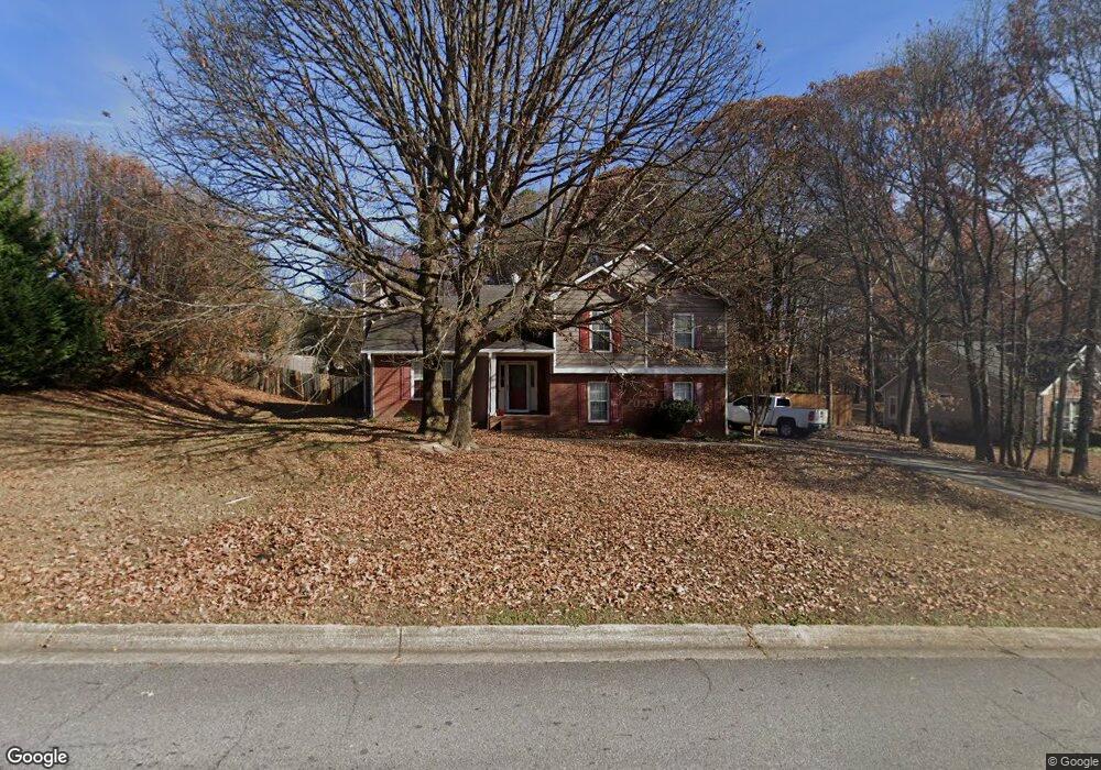
2125 Huntington Hill Trace Unit 1 Buford, GA 30519
Estimated Value: $377,000 - $395,000
3
Beds
2
Baths
1,575
Sq Ft
$243/Sq Ft
Est. Value
About This Home
This home is located at 2125 Huntington Hill Trace Unit 1, Buford, GA 30519 and is currently estimated at $382,889, approximately $243 per square foot. 2125 Huntington Hill Trace Unit 1 is a home located in Gwinnett County with nearby schools including Duncan Creek Elementary School, Frank N. Osborne Middle School, and Mill Creek High School.
Ownership History
Date
Name
Owned For
Owner Type
Purchase Details
Closed on
Sep 27, 2000
Sold by
Phillips Sue C
Bought by
Cook Sheila D and Cook Troy
Current Estimated Value
Home Financials for this Owner
Home Financials are based on the most recent Mortgage that was taken out on this home.
Original Mortgage
$133,850
Outstanding Balance
$48,161
Interest Rate
7.92%
Mortgage Type
FHA
Estimated Equity
$334,728
Purchase Details
Closed on
Oct 13, 1995
Sold by
Fried Jeffrey A
Bought by
Phillips Sue C
Purchase Details
Closed on
Dec 29, 1993
Sold by
Raborn Richard H
Bought by
Fried Jeffrey A
Home Financials for this Owner
Home Financials are based on the most recent Mortgage that was taken out on this home.
Original Mortgage
$89,100
Interest Rate
7.61%
Create a Home Valuation Report for This Property
The Home Valuation Report is an in-depth analysis detailing your home's value as well as a comparison with similar homes in the area
Home Values in the Area
Average Home Value in this Area
Purchase History
| Date | Buyer | Sale Price | Title Company |
|---|---|---|---|
| Cook Sheila D | $134,000 | -- | |
| Phillips Sue C | $104,000 | -- | |
| Fried Jeffrey A | $96,900 | -- |
Source: Public Records
Mortgage History
| Date | Status | Borrower | Loan Amount |
|---|---|---|---|
| Open | Cook Sheila D | $133,850 | |
| Previous Owner | Fried Jeffrey A | $89,100 | |
| Closed | Phillips Sue C | $0 |
Source: Public Records
Tax History Compared to Growth
Tax History
| Year | Tax Paid | Tax Assessment Tax Assessment Total Assessment is a certain percentage of the fair market value that is determined by local assessors to be the total taxable value of land and additions on the property. | Land | Improvement |
|---|---|---|---|---|
| 2024 | $3,688 | $136,720 | $30,800 | $105,920 |
| 2023 | $3,688 | $136,720 | $30,800 | $105,920 |
| 2022 | $3,228 | $116,320 | $27,200 | $89,120 |
| 2021 | $2,766 | $92,120 | $19,280 | $72,840 |
| 2020 | $2,632 | $84,960 | $18,360 | $66,600 |
| 2019 | $2,574 | $84,960 | $18,360 | $66,600 |
| 2018 | $2,273 | $71,040 | $13,200 | $57,840 |
| 2016 | $2,198 | $66,480 | $13,200 | $53,280 |
| 2015 | $1,982 | $56,000 | $12,000 | $44,000 |
| 2014 | $1,990 | $56,000 | $12,000 | $44,000 |
Source: Public Records
Map
Nearby Homes
- 1894 Gray Gables Way
- 4777 Waxwing St
- 2114 Sorrento Ct
- 4309 Mantova Dr
- 4335 Braselton Hwy Unit tax parcel R3003 327
- 4271 Haywater Cove
- 4132 Rovello Way
- 1661 Silver Crest Way
- 4457 Water Mill Dr
- 1682 Mineral Springs Rd
- 4415 Mulberry Ridge Ln Unit 1
- 3615 Greenside Ct
- 3078 Turning Creek Trail
- 3068 Turning Creek Trail
- 2235 Well Springs Dr
- 2206 Spring Stone Ct
- 2115 Huntington Hill Trace
- 2145 Huntington Hill Trace
- 4200 Gables Place Unit 1
- 4210 Gables Place
- 2105 Huntington Hill Trace
- 4190 Gables Place
- 2155 Huntington Hill Trace
- 2120 Huntington Hill Trace
- 2110 Huntington Hill Trace
- 4220 Gables Place
- 2095 Huntington Hill Trace
- 2100 Huntington Hill Trace
- 4001 Hwy 124
- 4170 Gables Place
- 4215 Gables Place
- 3980 Gables Place
- 4205 Gables Place Unit 1
- 3970 Gables Place
- 2080 Huntington Hill Trace
- 3990 Gables Place