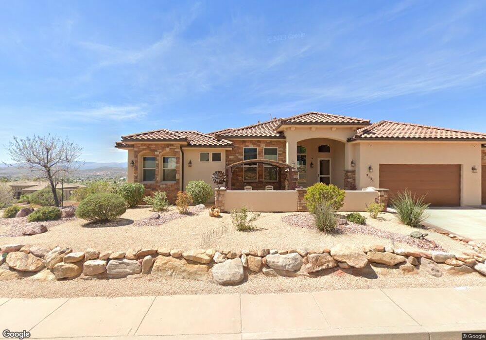
2125 N Tower Butte Dr St. George, UT 84770
Estimated Value: $689,000 - $824,000
3
Beds
2
Baths
11,087
Sq Ft
$70/Sq Ft
Est. Value
About This Home
This home is located at 2125 N Tower Butte Dr, St. George, UT 84770 and is currently estimated at $774,263, approximately $69 per square foot. 2125 N Tower Butte Dr is a home located in Washington County with nearby schools including Snow Canyon Middle School, Diamond Valley School, and Lava Ridge Intermediate School.
Ownership History
Date
Name
Owned For
Owner Type
Purchase Details
Closed on
Dec 15, 2020
Sold by
Edman Delain Andrew and Edman Kym L
Bought by
Edman Delain Andrew and Edman Kym L
Current Estimated Value
Home Financials for this Owner
Home Financials are based on the most recent Mortgage that was taken out on this home.
Original Mortgage
$160,000
Outstanding Balance
$89,360
Interest Rate
2.7%
Mortgage Type
New Conventional
Estimated Equity
$684,903
Purchase Details
Closed on
Jul 28, 2014
Sold by
S & S Construction Inc
Bought by
Edman Kym L and Edman Delain A
Home Financials for this Owner
Home Financials are based on the most recent Mortgage that was taken out on this home.
Original Mortgage
$314,964
Interest Rate
4.13%
Mortgage Type
New Conventional
Purchase Details
Closed on
Feb 25, 2014
Sold by
Turner Jerry L and Turner Carol S
Bought by
S & S Construction Inc
Create a Home Valuation Report for This Property
The Home Valuation Report is an in-depth analysis detailing your home's value as well as a comparison with similar homes in the area
Home Values in the Area
Average Home Value in this Area
Purchase History
| Date | Buyer | Sale Price | Title Company |
|---|---|---|---|
| Edman Delain Andrew | -- | Us Title Insurance Agency | |
| Edman Kym L | -- | Southern Utah Title | |
| S & S Construction Inc | -- | Skyview Title Insurance Agen |
Source: Public Records
Mortgage History
| Date | Status | Borrower | Loan Amount |
|---|---|---|---|
| Open | Edman Delain Andrew | $160,000 | |
| Closed | Edman Kym L | $314,964 |
Source: Public Records
Tax History Compared to Growth
Tax History
| Year | Tax Paid | Tax Assessment Tax Assessment Total Assessment is a certain percentage of the fair market value that is determined by local assessors to be the total taxable value of land and additions on the property. | Land | Improvement |
|---|---|---|---|---|
| 2025 | $2,963 | $448,690 | $112,200 | $336,490 |
| 2023 | $2,765 | $413,050 | $105,600 | $307,450 |
| 2022 | $3,028 | $425,480 | $99,000 | $326,480 |
| 2021 | $2,841 | $595,200 | $150,000 | $445,200 |
| 2020 | $2,705 | $533,800 | $120,000 | $413,800 |
| 2019 | $2,771 | $534,300 | $120,000 | $414,300 |
| 2018 | $4,480 | $445,900 | $0 | $0 |
| 2017 | $4,098 | $396,100 | $0 | $0 |
| 2016 | $4,476 | $400,100 | $0 | $0 |
| 2015 | $4,341 | $372,300 | $0 | $0 |
| 2014 | $1,043 | $90,000 | $0 | $0 |
Source: Public Records
Map
Nearby Homes
- 2294 N Gunsight Dr
- 1996 W 1940 N
- 2090 N Tuweap Dr Unit 13
- 2090 N Tuweap Dr Unit 9
- 2090 N Tuweap Dr Unit 15
- 2090 N Tuweap Dr Unit 56
- 1989 W 1800 N
- 1795 N Snow Canyon Parkway #40
- 1795 N Snow Canyon Pkwy Unit 28
- 1795 N Snow Canyon Pkwy Unit 59
- 1795 N Snow Canyon Pkwy Unit 40
- 1795 N Snow Canyon Pkwy Unit 40
- 1806 N Dixie Downs Rd Unit 27
- 1806 N Dixie Downs Rd Unit 27
- 1806 N Dixie Downs Rd Unit 29
- 1806 N Dixie Downs Rd Unit 29
- 1708 N 1975 W
- 2139 W Cougar Rock Cir Unit 192
- 2139 W Cougar Rock Cir
- 2139 W Cougar Rock Cir Unit 131
- 2131 N Tower Butte Dr
- 2098 N Lone Rock Dr
- 1735 W Castle Rock Rd
- 2098 Lone Rock Dr
- 1779 W Castle Rock Rd
- 2139 N Tower Butte Dr
- 2120 Lone Rock Dr
- 2120 N Lone Rock Dr
- 1733 Castle Rock Rd
- 1733 Castle Rock Rd
- 1733 Castle Rock Rd
- 0 W Castle Rock Dr Unit 13-144051
- 0 W Castle Rock Dr Unit 7-86527
- 0 W Castle Rock Dr Unit 18-197818
- 0 W Castle Rock Dr Unit 12-139570
- 0 W Castle Rock Dr Unit 7-87947
- 1779 W Castle Rock Dr
- 116 W Castle Rock Dr
- Lot 117 W Castle Rock Dr
- Lot 98 W Castle Rock Dr