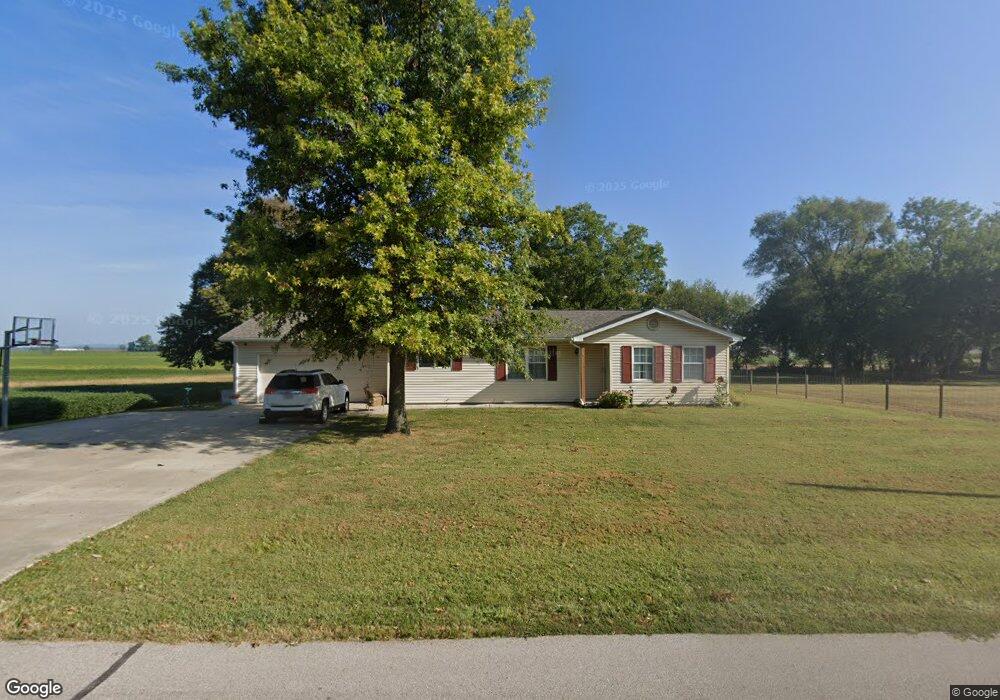
2125 Orchard Farm Dr Saint Charles, MO 63301
Kampville NeighborhoodEstimated Value: $206,000 - $292,000
3
Beds
1
Bath
1,352
Sq Ft
$187/Sq Ft
Est. Value
About This Home
This home is located at 2125 Orchard Farm Dr, Saint Charles, MO 63301 and is currently estimated at $253,145, approximately $187 per square foot. 2125 Orchard Farm Dr is a home located in St. Charles County with nearby schools including Orchard Farm Elementary School, Discovery Elementary School, and Orchard Farm Middle School.
Ownership History
Date
Name
Owned For
Owner Type
Purchase Details
Closed on
Apr 30, 2010
Sold by
Wuelling Cletus W and Wuelling Sharon K
Bought by
Bonderer Adam W and Denen Sara A
Current Estimated Value
Home Financials for this Owner
Home Financials are based on the most recent Mortgage that was taken out on this home.
Original Mortgage
$117,012
Outstanding Balance
$77,966
Interest Rate
4.93%
Mortgage Type
FHA
Estimated Equity
$175,179
Purchase Details
Closed on
Feb 25, 1999
Sold by
Wuelling Cletus W
Bought by
Wuelling Cletus and Clegg Katherine
Create a Home Valuation Report for This Property
The Home Valuation Report is an in-depth analysis detailing your home's value as well as a comparison with similar homes in the area
Home Values in the Area
Average Home Value in this Area
Purchase History
| Date | Buyer | Sale Price | Title Company |
|---|---|---|---|
| Bonderer Adam W | $125,000 | Ust | |
| Wuelling Cletus | -- | -- |
Source: Public Records
Mortgage History
| Date | Status | Borrower | Loan Amount |
|---|---|---|---|
| Open | Bonderer Adam W | $117,012 |
Source: Public Records
Tax History Compared to Growth
Tax History
| Year | Tax Paid | Tax Assessment Tax Assessment Total Assessment is a certain percentage of the fair market value that is determined by local assessors to be the total taxable value of land and additions on the property. | Land | Improvement |
|---|---|---|---|---|
| 2025 | $2,051 | $33,095 | -- | -- |
| 2023 | $2,048 | $32,538 | $0 | $0 |
| 2022 | $1,683 | $25,939 | $0 | $0 |
| 2021 | $1,685 | $25,939 | $0 | $0 |
| 2020 | $1,505 | $22,988 | $0 | $0 |
| 2019 | $1,352 | $22,988 | $0 | $0 |
| 2018 | $1,275 | $20,919 | $0 | $0 |
| 2017 | $1,266 | $20,919 | $0 | $0 |
| 2016 | $1,221 | $19,724 | $0 | $0 |
| 2015 | $1,232 | $19,724 | $0 | $0 |
| 2014 | $1,200 | $18,777 | $0 | $0 |
Source: Public Records
Map
Nearby Homes
- 2 Twin Silos
- 1 Twin Silos
- 0 Stringtown Rd Unit MIS25027831
- 0 Lot 11 Twin Silos Unit MAR25016691
- 0 Lot 10 Twin Silos Unit MAR25016676
- 0 Lot 8 Twin Silos Unit MAR25016668
- 0 Lot 7 Twin Silos Unit MAR25016662
- 0 Lot 5 Twin Silos Unit MAR25016659
- 0 Lot 4 Twin Silos Unit MAR25016643
- 00 Highway B
- 544 Summer Glen Ln
- 430 N Shore
- 706 Palisades Dr
- 164 Pampano Ln
- 701 Palisades Dr
- Carter Plan at Charlestowne Landing
- Westover Plan at Charlestowne Landing
- Aspen Plan at Charlestowne Landing
- Grayson 2 Plan at Charlestowne Landing
- Montego Plan at Charlestowne Landing
- 2120 Orchard Farm Dr
- 213 Fair Vue Way
- 210 Fair Vue Way
- 209 Fair Vue Way
- 5205 N Highway 94
- 206 Fair Vue Way
- 2140 Orchard Farm Dr
- 316 316 Pleasant Vue Way
- 316 Pleasant Vue Way
- 205 Fair Vue Way
- 2015 Meadow Vue Dr
- 312 Pleasant Vue Way
- 5195 N Highway 94
- 2025 Meadow Vue Dr
- 308 Pleasant Vue Way
- 2150 Orchard Farm Dr
- 315 Pleasant Vue Way
- 2014 Meadow Vue Dr
- 2006 Meadow Vue Dr
- 2018 Meadow Vue Dr