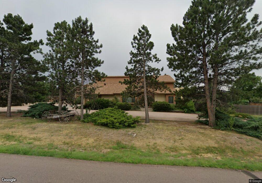
2125 Shrider Rd Colorado Springs, CO 80920
Falcon Estates NeighborhoodEstimated Value: $783,000 - $986,000
5
Beds
4
Baths
2,905
Sq Ft
$287/Sq Ft
Est. Value
About This Home
This home is located at 2125 Shrider Rd, Colorado Springs, CO 80920 and is currently estimated at $834,836, approximately $287 per square foot. 2125 Shrider Rd is a home located in El Paso County with nearby schools including Pioneer Elementary School, Mountain Ridge Middle School, and Rampart High School.
Ownership History
Date
Name
Owned For
Owner Type
Purchase Details
Closed on
Aug 20, 2024
Sold by
Peterson Duane J and Peterson Linda W
Bought by
Dlkp Family Trust
Current Estimated Value
Purchase Details
Closed on
Nov 5, 1993
Sold by
Williams James R and Williams Josi A
Bought by
Peterson Duane J and Peterson Linda W
Home Financials for this Owner
Home Financials are based on the most recent Mortgage that was taken out on this home.
Original Mortgage
$175,200
Interest Rate
6.88%
Purchase Details
Closed on
May 1, 1985
Bought by
Peterson Duane J and Peterson Linda W
Purchase Details
Closed on
Mar 1, 1985
Bought by
Peterson Duane J and Peterson Linda W
Purchase Details
Closed on
May 1, 1983
Bought by
Peterson Duane J and Peterson Linda W
Create a Home Valuation Report for This Property
The Home Valuation Report is an in-depth analysis detailing your home's value as well as a comparison with similar homes in the area
Home Values in the Area
Average Home Value in this Area
Purchase History
| Date | Buyer | Sale Price | Title Company |
|---|---|---|---|
| Dlkp Family Trust | -- | None Listed On Document | |
| Peterson Duane J | $219,000 | Security Title | |
| Peterson Duane J | -- | -- | |
| Peterson Duane J | -- | -- | |
| Peterson Duane J | -- | -- |
Source: Public Records
Mortgage History
| Date | Status | Borrower | Loan Amount |
|---|---|---|---|
| Previous Owner | Peterson Duane J | $175,200 |
Source: Public Records
Tax History Compared to Growth
Tax History
| Year | Tax Paid | Tax Assessment Tax Assessment Total Assessment is a certain percentage of the fair market value that is determined by local assessors to be the total taxable value of land and additions on the property. | Land | Improvement |
|---|---|---|---|---|
| 2025 | $3,048 | $57,740 | -- | -- |
| 2024 | $2,625 | $54,460 | $13,300 | $41,160 |
| 2023 | $2,625 | $54,460 | $13,300 | $41,160 |
| 2022 | $2,152 | $39,470 | $7,350 | $32,120 |
| 2021 | $2,390 | $40,600 | $7,560 | $33,040 |
| 2020 | $2,040 | $33,650 | $6,580 | $27,070 |
| 2019 | $2,563 | $33,650 | $6,580 | $27,070 |
| 2018 | $2,197 | $28,350 | $5,760 | $22,590 |
| 2017 | $2,189 | $28,350 | $5,760 | $22,590 |
| 2016 | $2,254 | $29,160 | $6,370 | $22,790 |
| 2015 | $2,250 | $29,160 | $6,370 | $22,790 |
| 2014 | $2,029 | $26,270 | $5,970 | $20,300 |
Source: Public Records
Map
Nearby Homes
- 7191 Ross Dr
- 6881 Los Reyes Cir
- 6872 Los Reyes Cir
- 2661 Hatch Cir
- 2546 Hatch Cir
- 1884 Fuller Rd
- 6868 Los Reyes Cir
- 6806 Los Reyes Cir
- 2570 Hatch Cir
- 2579 Hatch Cir
- 1871 Brookwood Dr
- 2563 Integrity Ct
- 2650 Bannister Ct
- 6641 Gambol Quail Dr W
- 2570 Covington Place
- 2110 Whitehorn Dr N
- 1907 Independence Dr
- 6655 Sproul Ln
- 6633 Dublin Loop W Unit 4
- 2650 Canton Ln
- 2173 Shrider Rd
- 2099 Shrider Rd
- 2128 Copley Rd
- 7237 Whitley Dr
- 7180 Stinson Dr
- 2090 Copley Rd
- 7230 Stinson Dr
- 7246 Whitley Dr
- 7189 Bell Dr
- 7147 Bell Dr
- 7245 Whitley Dr
- 2135 Copley Rd
- 2006 Shrider Rd
- 2171 Copley Rd
- 2097 Copley Rd
- 2235 Shrider Rd
- 7286 Stinson Dr
- 7235 Stinson Dr
- 7256 Whitley Dr
- 7095 Bell Dr