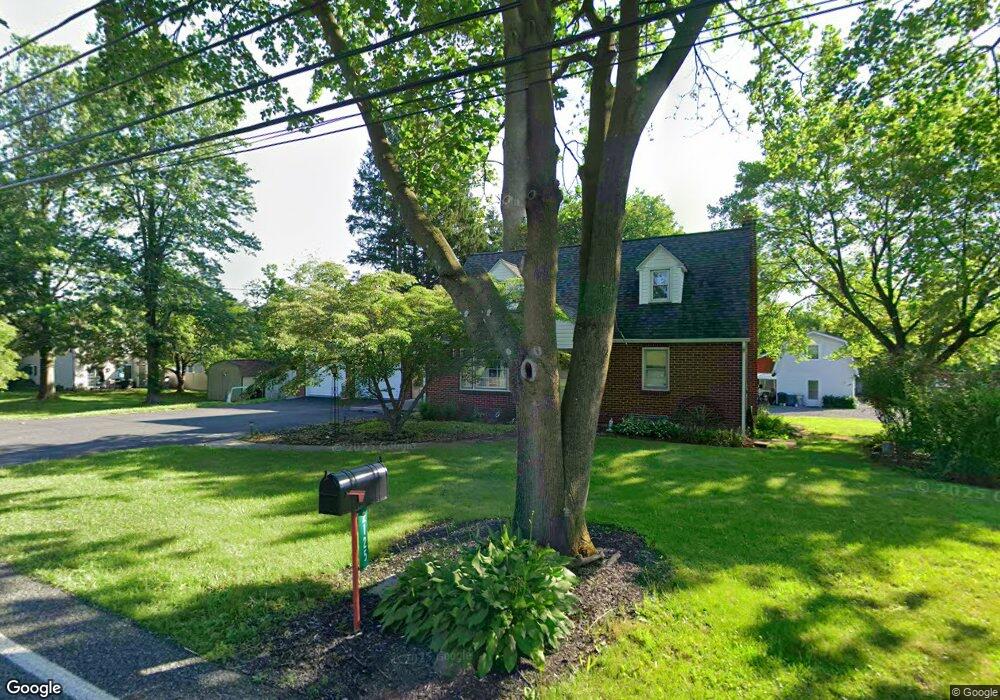
2125 Spinnerstown Rd Quakertown, PA 18951
Milford-Quakertown NeighborhoodEstimated Value: $323,000 - $374,000
2
Beds
2
Baths
1,224
Sq Ft
$291/Sq Ft
Est. Value
About This Home
This home is located at 2125 Spinnerstown Rd, Quakertown, PA 18951 and is currently estimated at $355,851, approximately $290 per square foot. 2125 Spinnerstown Rd is a home located in Bucks County with nearby schools including Pfaff Elementary School, Quakertown Community Senior High School, and United Friends School.
Ownership History
Date
Name
Owned For
Owner Type
Purchase Details
Closed on
Jun 3, 2019
Sold by
Rhoades Michael J and Rhoades Karen M
Bought by
Rlt Michael J Rhoades and Rlt Karen M Rhoades
Current Estimated Value
Purchase Details
Closed on
Mar 28, 2018
Sold by
Young Tyhetesa M and Young Family Trust
Bought by
Rhaode Karen M and Rhaode Mciahel J
Purchase Details
Closed on
Dec 1, 1998
Sold by
Young Edward J and Young Theresa M
Bought by
Young Edward J and Young Theresa M
Purchase Details
Closed on
Feb 3, 1956
Bought by
Young Edw J and Young Theresa
Create a Home Valuation Report for This Property
The Home Valuation Report is an in-depth analysis detailing your home's value as well as a comparison with similar homes in the area
Home Values in the Area
Average Home Value in this Area
Purchase History
| Date | Buyer | Sale Price | Title Company |
|---|---|---|---|
| Rlt Michael J Rhoades | -- | None Available | |
| Rhaode Karen M | -- | None Available | |
| Young Edward J | -- | -- | |
| Young Edw J | -- | -- |
Source: Public Records
Tax History Compared to Growth
Tax History
| Year | Tax Paid | Tax Assessment Tax Assessment Total Assessment is a certain percentage of the fair market value that is determined by local assessors to be the total taxable value of land and additions on the property. | Land | Improvement |
|---|---|---|---|---|
| 2025 | $3,711 | $18,400 | $2,800 | $15,600 |
| 2024 | $3,711 | $18,400 | $2,800 | $15,600 |
| 2023 | $3,674 | $18,400 | $2,800 | $15,600 |
| 2022 | $3,612 | $18,400 | $2,800 | $15,600 |
| 2021 | $3,612 | $18,400 | $2,800 | $15,600 |
| 2020 | $3,612 | $18,400 | $2,800 | $15,600 |
| 2019 | $3,511 | $18,400 | $2,800 | $15,600 |
| 2018 | $3,390 | $18,400 | $2,800 | $15,600 |
| 2017 | $3,285 | $18,400 | $2,800 | $15,600 |
| 2016 | -- | $18,400 | $2,800 | $15,600 |
| 2015 | -- | $18,400 | $2,800 | $15,600 |
| 2014 | -- | $18,400 | $2,800 | $15,600 |
Source: Public Records
Map
Nearby Homes
- 1805 Leedum Ln
- 1999 Crossing Way
- 1856 Alamingo Dr
- 8769 Spinnerstown Rd
- 1625 Canary Rd
- 1615 Canary Rd
- 1605 Canary Rd
- 444 Enclave Dr Unit SAVANNAH
- 444 Enclave Dr Unit COVINGTON
- 444 Enclave Dr Unit SEBASTIAN
- 444 Enclave Dr Unit DEVONSHIRE
- 444 Enclave Dr Unit PARKER
- 444 Enclave Dr Unit HAWTHORNE
- 1844 Enclave Dr
- 1765 Old Plains Rd
- 1940 Geryville Pike
- 1270 Fennel Rd
- 1830 Geryville Pike
- 1410 Fels Rd
- 2365 E Swamp Rd