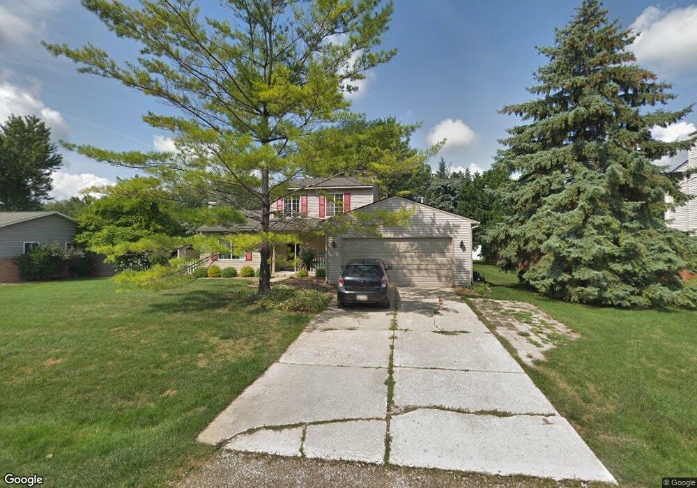
2126 Aurelia Rd Unit Bldg-Unit West Bloomfield, MI 48324
Estimated Value: $366,000 - $504,000
3
Beds
3
Baths
1,616
Sq Ft
$271/Sq Ft
Est. Value
About This Home
This home is located at 2126 Aurelia Rd Unit Bldg-Unit, West Bloomfield, MI 48324 and is currently estimated at $437,241, approximately $270 per square foot. 2126 Aurelia Rd Unit Bldg-Unit is a home located in Oakland County with nearby schools including Waterford Montessori Academy, Our Lady Of Refuge School, and Lakecrest Baptist School.
Ownership History
Date
Name
Owned For
Owner Type
Purchase Details
Closed on
Jul 26, 2018
Sold by
Hayes Michael F and Hayes Kathleehn J
Bought by
Doerscher Thomas Carl and Doerscher Nicole
Current Estimated Value
Purchase Details
Closed on
Mar 24, 1997
Sold by
Beakley James D
Bought by
Hayes Michael F
Create a Home Valuation Report for This Property
The Home Valuation Report is an in-depth analysis detailing your home's value as well as a comparison with similar homes in the area
Home Values in the Area
Average Home Value in this Area
Purchase History
| Date | Buyer | Sale Price | Title Company |
|---|---|---|---|
| Doerscher Thomas Carl | $235,000 | Ata National Title Group Llc | |
| Hayes Michael F | $155,000 | -- |
Source: Public Records
Tax History Compared to Growth
Tax History
| Year | Tax Paid | Tax Assessment Tax Assessment Total Assessment is a certain percentage of the fair market value that is determined by local assessors to be the total taxable value of land and additions on the property. | Land | Improvement |
|---|---|---|---|---|
| 2024 | $3,585 | $175,330 | $0 | $0 |
| 2022 | $3,433 | $142,770 | $37,500 | $105,270 |
| 2021 | $5,159 | $133,510 | $0 | $0 |
| 2020 | $3,327 | $130,970 | $37,500 | $93,470 |
| 2018 | $4,584 | $114,660 | $37,510 | $77,150 |
| 2015 | -- | $94,810 | $0 | $0 |
| 2014 | -- | $86,120 | $0 | $0 |
| 2011 | -- | $78,850 | $0 | $0 |
Source: Public Records
Map
Nearby Homes
- 5149 Latimer St
- 5145 Greer Rd
- 2115 Aldwin Dr
- 1859 Poppleton Dr
- 1844 Poppleton Dr
- 2110 Peachtree Ct
- 4796 Dow Ridge Rd
- 1753 Dawncrest Dr
- 4764 Dow Ridge Rd
- 5699 Applegrove Dr
- 2501 Doleman Dr
- 5190 Westcombe Ln
- 2140 Timberridge Ct
- 1677 Parkview Ave
- 1522 Oregon Ct
- VAC Daron Ln
- Lot 94 Hiller Rd
- 3102 Rose Ln
- Lots Green Lake Langtoft
- 2780 Orchard Place
- 2126 Aurelia Rd
- 2148 Aurelia Rd
- 2104 Aurelia Rd
- 2125 Greydale
- 2147 Greydale
- 2103 Greydale
- 2129 Aurelia Rd
- 2151 Aurelia Rd
- 2111 Aurelia Rd
- 5110 Latimer St
- 5136 Latimer St Unit Bldg-Unit
- 5136 Latimer St
- 2102 Greydale
- 00 Latimer
- 2130 Aldwin Dr
- 2124 Greydale Unit Bldg-Unit
- 2124 Greydale
- 2150 Aldwin Dr
- 2110 Aldwin Dr
- 5347 Midchester Ct