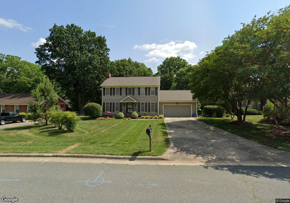
2126 Hawthorne Ln Burlington, NC 27215
West Burlington NeighborhoodEstimated Value: $334,000 - $364,000
4
Beds
3
Baths
2,166
Sq Ft
$161/Sq Ft
Est. Value
About This Home
This home is located at 2126 Hawthorne Ln, Burlington, NC 27215 and is currently estimated at $349,080, approximately $161 per square foot. 2126 Hawthorne Ln is a home located in Alamance County with nearby schools including Marvin B. Smith Elementary School, Turrentine Middle School, and Walter M. Williams High School.
Ownership History
Date
Name
Owned For
Owner Type
Purchase Details
Closed on
Jun 3, 2022
Sold by
Allan Brown Mackenzie and Sakurai Ayako
Bought by
Teachey Michael Addison and Teachey Lindy Terry
Current Estimated Value
Purchase Details
Closed on
Mar 3, 2006
Sold by
Beshel John P
Bought by
Brown Mackenzie A
Home Financials for this Owner
Home Financials are based on the most recent Mortgage that was taken out on this home.
Original Mortgage
$152,800
Interest Rate
6.04%
Mortgage Type
New Conventional
Purchase Details
Closed on
Jan 13, 2004
Sold by
Beaman Philip
Bought by
Beshel John
Purchase Details
Closed on
Jul 17, 2001
Sold by
Cole Phillip J
Bought by
Beshel John P
Home Financials for this Owner
Home Financials are based on the most recent Mortgage that was taken out on this home.
Original Mortgage
$178,190
Interest Rate
7.16%
Create a Home Valuation Report for This Property
The Home Valuation Report is an in-depth analysis detailing your home's value as well as a comparison with similar homes in the area
Home Values in the Area
Average Home Value in this Area
Purchase History
| Date | Buyer | Sale Price | Title Company |
|---|---|---|---|
| Teachey Michael Addison | $280,000 | Law Office Of Ann Marie Vosbur | |
| Brown Mackenzie A | $191,000 | -- | |
| Beshel John | $53,000 | -- | |
| Beshel John P | $173,000 | -- |
Source: Public Records
Mortgage History
| Date | Status | Borrower | Loan Amount |
|---|---|---|---|
| Previous Owner | Brown Mackenzie A | $152,800 | |
| Previous Owner | Beshel John P | $178,190 | |
| Closed | Teachey Michael Addison | $0 |
Source: Public Records
Tax History Compared to Growth
Tax History
| Year | Tax Paid | Tax Assessment Tax Assessment Total Assessment is a certain percentage of the fair market value that is determined by local assessors to be the total taxable value of land and additions on the property. | Land | Improvement |
|---|---|---|---|---|
| 2025 | $1,622 | $328,339 | $65,000 | $263,339 |
| 2024 | $1,540 | $328,339 | $65,000 | $263,339 |
| 2023 | $2,991 | $328,339 | $65,000 | $263,339 |
| 2022 | $2,226 | $179,343 | $36,500 | $142,843 |
| 2021 | $2,244 | $179,343 | $36,500 | $142,843 |
| 2020 | $2,261 | $179,343 | $36,500 | $142,843 |
| 2019 | $2,267 | $179,343 | $36,500 | $142,843 |
| 2018 | $1,066 | $179,343 | $36,500 | $142,843 |
| 2017 | $2,111 | $179,343 | $36,500 | $142,843 |
| 2016 | $2,227 | $192,018 | $36,500 | $155,518 |
| 2015 | $1,108 | $192,018 | $36,500 | $155,518 |
| 2014 | $1,013 | $192,018 | $36,500 | $155,518 |
Source: Public Records
Map
Nearby Homes
- 1409 Keogh St
- 1413 Keogh St
- 1303 Cherry Dr
- 1405 Cherry Dr
- 1950 W Front St
- 2149 Woodland Ave
- 1709 Hawthorne Ln
- 2174 Woodland Ave
- 1526 Regency Ct
- 1518 Sherwood Dr
- 2037 Gurney Ct
- 2228 Walker Ave
- 1004 Sherwood Dr
- 1700 Roslyn Dr Unit 29D
- 1700 Roslyn Dr Unit 25c
- 1926 Downing Dr
- 1917 Edgewood Ave
- 1300 Warwick Dr Unit 5d
- 1510 W Davis St
- 2003 Edgewood Ave
- 2132 Hawthorne Ln
- 2122 Hawthorne Ln
- 2127 Crosby Dr
- 2133 Crosby Dr
- 2136 Hawthorne Ln
- 2116 Hawthorne Ln
- 2125 Hawthorne Ln
- 2125 Crosby Dr
- 1701 Dorsett St
- 2137 Crosby Dr
- 2121 Crosby Dr
- 2129 Hawthorne Ln
- 1703 Dorsett St
- 2115 Crosby Dr
- 1707 Dorsett St
- 1710 Dorsett St
- 1334 McCuiston Dr
- 1328 McCuiston Dr
- 1338 McCuiston Dr