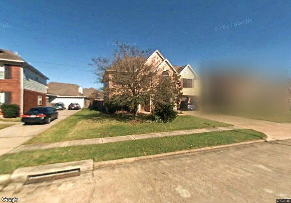
2126 Laurel Oaks Dr Houston, TX 77014
Northside NeighborhoodEstimated Value: $294,860 - $312,000
4
Beds
3
Baths
2,927
Sq Ft
$104/Sq Ft
Est. Value
About This Home
This home is located at 2126 Laurel Oaks Dr, Houston, TX 77014 and is currently estimated at $304,215, approximately $103 per square foot. 2126 Laurel Oaks Dr is a home located in Harris County with nearby schools including Deloras E Thompson Elementary School, Stelle Claughton Middle School, and Andy Dekaney High School.
Ownership History
Date
Name
Owned For
Owner Type
Purchase Details
Closed on
Jun 16, 2003
Sold by
Sheffield Donald Ray and Sheffield Mollie J
Bought by
Edmondson Gerald and Edmondson Christine
Current Estimated Value
Home Financials for this Owner
Home Financials are based on the most recent Mortgage that was taken out on this home.
Original Mortgage
$132,600
Outstanding Balance
$68,760
Interest Rate
8.37%
Mortgage Type
Purchase Money Mortgage
Estimated Equity
$235,455
Purchase Details
Closed on
Dec 28, 1995
Sold by
Kimball Hill Homes Texas Inc
Bought by
Sheffield Donald Ray and Sheffield Mollie J
Home Financials for this Owner
Home Financials are based on the most recent Mortgage that was taken out on this home.
Original Mortgage
$115,750
Interest Rate
7.5%
Mortgage Type
VA
Create a Home Valuation Report for This Property
The Home Valuation Report is an in-depth analysis detailing your home's value as well as a comparison with similar homes in the area
Home Values in the Area
Average Home Value in this Area
Purchase History
| Date | Buyer | Sale Price | Title Company |
|---|---|---|---|
| Edmondson Gerald | -- | First Southwestern Title | |
| Sheffield Donald Ray | -- | Stewart Title |
Source: Public Records
Mortgage History
| Date | Status | Borrower | Loan Amount |
|---|---|---|---|
| Open | Edmondson Gerald | $132,600 | |
| Previous Owner | Sheffield Donald Ray | $115,750 |
Source: Public Records
Tax History Compared to Growth
Tax History
| Year | Tax Paid | Tax Assessment Tax Assessment Total Assessment is a certain percentage of the fair market value that is determined by local assessors to be the total taxable value of land and additions on the property. | Land | Improvement |
|---|---|---|---|---|
| 2025 | $2,602 | $288,457 | $48,124 | $240,333 |
| 2024 | $2,602 | $288,049 | $48,124 | $239,925 |
| 2023 | $2,602 | $315,188 | $48,124 | $267,064 |
| 2022 | $6,635 | $258,951 | $21,035 | $237,916 |
| 2021 | $6,330 | $220,014 | $21,035 | $198,979 |
| 2020 | $6,118 | $214,505 | $21,672 | $192,833 |
| 2019 | $5,785 | $197,979 | $21,672 | $176,307 |
| 2018 | $2,333 | $171,706 | $21,672 | $150,034 |
| 2017 | $5,903 | $174,000 | $21,672 | $152,328 |
| 2016 | $5,419 | $166,000 | $21,672 | $144,328 |
| 2015 | $2,878 | $154,011 | $21,672 | $132,339 |
| 2014 | $2,878 | $136,694 | $21,672 | $115,022 |
Source: Public Records
Map
Nearby Homes
- 2230 Laurel Oaks Dr
- 2223 Laurel Branch Way
- 12330 Garden Laurel Ln
- 2230 Laurel Branch Way
- 2214 Brimmage Dr
- 12306 Wright Oaks Dr
- 12231 Auronia Dr
- 12606 Riverhill Ct
- 12638 Riverhill Ct
- 12415 Silversmine Dr
- 12322 Tranquil Pines Dr
- 12303 Lariat Run Dr
- 2411 Prides Crossing Rd
- 1727 Plumwood Dr
- 2423 Prides Crossing Rd
- 12147 Swords Creek Rd
- 5519 Handlewood Ln
- 12222 Cobbs Creek Rd
- 1675 Hugh Rd Unit C
- 1675 Hugh Rd Unit B
- 2122 Laurel Oaks Dr
- 2202 Laurel Oaks Dr
- 2243 Laurel Forest Way
- 2206 Laurel Oaks Dr
- 2118 Laurel Oaks Dr
- 2103 Laurel Forest Way
- 12318 Wilde Laurel Ln
- 2242 Laurel Forest Way
- 2107 Laurel Forest Way
- 2239 Laurel Forest Way
- 2210 Laurel Oaks Dr
- 2114 Laurel Oaks Dr
- 2102 Laurel Forest Way
- 12319 Wilde Laurel Ln
- 12314 Wilde Laurel Ln
- 2238 Laurel Forest Way
- 2110 Laurel Oaks Dr
- 12351 Misty Laurel Dr
- 2214 Laurel Oaks Dr
- 12315 Wilde Laurel Ln