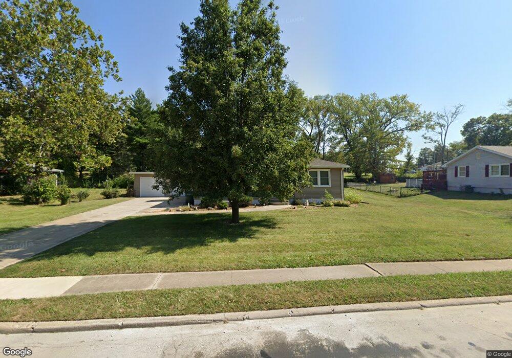
2126 S Franklin Street Rd Decatur, IL 62521
South Shores NeighborhoodEstimated Value: $104,000 - $218,000
3
Beds
2
Baths
1,357
Sq Ft
$138/Sq Ft
Est. Value
About This Home
This home is located at 2126 S Franklin Street Rd, Decatur, IL 62521 and is currently estimated at $187,485, approximately $138 per square foot. 2126 S Franklin Street Rd is a home located in Macon County with nearby schools including South Shores Elementary School, Stephen Decatur Middle School, and Holy Family Catholic School.
Ownership History
Date
Name
Owned For
Owner Type
Purchase Details
Closed on
Jun 2, 2025
Sold by
Burtley Chonice
Bought by
Deberry Brenda
Current Estimated Value
Purchase Details
Closed on
May 27, 2025
Sold by
Palmer Richard
Bought by
Burtley Chonice
Purchase Details
Closed on
Apr 30, 2025
Sold by
Palmer Richard and Jackson Brett
Bought by
Palmer Richard
Purchase Details
Closed on
Jan 11, 2020
Sold by
Jackson Donna K Palmer
Bought by
Jackson Brett A and Palmer Richard S
Purchase Details
Closed on
Dec 1, 2003
Create a Home Valuation Report for This Property
The Home Valuation Report is an in-depth analysis detailing your home's value as well as a comparison with similar homes in the area
Home Values in the Area
Average Home Value in this Area
Purchase History
| Date | Buyer | Sale Price | Title Company |
|---|---|---|---|
| Deberry Brenda | -- | None Listed On Document | |
| Burtley Chonice | -- | None Listed On Document | |
| Palmer Richard | -- | None Listed On Document | |
| Jackson Brett A | -- | None Listed On Document | |
| Jackson Brett A | -- | None Listed On Document | |
| -- | $60,000 | -- |
Source: Public Records
Tax History Compared to Growth
Tax History
| Year | Tax Paid | Tax Assessment Tax Assessment Total Assessment is a certain percentage of the fair market value that is determined by local assessors to be the total taxable value of land and additions on the property. | Land | Improvement |
|---|---|---|---|---|
| 2024 | $2,076 | $27,449 | $8,258 | $19,191 |
| 2023 | $2,038 | $26,478 | $7,966 | $18,512 |
| 2022 | $1,866 | $24,249 | $7,372 | $16,877 |
| 2021 | $1,713 | $22,645 | $6,884 | $15,761 |
| 2020 | $1,658 | $21,594 | $6,564 | $15,030 |
| 2019 | $1,658 | $21,594 | $6,564 | $15,030 |
| 2018 | $1,449 | $19,789 | $7,222 | $12,567 |
| 2017 | $1,290 | $20,317 | $7,415 | $12,902 |
| 2016 | $1,535 | $20,525 | $7,491 | $13,034 |
| 2015 | $1,448 | $20,163 | $7,359 | $12,804 |
| 2014 | $1,339 | $19,963 | $7,286 | $12,677 |
| 2013 | $1,405 | $20,713 | $7,560 | $13,153 |
Source: Public Records
Map
Nearby Homes
- 38 Reeder Dr
- 23 La Salle Dr
- 344 W Imboden Dr
- 28 Sandcreek Dr
- 59 Medial Dr
- 134 Madison Dr
- 4220 S Lake Ct
- 19 Peggy Ann Dr
- 20 Ridge Dr
- 2265 S Franzy Dr
- 0 Wildwood Ct
- 102 Phillips Dr
- 405 Hackberry Dr
- 320 Hackberry Place
- 98 Ridgeway Dr
- 2605 S Forrest Green Dr
- 2626 S Forrest Green Dr
- 2628 S Forrest Green Dr
- 1347 S Maffit St
- 409 Southmoreland Place
- 2114 S Franklin Street Rd
- 2138 S Franklin Street Rd
- 2150 S Franklin Street Rd
- 2104 S Franklin Street Rd
- 2160 S Franklin Street Rd
- 105 S Shores Dr
- 3 8th Dr
- 7 8th Dr
- 48 W Enlow Dr
- 2170 S Franklin Street Rd
- 107 S Shores Dr
- 19 8th Dr
- 46 W Enlow Dr
- 11 8th Dr
- 23 8th Dr
- 2 8th Dr
- 2140 S Imboden Place
- 4 8th Dr
- 44 W Enlow Dr
- 2130 S Imboden Place