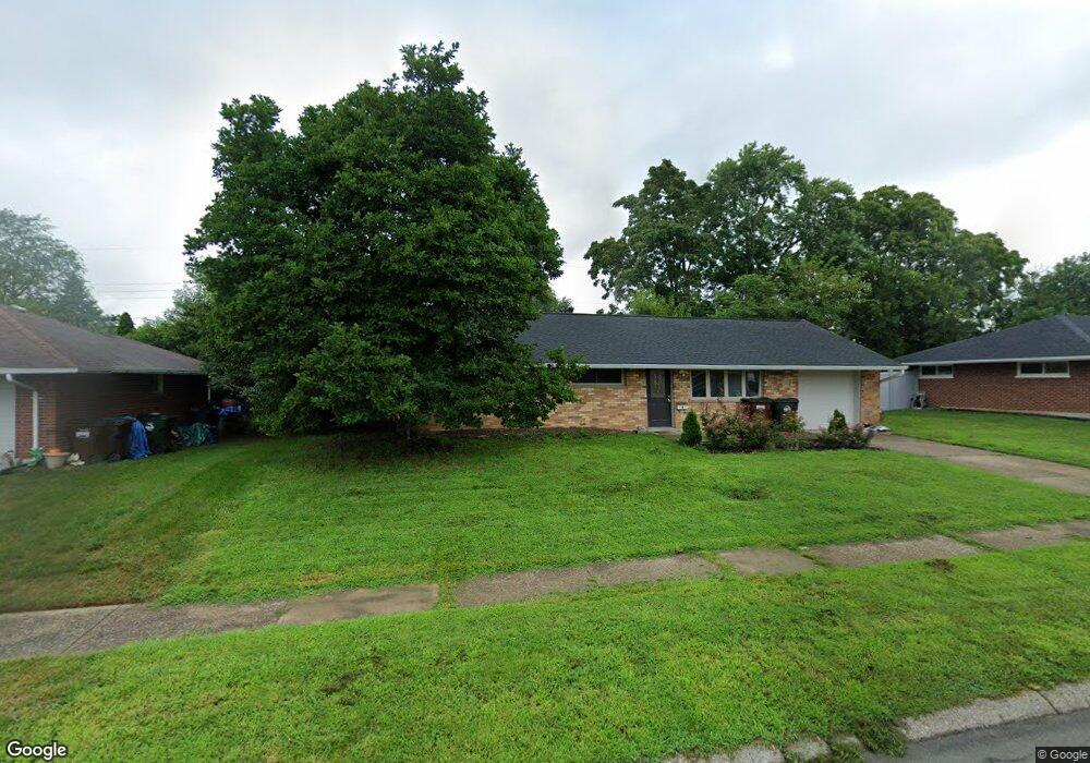
2127 Mattis Dr Dayton, OH 45439
Woodbourne-Hyde Park NeighborhoodEstimated Value: $171,144 - $194,000
3
Beds
1
Bath
1,080
Sq Ft
$172/Sq Ft
Est. Value
About This Home
This home is located at 2127 Mattis Dr, Dayton, OH 45439 and is currently estimated at $186,036, approximately $172 per square foot. 2127 Mattis Dr is a home located in Montgomery County with nearby schools including West Carrollton High School, Miami Valley Academies, and St. Albert the Great Catholic School.
Ownership History
Date
Name
Owned For
Owner Type
Purchase Details
Closed on
Dec 13, 2022
Sold by
Diskete Melissa L
Bought by
Flores Jose Eulices Reye
Current Estimated Value
Home Financials for this Owner
Home Financials are based on the most recent Mortgage that was taken out on this home.
Original Mortgage
$97,600
Outstanding Balance
$94,322
Interest Rate
6.33%
Mortgage Type
New Conventional
Estimated Equity
$91,714
Purchase Details
Closed on
Oct 22, 2007
Sold by
Goings Kimberly D
Bought by
Diskete Melissa L and Diskete Kenneth R
Home Financials for this Owner
Home Financials are based on the most recent Mortgage that was taken out on this home.
Original Mortgage
$86,640
Interest Rate
6.38%
Mortgage Type
FHA
Create a Home Valuation Report for This Property
The Home Valuation Report is an in-depth analysis detailing your home's value as well as a comparison with similar homes in the area
Home Values in the Area
Average Home Value in this Area
Purchase History
| Date | Buyer | Sale Price | Title Company |
|---|---|---|---|
| Flores Jose Eulices Reye | $125,500 | -- | |
| Diskete Melissa L | $88,000 | Midwest Title Company |
Source: Public Records
Mortgage History
| Date | Status | Borrower | Loan Amount |
|---|---|---|---|
| Open | Flores Jose Eulices Reye | $97,600 | |
| Previous Owner | Diskete Melissa L | $86,640 |
Source: Public Records
Tax History Compared to Growth
Tax History
| Year | Tax Paid | Tax Assessment Tax Assessment Total Assessment is a certain percentage of the fair market value that is determined by local assessors to be the total taxable value of land and additions on the property. | Land | Improvement |
|---|---|---|---|---|
| 2024 | $3,228 | $45,900 | $7,820 | $38,080 |
| 2023 | $3,228 | $45,900 | $7,820 | $38,080 |
| 2022 | $2,810 | $30,810 | $5,250 | $25,560 |
| 2021 | $2,595 | $30,810 | $5,250 | $25,560 |
| 2020 | $2,595 | $30,810 | $5,250 | $25,560 |
| 2019 | $2,557 | $26,550 | $5,250 | $21,300 |
| 2018 | $2,392 | $26,550 | $5,250 | $21,300 |
| 2017 | $2,378 | $26,550 | $5,250 | $21,300 |
| 2016 | $2,404 | $25,970 | $5,250 | $20,720 |
| 2015 | $2,237 | $25,970 | $5,250 | $20,720 |
| 2014 | $2,237 | $25,970 | $5,250 | $20,720 |
| 2012 | -- | $26,640 | $7,000 | $19,640 |
Source: Public Records
Map
Nearby Homes
- 2090 Mattis Dr
- 1692 Hillwood Dr
- 1673 W Stroop Rd
- 4301 Tait Rd
- 4051 Ellery Ave
- 1952 Tait Circle Rd
- 1905 Tait Circle Rd
- 4207 S Dixie Dr
- 4629 Richwood Dr
- 4661 Richwood Dr
- 2050 William Ln
- 3720 Ridgeleigh Rd Unit D
- 2639 Blanchard Ave
- 4792 Loxley Dr
- 2571 Cluster Ave
- 1349 Tamerlane Rd
- 1955 Kresswood Cir
- 5084 Mays Ave
- 4400 Royal Ridge Way
- 2399 Polo Park Dr
- 2141 Mattis Dr
- 2112 Norway Dr
- 2126 Norway Dr
- 2098 Norway Dr
- 2128 Mattis Dr
- 2153 Mattis Dr
- 2114 Mattis Dr
- 2064 Norway Dr
- 2140 Norway Dr
- 2142 Mattis Dr
- 2093 Mattis Dr
- 2154 Mattis Dr
- 2167 Mattis Dr
- 2115 Norway Dr
- 2154 Norway Dr
- 2139 Owendale Dr
- 2101 Norway Dr
- 2125 Owendale Dr
- 2129 Norway Dr
- 2153 Owendale Dr