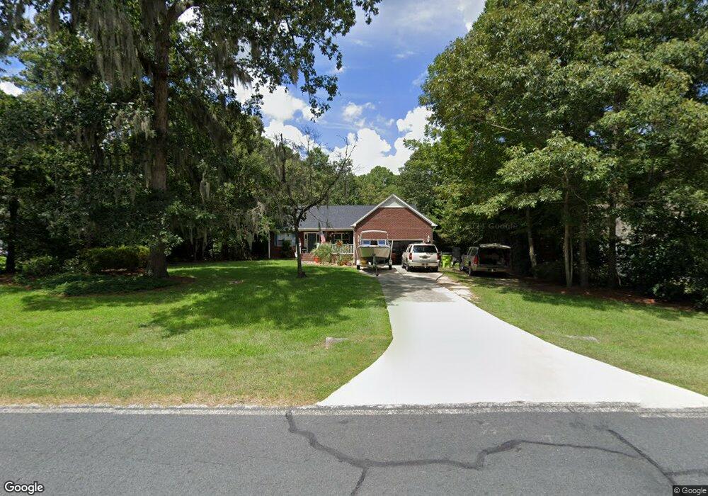
2127 Perrytown Loop Rd New Bern, NC 28562
Estimated Value: $308,452 - $332,000
3
Beds
2
Baths
1,524
Sq Ft
$212/Sq Ft
Est. Value
About This Home
This home is located at 2127 Perrytown Loop Rd, New Bern, NC 28562 and is currently estimated at $323,363, approximately $212 per square foot. 2127 Perrytown Loop Rd is a home located in Craven County with nearby schools including Brinson Memorial Elementary School, Grover C. Fields Middle School, and New Bern High School.
Ownership History
Date
Name
Owned For
Owner Type
Purchase Details
Closed on
Sep 6, 2022
Sold by
Smith John M and Smith Carl Mildred
Bought by
Brigode Thomas H and Brigode Cheryl L
Current Estimated Value
Home Financials for this Owner
Home Financials are based on the most recent Mortgage that was taken out on this home.
Original Mortgage
$216,800
Outstanding Balance
$206,479
Interest Rate
5.54%
Mortgage Type
New Conventional
Estimated Equity
$116,884
Purchase Details
Closed on
Jun 6, 1997
Sold by
Dedco Inc
Bought by
Smith Mildred B Carl
Create a Home Valuation Report for This Property
The Home Valuation Report is an in-depth analysis detailing your home's value as well as a comparison with similar homes in the area
Home Values in the Area
Average Home Value in this Area
Purchase History
| Date | Buyer | Sale Price | Title Company |
|---|---|---|---|
| Brigode Thomas H | $271,000 | -- | |
| Smith Mildred B Carl | $109,500 | -- |
Source: Public Records
Mortgage History
| Date | Status | Borrower | Loan Amount |
|---|---|---|---|
| Open | Brigode Thomas H | $216,800 |
Source: Public Records
Tax History
| Year | Tax Paid | Tax Assessment Tax Assessment Total Assessment is a certain percentage of the fair market value that is determined by local assessors to be the total taxable value of land and additions on the property. | Land | Improvement |
|---|---|---|---|---|
| 2025 | $1,209 | $244,540 | $58,430 | $186,110 |
| 2024 | $1,209 | $244,540 | $58,430 | $186,110 |
| 2023 | $1,197 | $244,540 | $58,430 | $186,110 |
| 2022 | $1,051 | $169,410 | $48,450 | $120,960 |
| 2021 | $1,051 | $169,410 | $48,450 | $120,960 |
| 2020 | $1,033 | $169,410 | $48,450 | $120,960 |
| 2019 | $1,033 | $169,410 | $48,450 | $120,960 |
| 2018 | $992 | $169,410 | $48,450 | $120,960 |
| 2017 | $996 | $169,410 | $48,450 | $120,960 |
| 2016 | $986 | $181,270 | $50,400 | $130,870 |
| 2015 | $918 | $181,270 | $50,400 | $130,870 |
| 2014 | $916 | $181,270 | $50,400 | $130,870 |
Source: Public Records
Map
Nearby Homes
- 103 Brigadoon Ct
- 2504 Brices Creek Rd
- 2301 Brices Creek Rd
- 2519 Starling Ln
- 2504 Starling Ln
- 2514 Starling Ln
- 112 Pebblebrook Dr
- 2507 Wild Turkey Rd
- 2428 Starling
- 2430 Starling
- 2413 Starling
- 2410 Starling
- 2500 Plover Way
- 2505 Plover Way
- 2500 Starling
- 102 Featherstone Ln
- 2508 Plover Way
- Lot 5 Junco
- Lot 6 Junco
- Lot 7 Junco
- 2125 Perrytown Loop Rd
- 2129 Perrytown Loop Rd
- 102 Shady Oaks Ct
- 2131 Perrytown Loop Rd
- 104 Shady Oaks Ct
- 102 Walnut Rd
- 2311 Oakview Dr
- 106 Walnut Rd
- 2133 Perrytown Loop Rd
- 100 Shady Oaks Ct
- 103 Walnut Rd
- 2309 Oakview Dr
- 103 Shady Oaks Ct
- 108 Walnut Rd
- 2401 Oakview Dr
- 110 Walnut Rd
- 2121 Perrytown Loop Rd
- 2307 Oakview Dr
- 2137 Perrytown Loop Rd
- 109 Walnut Rd
Your Personal Tour Guide
Ask me questions while you tour the home.