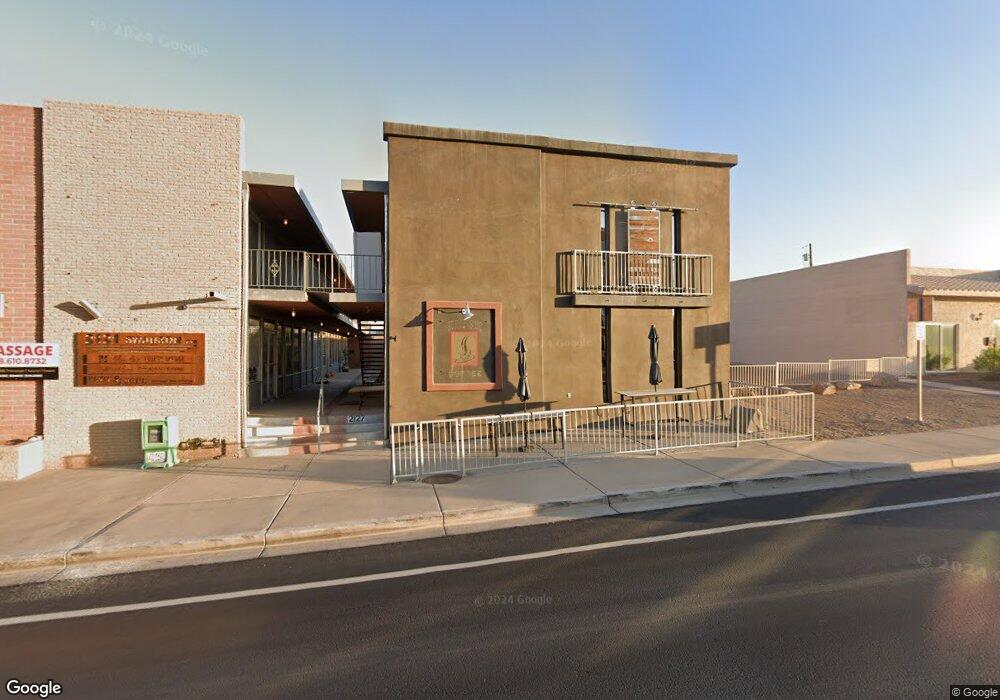
2127 Swanson Ave Lake Havasu City, AZ 86403
Estimated Value: $450,564
--
Bed
--
Bath
1,829
Sq Ft
$246/Sq Ft
Est. Value
About This Home
This home is located at 2127 Swanson Ave, Lake Havasu City, AZ 86403 and is currently estimated at $450,564, approximately $246 per square foot. 2127 Swanson Ave is a home located in Mohave County with nearby schools including Smoketree Elementary School, Thunderbolt Middle School, and Lake Havasu High School.
Ownership History
Date
Name
Owned For
Owner Type
Purchase Details
Closed on
Jan 17, 2023
Sold by
Thomas Steven Alan and Thomas Theresa Renee
Bought by
Thomas Family Trust
Current Estimated Value
Purchase Details
Closed on
Aug 9, 2012
Sold by
Thomas Steven Alan and Thomas Theresa Renee
Bought by
Thomas Steven Alan and Thomas Theresa Renee
Purchase Details
Closed on
Mar 22, 2012
Sold by
Collins Timothy and Collins Darlena
Bought by
Thomas Steven Alan and Thomas Theresa Renee
Home Financials for this Owner
Home Financials are based on the most recent Mortgage that was taken out on this home.
Original Mortgage
$125,000
Interest Rate
3.83%
Mortgage Type
Seller Take Back
Purchase Details
Closed on
Jan 26, 2004
Sold by
Haslem Ann E
Bought by
Haslem Patrick M
Purchase Details
Closed on
Jan 23, 2004
Sold by
Haslem Patrick M
Bought by
Collins Timothy and Collins Darlena
Purchase Details
Closed on
Feb 12, 2002
Sold by
Spencer Donald J
Bought by
Bailey Timothy A and Bailey Patricia S
Home Financials for this Owner
Home Financials are based on the most recent Mortgage that was taken out on this home.
Original Mortgage
$92,000
Interest Rate
6.99%
Mortgage Type
Seller Take Back
Purchase Details
Closed on
Jun 17, 1999
Sold by
Samons Harley Dean
Bought by
Spencer Donald J
Home Financials for this Owner
Home Financials are based on the most recent Mortgage that was taken out on this home.
Original Mortgage
$46,000
Interest Rate
7.24%
Mortgage Type
Commercial
Purchase Details
Closed on
Feb 17, 1999
Sold by
Samons Harley Dean
Bought by
Samons Harley Dean
Home Financials for this Owner
Home Financials are based on the most recent Mortgage that was taken out on this home.
Original Mortgage
$38,000
Interest Rate
6.77%
Mortgage Type
Commercial
Purchase Details
Closed on
Dec 16, 1998
Sold by
Anthis Delores Inez
Bought by
Samons Harley Dean
Create a Home Valuation Report for This Property
The Home Valuation Report is an in-depth analysis detailing your home's value as well as a comparison with similar homes in the area
Home Values in the Area
Average Home Value in this Area
Purchase History
| Date | Buyer | Sale Price | Title Company |
|---|---|---|---|
| Thomas Family Trust | -- | -- | |
| Thomas Steven Alan | -- | None Available | |
| Thomas Steven Alan | $145,000 | Pioneer Title Agency Inc | |
| Haslem Patrick M | -- | State Title Agency Inc | |
| Haslem Patrick M | $120,000 | State Title Agency Inc | |
| Collins Timothy | $150,000 | State Title Agency Inc | |
| Bailey Timothy A | -- | First American Title | |
| Spencer Donald J | $66,000 | First American Title | |
| Samons Harley Dean | -- | First American Title | |
| Samons Harley Dean | $46,000 | First American Title |
Source: Public Records
Mortgage History
| Date | Status | Borrower | Loan Amount |
|---|---|---|---|
| Previous Owner | Thomas Steven Alan | $125,000 | |
| Previous Owner | Bailey Timothy A | $92,000 | |
| Previous Owner | Spencer Donald J | $46,000 | |
| Previous Owner | Samons Harley Dean | $38,000 |
Source: Public Records
Tax History Compared to Growth
Tax History
| Year | Tax Paid | Tax Assessment Tax Assessment Total Assessment is a certain percentage of the fair market value that is determined by local assessors to be the total taxable value of land and additions on the property. | Land | Improvement |
|---|---|---|---|---|
| 2026 | -- | -- | -- | -- |
| 2025 | $1,459 | $44,764 | $0 | $0 |
| 2024 | $1,459 | $40,067 | $0 | $0 |
| 2023 | $1,459 | $26,640 | $0 | $0 |
| 2022 | $1,422 | $23,936 | $0 | $0 |
| 2021 | $1,616 | $23,603 | $0 | $0 |
| 2019 | $1,536 | $15,337 | $0 | $0 |
| 2018 | $1,484 | $19,732 | $0 | $0 |
| 2017 | $1,470 | $15,191 | $0 | $0 |
| 2016 | $1,333 | $14,160 | $0 | $0 |
| 2015 | $1,299 | $12,389 | $0 | $0 |
Source: Public Records
Map
Nearby Homes
- 2100 Swanson Ave Unit 103
- 2100 Swanson Ave Unit 201
- 2100 Swanson Ave Unit 208
- 2121 Magnolia Dr Unit 1
- 2121 Magnolia Dr Unit 16
- 2147 Mcculloch Blvd N
- 3080 Mcculloch Blvd N
- 100 Mulberry Ave Unit 210
- 100 Mulberry Ave Unit 113
- 2080 Swanson Ave Unit F
- 2080 Swanson Ave Unit I
- 2080 Swanson Ave Unit D
- 2080 Swanson Ave Unit C
- 89 Acoma Blvd N Unit 19
- 89 Acoma Blvd N
- 2295 Daytona Loop
- 2042 Swanson Ave Unit H
- 169 Locust Dr
- 72 Mariposa Dr Unit D
- 209 Snead Dr
- 2121 Swanson Ave
- 2121 Swanson Ave Unit C/D
- 2121 Swanson Ave Unit A
- 2133 & 9 Swanson Ave
- 2133 Swanson Ave
- 2133 Swanson Ave
- 2133 Swanson Ave
- 2139 Swanson Ave
- 2115 Swanson Ave Unit 4
- 2115 Swanson Ave
- 2115 Swanson Ave Unit 2
- 2115 Swanson Ave Unit 3
- 2100 Swanson Ave
- 2100 Swanson Ave
- 2100 Swanson Ave
- 2100 Swanson Ave
- 2100 Swanson Ave
- 2100 Swanson Ave
- 2100 Swanson Ave
- 2100 Swanson Ave