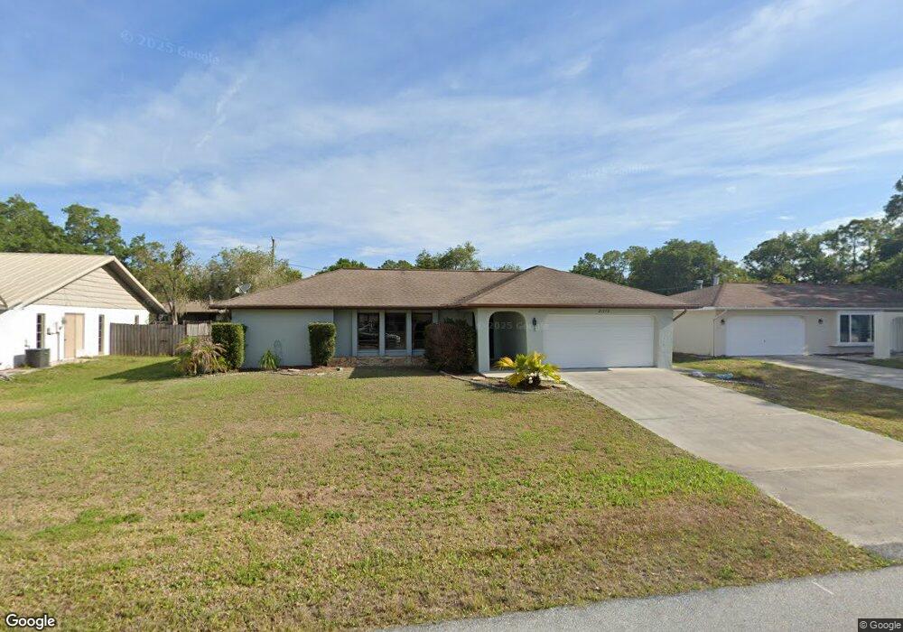
21272 Davison Ave Port Charlotte, FL 33954
Estimated Value: $270,544 - $294,000
3
Beds
2
Baths
1,694
Sq Ft
$167/Sq Ft
Est. Value
About This Home
This home is located at 21272 Davison Ave, Port Charlotte, FL 33954 and is currently estimated at $282,386, approximately $166 per square foot. 21272 Davison Ave is a home located in Charlotte County with nearby schools including Liberty Elementary School, Murdock Middle School, and Port Charlotte High School.
Ownership History
Date
Name
Owned For
Owner Type
Purchase Details
Closed on
Jun 27, 2012
Sold by
Armstrong Peter P and Armstrong Mary Anne
Bought by
Armstrong Peter P and Armstrong Mary Anne
Current Estimated Value
Purchase Details
Closed on
Apr 29, 1994
Sold by
Clark Charles L and Clark Evelyn I
Bought by
Armstrong Peter P and Armstrong Mary Anne
Home Financials for this Owner
Home Financials are based on the most recent Mortgage that was taken out on this home.
Original Mortgage
$81,900
Interest Rate
7.77%
Mortgage Type
VA
Create a Home Valuation Report for This Property
The Home Valuation Report is an in-depth analysis detailing your home's value as well as a comparison with similar homes in the area
Home Values in the Area
Average Home Value in this Area
Purchase History
| Date | Buyer | Sale Price | Title Company |
|---|---|---|---|
| Armstrong Peter P | -- | Attorney | |
| Armstrong Peter P | $89,900 | -- |
Source: Public Records
Mortgage History
| Date | Status | Borrower | Loan Amount |
|---|---|---|---|
| Closed | Armstrong Peter P | $81,900 |
Source: Public Records
Tax History Compared to Growth
Tax History
| Year | Tax Paid | Tax Assessment Tax Assessment Total Assessment is a certain percentage of the fair market value that is determined by local assessors to be the total taxable value of land and additions on the property. | Land | Improvement |
|---|---|---|---|---|
| 2023 | $1,489 | $88,102 | $0 | $0 |
| 2022 | $1,412 | $85,536 | $0 | $0 |
| 2021 | $1,391 | $83,045 | $0 | $0 |
| 2020 | $1,347 | $81,898 | $0 | $0 |
| 2019 | $1,264 | $80,057 | $0 | $0 |
| 2018 | $1,146 | $78,564 | $0 | $0 |
| 2017 | $1,127 | $76,948 | $0 | $0 |
| 2016 | $1,112 | $75,365 | $0 | $0 |
| 2015 | $1,096 | $74,841 | $0 | $0 |
| 2014 | $1,077 | $74,247 | $0 | $0 |
Source: Public Records
Map
Nearby Homes
- 21288 Argyle Ave
- 21296 Argyle Ave
- 21229 Peachland Blvd
- 21220 Pemberton Ave
- 408 Fletcher St
- 21252 Kennedy Ave
- 400 Waterside St
- 375 Waterside St
- 1012 Waterside St
- 399 Kensington St
- 1022 Waterside St
- 448 Yorkshire St
- 21507 Dobbins Ave
- 21460 Chipman Ave
- 304 Fletcher St
- 21475 Argosy Ave
- 21086 Peachland Blvd
- 21427 Michigan Ave
- 1150 Winston St
- 21093 Keeler Ave
- 21280 Davison Ave
- 21264 Davison Ave
- 21271 Hawthorne Ave
- 21263 Hawthorne Ave
- 21279 Hawthorne Ave
- 21288 Davison Ave
- 21271 Davison Ave
- 21279 Davison Ave
- 21263 Davison Ave
- 21287 Hawthorne Ave
- 21287 Davison Ave
- 21296 Davison Ave
- 21255 Davison Ave
- 21247 Hawthorne Ave
- 21295 Hawthorne Ave
- 21352 Walling Ct
- 21295 Davison Ave
- 21247 Davison Ave
- 21304 Davison Ave
- 21240 Davison Ave