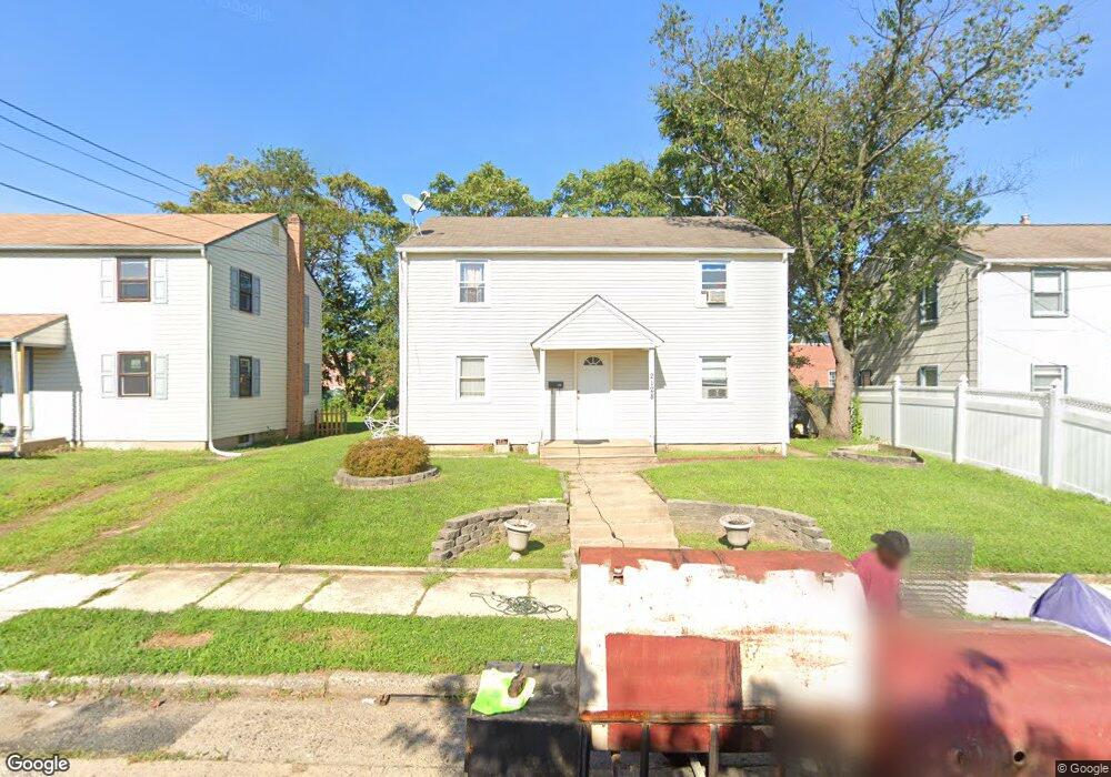
2128 49th St Pennsauken, NJ 08110
Estimated Value: $277,119 - $313,000
--
Bed
--
Bath
1,536
Sq Ft
$192/Sq Ft
Est. Value
About This Home
This home is located at 2128 49th St, Pennsauken, NJ 08110 and is currently estimated at $295,280, approximately $192 per square foot. 2128 49th St is a home located in Camden County with nearby schools including Pennsauken High School, St. Peter Elementary School, and St. Cecilia School.
Ownership History
Date
Name
Owned For
Owner Type
Purchase Details
Closed on
Jan 31, 2005
Sold by
Lkb & Ljb Realty Hldgs Llc
Bought by
Davis Curtis
Current Estimated Value
Home Financials for this Owner
Home Financials are based on the most recent Mortgage that was taken out on this home.
Original Mortgage
$139,945
Outstanding Balance
$70,710
Interest Rate
5.66%
Mortgage Type
VA
Estimated Equity
$224,570
Purchase Details
Closed on
Oct 3, 2002
Sold by
Belvin Lynn
Bought by
Lkb & Ljb Realty Holdings
Create a Home Valuation Report for This Property
The Home Valuation Report is an in-depth analysis detailing your home's value as well as a comparison with similar homes in the area
Home Values in the Area
Average Home Value in this Area
Purchase History
| Date | Buyer | Sale Price | Title Company |
|---|---|---|---|
| Davis Curtis | $137,000 | -- | |
| Lkb & Ljb Realty Holdings | -- | -- | |
| Belvin Lynn | $44,005 | -- |
Source: Public Records
Mortgage History
| Date | Status | Borrower | Loan Amount |
|---|---|---|---|
| Open | Davis Curtis | $139,945 |
Source: Public Records
Tax History Compared to Growth
Tax History
| Year | Tax Paid | Tax Assessment Tax Assessment Total Assessment is a certain percentage of the fair market value that is determined by local assessors to be the total taxable value of land and additions on the property. | Land | Improvement |
|---|---|---|---|---|
| 2025 | $6,215 | $251,800 | $52,300 | $199,500 |
| 2024 | $6,095 | $142,800 | $36,600 | $106,200 |
| 2023 | $6,095 | $142,800 | $36,600 | $106,200 |
| 2022 | $5,511 | $142,800 | $36,600 | $106,200 |
| 2021 | $5,659 | $142,800 | $36,600 | $106,200 |
| 2020 | $5,069 | $142,800 | $36,600 | $106,200 |
| 2019 | $5,128 | $142,800 | $36,600 | $106,200 |
| 2018 | $5,155 | $142,800 | $36,600 | $106,200 |
| 2017 | $5,165 | $142,800 | $36,600 | $106,200 |
| 2016 | $5,072 | $142,800 | $36,600 | $106,200 |
| 2015 | $5,224 | $142,800 | $36,600 | $106,200 |
| 2014 | $5,228 | $94,000 | $19,500 | $74,500 |
Source: Public Records
Map
Nearby Homes
- 2154 Browning Rd
- 4747 Westfield Ave
- 1938 W River Dr
- 1903 Tinsman Ave
- 5507 Wayne Ave
- 1828 47th St
- 2146 44th St
- 1666 Browning Rd
- 2446 46th St
- 1824 44th St
- 2217 Hollinshed Ave
- 2503 46th St
- 2232 42nd St
- 1715 47th St
- 2254 Hollinshed Ave
- 2404 42nd St
- 3241 N 48th St
- 1722 44th St
- 3204 Merchantville Ave
- 1744 43rd St
- 2122 49th St
- 2118 49th St
- 2116 49th St
- 2119 Browning Rd
- 4924 Westfield Ave
- 2115 Browning Rd
- 0 Westfield Ave Unit 7200263
- 0 Westfield Ave Unit NJCD419642
- 0 Westfield Ave Unit NJCD416064
- 0 Westfield Ave Unit NJCD416062
- 0 Westfield Ave Unit NJCD404652
- 0 Westfield Ave Unit NJCD392196
- 2130 48th St
- 2124 48th St
- 2116 48th St
- 4902 Camden Ave
- 4902 Camden Ave Unit B
- 4902 Camden Ave Unit A
- 4908 Camden Ave
- 4916 Camden Ave