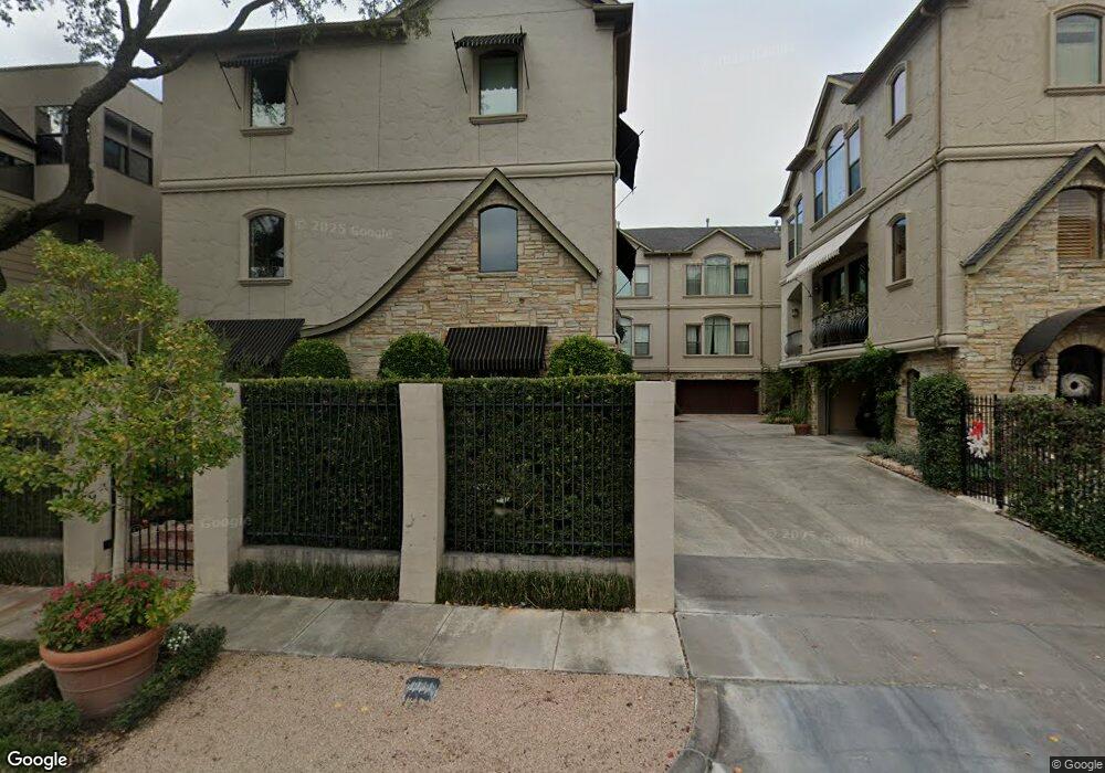
2128 Harold St Unit B Houston, TX 77098
River Oaks NeighborhoodEstimated Value: $552,000 - $698,000
3
Beds
4
Baths
2,390
Sq Ft
$251/Sq Ft
Est. Value
About This Home
This home is located at 2128 Harold St Unit B, Houston, TX 77098 and is currently estimated at $599,460, approximately $250 per square foot. 2128 Harold St Unit B is a home located in Harris County with nearby schools including Poe Elementary School, Lanier Middle School, and Lamar High School.
Ownership History
Date
Name
Owned For
Owner Type
Purchase Details
Closed on
Dec 20, 2018
Sold by
Simotas Alexandra and Papasakellariou Aristides
Bought by
Young Vernon R and Young Elizabeth H
Current Estimated Value
Purchase Details
Closed on
Jul 15, 2005
Sold by
Blantyre Homes Ltd
Bought by
Simotas Alexandra
Home Financials for this Owner
Home Financials are based on the most recent Mortgage that was taken out on this home.
Original Mortgage
$296,000
Interest Rate
5.64%
Mortgage Type
Fannie Mae Freddie Mac
Create a Home Valuation Report for This Property
The Home Valuation Report is an in-depth analysis detailing your home's value as well as a comparison with similar homes in the area
Home Values in the Area
Average Home Value in this Area
Purchase History
| Date | Buyer | Sale Price | Title Company |
|---|---|---|---|
| Young Vernon R | -- | Stewart Title | |
| Simotas Alexandra | -- | Ameripoint Title |
Source: Public Records
Mortgage History
| Date | Status | Borrower | Loan Amount |
|---|---|---|---|
| Previous Owner | Simotas Alexandra | $296,000 |
Source: Public Records
Tax History
| Year | Tax Paid | Tax Assessment Tax Assessment Total Assessment is a certain percentage of the fair market value that is determined by local assessors to be the total taxable value of land and additions on the property. | Land | Improvement |
|---|---|---|---|---|
| 2025 | $12,552 | $527,786 | $240,144 | $287,642 |
| 2024 | $12,552 | $599,887 | $240,144 | $359,743 |
| 2023 | $12,552 | $585,000 | $240,144 | $344,856 |
| 2022 | $9,938 | $451,329 | $198,380 | $252,949 |
| 2021 | $11,795 | $506,067 | $198,380 | $307,687 |
| 2020 | $11,778 | $486,356 | $198,380 | $287,976 |
| 2019 | $12,397 | $489,923 | $133,290 | $356,633 |
| 2018 | $9,228 | $468,446 | $111,075 | $357,371 |
| 2017 | $11,845 | $468,446 | $109,240 | $359,206 |
| 2016 | $11,383 | $468,446 | $109,240 | $359,206 |
| 2015 | $7,511 | $468,446 | $109,240 | $359,206 |
| 2014 | $7,511 | $427,255 | $95,585 | $331,670 |
Source: Public Records
Map
Nearby Homes
- 2630 Peckham St
- 2628 Peckham St
- 2128 Harold St Unit A
- 2630 Persa St
- 2129 Harold St
- 2120 Kipling St Unit 406
- 2120 Kipling St Unit 301
- 2120 Kipling St Unit 208
- 2120 Kipling St Unit 306
- 2817 Newman St
- 2643 Westgate St
- 2522 Kingston St
- 2521 Westgate Dr
- 2207 Dunraven Ln
- 2211 Dunraven Ln
- 2508 Brun St
- 2145 Fairview Ave
- 2124 Sul Ross St
- 1912 Kipling St
- 2413 Brun St Unit A
- 2128 Harold St
- 2128 Harold St Unit C
- 2641 Persa St
- 2126 Harold St Unit B
- 2639 Persa St
- 2130 Harold St
- 2124 Harold St Unit A
- 2124 Harold St
- 2124 Harold St Unit B
- 2124 Harold St Unit C
- 2635 Persa St
- 2122 Harold St
- 2642 Peckham St
- 2640 Peckham St
- 2636 Peckham St
- 2636 Peckham St Unit 2
- 2644 Peckham St
- 2638 Peckham St
- 2631 Persa St
- 2631 Persa St Unit C
Your Personal Tour Guide
Ask me questions while you tour the home.