Estimated Value: $204,904 - $230,000
3
Beds
2
Baths
1,350
Sq Ft
$164/Sq Ft
Est. Value
About This Home
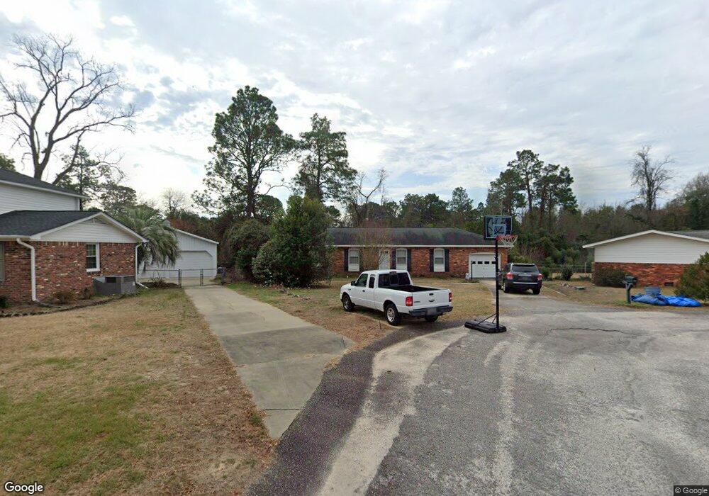
This home is located at 2128 Lawn Ct, Cayce, SC 29033 and is currently estimated at $221,476, approximately $164 per square foot. 2128 Lawn Ct is a home located in Lexington County with nearby schools including Cayce Elementary, Cyril B. Busbee Creative Arts Academy, and Brookland-Cayce High School.
Ownership History
Date
Name
Owned For
Owner Type
Purchase Details
Closed on
Sep 18, 2008
Sold by
Ferrell Robert V and Ferrell Heyward L
Bought by
Wingard S Reed and Wingard Alison F
Current Estimated Value
Home Financials for this Owner
Home Financials are based on the most recent Mortgage that was taken out on this home.
Original Mortgage
$118,340
Outstanding Balance
$78,599
Interest Rate
6.49%
Mortgage Type
Purchase Money Mortgage
Estimated Equity
$142,877
Purchase Details
Closed on
Feb 7, 2008
Sold by
Ferrell Robert V and Ansell Alice F
Bought by
Ferrell Robert and Ansell Alice F
Create a Home Valuation Report for This Property
The Home Valuation Report is an in-depth analysis detailing your home's value as well as a comparison with similar homes in the area
Home Values in the Area
Average Home Value in this Area
Purchase History
| Date | Buyer | Sale Price | Title Company |
|---|---|---|---|
| Wingard S Reed | $122,000 | -- | |
| Ferrell Robert | -- | -- |
Source: Public Records
Mortgage History
| Date | Status | Borrower | Loan Amount |
|---|---|---|---|
| Open | Wingard S Reed | $118,340 |
Source: Public Records
Tax History
| Year | Tax Paid | Tax Assessment Tax Assessment Total Assessment is a certain percentage of the fair market value that is determined by local assessors to be the total taxable value of land and additions on the property. | Land | Improvement |
|---|---|---|---|---|
| 2024 | $911 | $4,563 | $1,000 | $3,563 |
| 2023 | $822 | $4,563 | $1,000 | $3,563 |
| 2022 | $813 | $4,563 | $1,000 | $3,563 |
| 2020 | $792 | $4,563 | $1,000 | $3,563 |
| 2019 | $784 | $4,423 | $800 | $3,623 |
| 2018 | $775 | $4,423 | $800 | $3,623 |
| 2017 | $747 | $4,423 | $800 | $3,623 |
| 2016 | $760 | $4,422 | $800 | $3,622 |
| 2014 | $613 | $4,881 | $800 | $4,081 |
| 2013 | -- | $4,880 | $800 | $4,080 |
Source: Public Records
Map
Nearby Homes
- 1832 Wadsworth Dr
- 1855 Evelyn St
- 1805 Chadsworth Dr
- 300 Dale Ln
- 1414 Hazel St
- 1740 Sunnyside Dr
- 2312 Lucas St
- 1521 Benton Cir
- 1515 Benedict St
- 940 Glenn St Unit 303
- 000 Frink St
- 2402 Breezewood Rd
- 2314 Orchard St
- 103 Pine Ln
- 157 Cavendish Dr
- 121 Odell Dr
- 117 Odell Dr
- 129 Odell Dr
- 2024 Platt Springs Rd
- 133 Odell Dr
- 2132 Fairlawn Cir
- 2124 Lawn Ct
- 1904 Charleston Hwy
- 1900 Charleston Hwy
- 2120 Lawn Ct
- 2116 Lawn Ct
- 1 Audrey St
- 2117 Fairlawn Cir
- 1894 Charleston Hwy
- 2112 Fairlawn Cir
- 2113 Fairlawn Cir
- 2109 Fairlawn Cir
- 1890 Charleston Hwy
- 2108 Fairlawn Cir
- 2105 Fairlawn Cir
- 1918 Charleston Hwy
- 1886 Charleston Hwy
- 2104 Fairlawn Cir
- 2101 Rosemary Dr
- 1840 Rosemary Dr
Your Personal Tour Guide
Ask me questions while you tour the home.