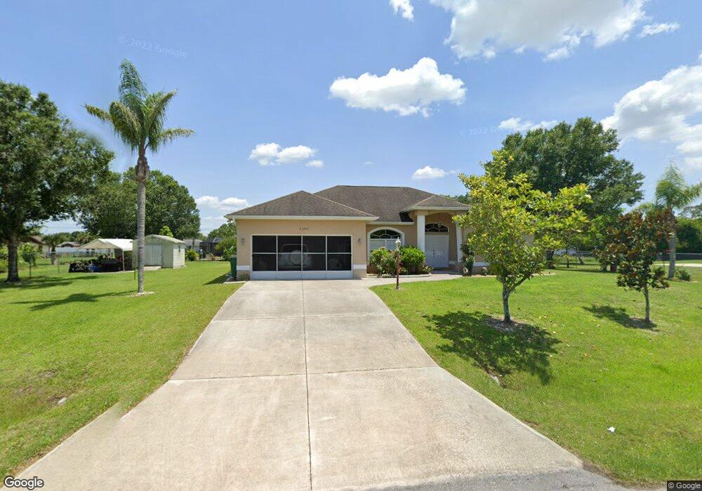
21287 Wynyard Ave Port Charlotte, FL 33954
Estimated Value: $334,369 - $351,000
3
Beds
2
Baths
2,697
Sq Ft
$127/Sq Ft
Est. Value
About This Home
This home is located at 21287 Wynyard Ave, Port Charlotte, FL 33954 and is currently estimated at $342,842, approximately $127 per square foot. 21287 Wynyard Ave is a home located in Charlotte County with nearby schools including Liberty Elementary School, Murdock Middle School, and Port Charlotte High School.
Ownership History
Date
Name
Owned For
Owner Type
Purchase Details
Closed on
May 7, 2025
Sold by
Ruiz Antonio
Bought by
Ruiz Antonio and Ruiz Felix Antonio
Current Estimated Value
Purchase Details
Closed on
May 21, 2003
Sold by
Ruiz Antonio and Ruiz Shirley
Bought by
Hoopmann Werner
Purchase Details
Closed on
Jan 6, 2003
Sold by
Mackey George P and Mackey George P
Bought by
Ruiz Antonio and Ruiz Sherley
Create a Home Valuation Report for This Property
The Home Valuation Report is an in-depth analysis detailing your home's value as well as a comparison with similar homes in the area
Home Values in the Area
Average Home Value in this Area
Purchase History
| Date | Buyer | Sale Price | Title Company |
|---|---|---|---|
| Ruiz Antonio | $100 | None Listed On Document | |
| Hoopmann Werner | $15,000 | -- | |
| Ruiz Antonio | $4,000 | -- | |
| Ruiz Antonio | $4,000 | -- | |
| Ruiz Antonio | $4,000 | -- |
Source: Public Records
Tax History Compared to Growth
Tax History
| Year | Tax Paid | Tax Assessment Tax Assessment Total Assessment is a certain percentage of the fair market value that is determined by local assessors to be the total taxable value of land and additions on the property. | Land | Improvement |
|---|---|---|---|---|
| 2024 | $1,858 | $128,918 | -- | -- |
| 2023 | $1,858 | $109,029 | $0 | $0 |
| 2022 | $2,023 | $121,517 | $0 | $0 |
| 2021 | $2,007 | $117,978 | $0 | $0 |
| 2020 | $1,959 | $116,349 | $0 | $0 |
| 2019 | $1,870 | $113,733 | $0 | $0 |
| 2018 | $1,716 | $111,612 | $0 | $0 |
| 2017 | $1,695 | $109,316 | $0 | $0 |
| 2016 | $1,680 | $107,068 | $0 | $0 |
| 2015 | $1,668 | $106,324 | $0 | $0 |
| 2014 | $1,642 | $105,480 | $0 | $0 |
Source: Public Records
Map
Nearby Homes
- 21271 Leonard Ave
- 21359 Leonard Ave
- 21335 Leonard Ave
- 304 Fletcher St
- 207 Fletcher St
- 375 Waterside St
- 21296 Argyle Ave
- 21288 Argyle Ave
- 175 Fletcher St
- 408 Fletcher St
- 400 Waterside St
- 21475 Argosy Ave
- 234 Harbor Blvd
- 21507 Dobbins Ave
- 215 Fletcher St
- 19400 Veterans Blvd Unit 3
- 256 Yorkshire St
- 399 Kensington St
- 21093 Keeler Ave
- 21464 Bingham Ave
- 21295 Wynyard Ave
- 21296 Berkshire Ave
- 21272 Berkshire Ave
- 21288 Wynyard Ave
- 21263 Wynyard Ave
- 21296 Wynyard Ave
- 21304 Berkshire Ave
- 21264 Berkshire Ave
- 21303 Wynyard Ave
- 21304 Wynyard Ave
- 21279 Berkshire Ave
- 21288 Berkshire Ave
- 21312 Berkshire Ave
- 21287 Berkshire Ave
- 21256 Berkshire Ave
- 21295 Dearborn Ave
- 21271 Dearborn Ave
- 21295 Berkshire Ave
- 21256 Wynyard Ave
- 21263 Berkshire Ave