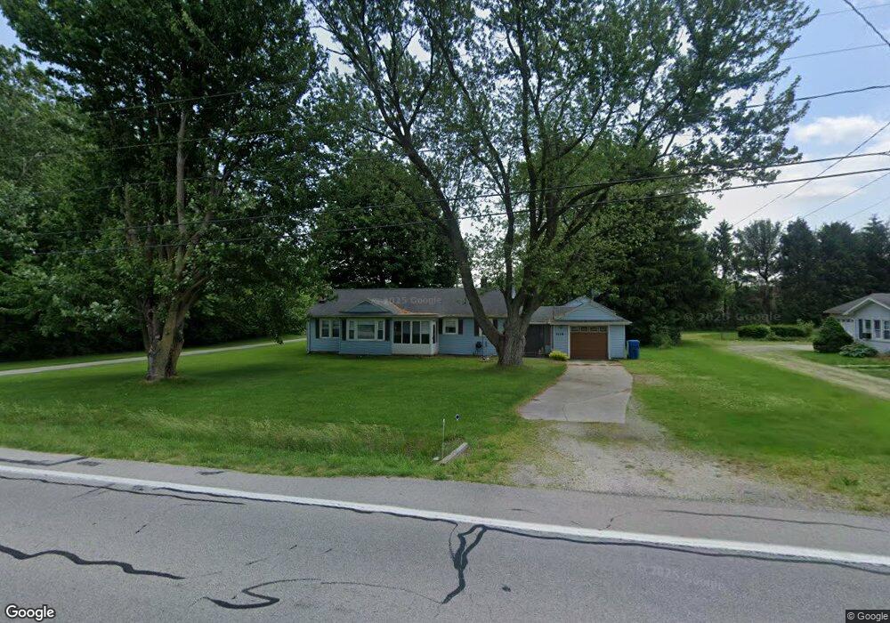
2129 N 5th St Fremont, OH 43420
Estimated Value: $175,000 - $199,000
3
Beds
2
Baths
1,704
Sq Ft
$108/Sq Ft
Est. Value
About This Home
This home is located at 2129 N 5th St, Fremont, OH 43420 and is currently estimated at $184,845, approximately $108 per square foot. 2129 N 5th St is a home located in Sandusky County with nearby schools including Fremont Ross High School, Bishop Hoffman Catholic School - This is St Joe's School now, and St. Joseph School.
Ownership History
Date
Name
Owned For
Owner Type
Purchase Details
Closed on
Nov 28, 2000
Sold by
Gunter Delores J
Bought by
Huey Richard L and Huey Nancy J
Current Estimated Value
Home Financials for this Owner
Home Financials are based on the most recent Mortgage that was taken out on this home.
Original Mortgage
$85,450
Outstanding Balance
$31,874
Interest Rate
7.87%
Mortgage Type
VA
Estimated Equity
$152,971
Purchase Details
Closed on
May 1, 1994
Sold by
Huey Richard L and Huey Nancy J
Bought by
Huey Richard L and Huey Nancy J
Purchase Details
Closed on
Feb 1, 1986
Bought by
Huey Richard L and Huey Nancy J
Create a Home Valuation Report for This Property
The Home Valuation Report is an in-depth analysis detailing your home's value as well as a comparison with similar homes in the area
Home Values in the Area
Average Home Value in this Area
Purchase History
| Date | Buyer | Sale Price | Title Company |
|---|---|---|---|
| Huey Richard L | $83,000 | -- | |
| Huey Richard L | $77,000 | -- | |
| Huey Richard L | $57,000 | -- |
Source: Public Records
Mortgage History
| Date | Status | Borrower | Loan Amount |
|---|---|---|---|
| Open | Huey Richard L | $85,450 |
Source: Public Records
Tax History Compared to Growth
Tax History
| Year | Tax Paid | Tax Assessment Tax Assessment Total Assessment is a certain percentage of the fair market value that is determined by local assessors to be the total taxable value of land and additions on the property. | Land | Improvement |
|---|---|---|---|---|
| 2024 | $1,386 | $46,590 | $6,930 | $39,660 |
| 2023 | $1,386 | $37,240 | $5,530 | $31,710 |
| 2022 | $1,141 | $37,240 | $5,530 | $31,710 |
| 2021 | $1,177 | $37,240 | $5,530 | $31,710 |
| 2020 | $1,025 | $33,150 | $5,530 | $27,620 |
| 2019 | $1,024 | $33,150 | $5,530 | $27,620 |
| 2018 | $1,026 | $33,150 | $5,530 | $27,620 |
| 2017 | $924 | $30,630 | $5,530 | $25,100 |
| 2016 | $814 | $30,630 | $5,530 | $25,100 |
| 2015 | $801 | $30,630 | $5,530 | $25,100 |
| 2014 | $838 | $30,560 | $5,880 | $24,680 |
| 2013 | $820 | $30,560 | $5,880 | $24,680 |
Source: Public Records
Map
Nearby Homes
- 711 Bloom Rd
- 263 Saint Paul Dr
- 612 2nd St
- 251 Saint Paul Dr
- 315 Ethan Dr
- 318 Ethan Dr
- 533 Sandusky Ave Unit 535
- 1730 Port Clinton Rd Unit 41
- 1730 Port Clinton Rd
- 1730 Port Clinton Rd Unit 33
- 230 N Pennsylvania Ave
- 199 Saint Thomas Dr
- 433 Sandusky Ave
- 322 4th St
- 340 340 Sandusky Ave
- 714 E State St
- 2248 E State St
- 224 Sandusky Ave Unit 226
- 2100 Ohio 53
- 309 S Collinwood Blvd
- 2119 N 5th St
- 2203 N 5th St
- 1631 Edwards Dr
- 2163 Us Highway 6 E
- 2180 N 5th St
- 2100 N 5th St
- 1621 Edwards Dr
- 2215 N 5th St
- 2210 N 5th St
- 1613 Edwards Dr
- 2053 N 5th St
- 2216 N 5th St
- 1607 Edwards Dr
- 2042 N 5th St
- 1690 County Road 243
- 1636 County Road 243
- 1626 County Road 243
- 1614 County Road 243
- 1608 Edwards Dr
- 2240 N 5th St