NOT LISTED FOR SALE

21297 Dale Rouse Rd Springdale, AR 72762

Estimated Value: $492,000 - $588,358

45.33 Acres
$11,917 Price per Acre
1,974,575 Sq Ft Lot

Last Sold April 21, 2017

Last sale price $339,975 $214 Per Sq Ft

Est. 59% increase in value since last sale

Current estimated payment $2,846/month

267 Days on Market

Highlights

  • 45.33 Acre Lot
  • Partially Wooded Lot
  • Views
  • Willis Shaw Elementary School Rated A-
  • Corner Lot
  • Property is Fully Fenced

About This Lot

As of April 2017

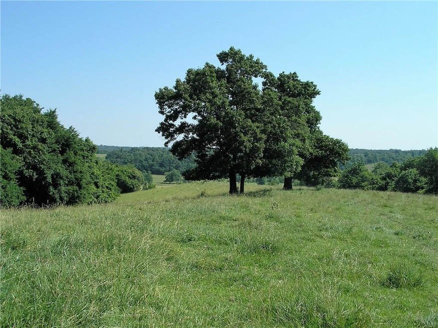
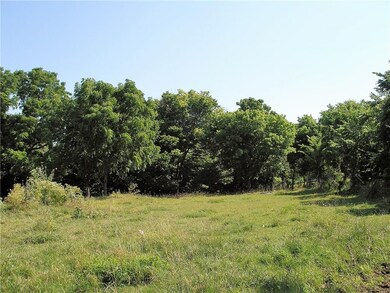
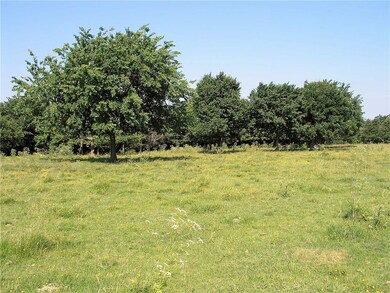
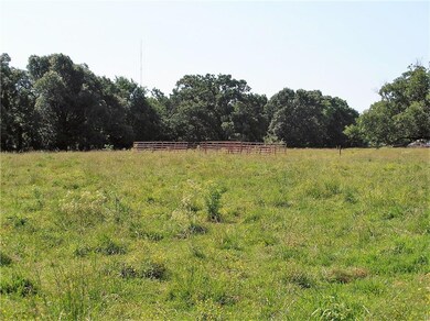
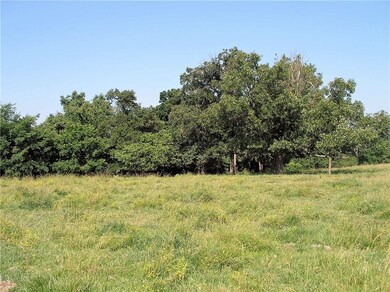
This is a wonderful property with a great deal of potential. All utilities located on property or at street. Beautiful views throughout. In the much sought after Tontitown Area, Har-Ber School district with great access to all of NWA.

Last Agent to Sell the Property

Gregory Taylor

The Griffin Company Commercial Division-Springdale License #EB00055642 Listed on: 06/27/2016

The Griffin Company Commercial Division-Springdale

Co-Listed By

Tim Davis

Weichert REALTORS - The Griffin Company Springdale License #SA00072282

Last Buyer's Agent

Tom Joseph

The Griffin Company Commercial Division-Springdale License #SA44924-D01

The Griffin Company Commercial Division-Springdale

Property Details

Property Type

  • Land

Est. Annual Taxes

  • $909

Lot Details

  • 45.33 Acre Lot
  • Property is Fully Fenced
  • Wire Fence
  • Corner Lot
  • Level Lot
  • Cleared Lot
  • Partially Wooded Lot
  • Zoning described as Agricultural

Additional Features

  • Mobile Home Allowed
  • Septic Needed
  • Property Views

Community Details

  • 32 18 31 Subdivision

Property Details

Property Type

Land

Est. Annual Taxes

$909

Lot Details

0

Listing Details

  • Property Sub Type: Unimproved Land
  • Prop. Type: Land
  • Lot Size Acres: 45.33
  • Road Frontage Type: Main Thoroughfare
  • Road Surface Type: Paved
  • Co List Office Mls Id: 2311
  • Co List Office Phone: 479-756-1003
  • Subdivision Name: 32-18-31
  • Directions: 412 West to Old HWY 68 on Right. Turn Right to Liberty. Turn Right to first split in road, stay left. You are now on Dale Rouse. Follow it to Osage, turn left, Property on Left.
  • ResoPropertyType: Land
  • Special Features: None

Interior Features

  • Possible Use: Agricultural, Development, Pasture, Unimproved

Exterior Features

  • Fencing: Full, Wire
  • Lot Features: Cleared, Corner Lot, Level, Mobile Home Allowed, None, Rolling Slope, Sloped, Views, Wooded
  • Topography: Cleared,Rolling,Sloping
  • View: Yes

Utilities

  • Electricity On Property: Yes
  • Sewer: Septic Needed
  • Utilities: Natural Gas Available, Electricity Available
  • Water Source: Public

Schools

  • Junior High Dist: Springdale

Lot Info

  • Additional Parcels Description: 001-19313-000 =59.15 acres plus 001-19337-000 = 80 acres for a total of 140 acre
  • Zoning Description: Agricultural
  • Zoning: N
  • ResoLotSizeUnits: Acres

Tax Info

  • Tax Annual Amount: 909.0
  • Tax Block: .
  • Tax Lot: .

Ownership History

Date Name Owned For Owner Type

Purchase Details

Closed on
May 30, 2012
Sold by
Baker Donna Ann
Bought by
Baker Donna Ann
Current Estimated Value
$540,179

Purchase Details

Closed on
Jun 17, 2011
Sold by
Baker Eugene and Baker Donna Ann
Bought by
Baker Eugene and Baker Donna Ann

Purchase Details

Closed on
Jan 1, 1985
Bought by
Baker Gene and Donna Ann
Source: Public Records

Range of Values:

--
Value Increase
--
Percent Increase
--
Adjusted for Inflation
Collateral Analytics

Collateral Analytics Collateral Analytics AVMs (Automated Valuation Model) employ a number of statistical approaches combined with neighborhood-specific comparable selection guarantees the most up-to-date and precise valuations.

Not Available

Collateral Analytics does not have data for the current month. Please view the chart for historical values.

ICE

ICE Mortgage Technology ICE Mortgage Technology’s AVM (Automated Valuation Model) is a state-of-the-art online residential property valuation tool that provides a quick and accurate estimate of the value of almost any home in the U.S.

Not Available

ICE Mortgage Technology does not have data for the current month. Please view the chart for historical values.

First American

First American First American Data & Analytics’ next-generation AVM combines unrivaled data assets with a blended ensemble of valuation models to produce highly accurate, reliable valuations you can trust.

Not Available

First American does not have data for the current month. Please view the chart for historical values.

Quantarium

Quantarium Quantarium’s valuation service, repeatedly proven the industry’s most accurate and comprehensive, is supercharged with a self-learning and auto-tuning AI engine that continually becomes smarter and more accurate as it processes daily inputs from the industry’s leading RE data lake.

Not Available

Quantarium does not have data for the current month. Please view the chart for historical values.

Average Value
Not Available
List Price
Sold Price
Create a Home Valuation Report for This Property
The Home Valuation Report is an in-depth analysis detailing your home's value as well as a comparison with similar homes in the area

Home Values in the Area

Source: Public Records

Average Home Value in this Area


Source: Public Records

Purchase History

Date Buyer Sale Price Title Company
Baker Donna Ann -- None Available
Baker Eugene -- None Available
Baker Gene -- --
Source: Public Records

Property History

Date Event Price List to Sale Price per Sq Ft
04/21/2017 04/21/17 Sold $339,975 -73.0% $214 / Sq Ft
03/22/2017 03/22/17 Pending -- -- --
06/27/2016 06/27/16 For Sale $1,260,000 -- $794 / Sq Ft
Source: Northwest Arkansas Board of REALTORS®

Tax History Compared to Growth

Source: Public Records

Tax History

Year Tax Paid Tax Assessment Tax Assessment Total Assessment is a certain percentage of the fair market value that is determined by local assessors to be the total taxable value of land and additions on the property. Land Improvement
2025 $23 $490 $240 $250
2024 $23 $490 $240 $250
2023 $23 $490 $240 $250
2022 $23 $480 $230 $250
2021 $23 $480 $230 $250
2020 $23 $480 $230 $250
2019 $56 $1,110 $860 $250
2018 $56 $1,110 $860 $250
2017 $926 $19,920 $8,810 $11,110
2016 $987 $21,080 $9,970 $11,110
2015 $987 $21,080 $9,970 $11,110
2014 $909 $19,400 $8,290 $11,110
Source: Public Records

Agents Affiliated with this Home

  • Section Image
  • Section Image
See All Agents

Map

Source: Northwest Arkansas Board of REALTORS®

MLS Number: 1018844

Northwest Arkansas Board of REALTORS®

APN: 001-19337-000