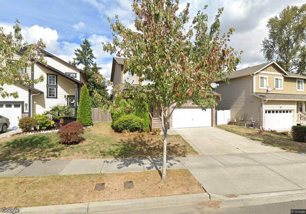
213 202nd St SW Lynnwood, WA 98036
Queensborough-Brentwood NeighborhoodEstimated Value: $904,000 - $1,014,000
4
Beds
3
Baths
1,903
Sq Ft
$498/Sq Ft
Est. Value
About This Home
This home is located at 213 202nd St SW, Lynnwood, WA 98036 and is currently estimated at $948,391, approximately $498 per square foot. 213 202nd St SW is a home located in Snohomish County with nearby schools including Hilltop Elementary School, Brier Terrace Middle School, and Mountlake Terrace High School.
Ownership History
Date
Name
Owned For
Owner Type
Purchase Details
Closed on
Dec 10, 2010
Sold by
Union Street Holdings Llc
Bought by
Kelati Teages G
Current Estimated Value
Home Financials for this Owner
Home Financials are based on the most recent Mortgage that was taken out on this home.
Original Mortgage
$258,871
Outstanding Balance
$171,292
Interest Rate
4.25%
Mortgage Type
FHA
Estimated Equity
$777,099
Create a Home Valuation Report for This Property
The Home Valuation Report is an in-depth analysis detailing your home's value as well as a comparison with similar homes in the area
Home Values in the Area
Average Home Value in this Area
Purchase History
| Date | Buyer | Sale Price | Title Company |
|---|---|---|---|
| Kelati Teages G | $266,500 | Chicago Title |
Source: Public Records
Mortgage History
| Date | Status | Borrower | Loan Amount |
|---|---|---|---|
| Open | Kelati Teages G | $258,871 |
Source: Public Records
Tax History Compared to Growth
Tax History
| Year | Tax Paid | Tax Assessment Tax Assessment Total Assessment is a certain percentage of the fair market value that is determined by local assessors to be the total taxable value of land and additions on the property. | Land | Improvement |
|---|---|---|---|---|
| 2025 | $5,756 | $737,700 | $454,500 | $283,200 |
| 2024 | $5,756 | $691,900 | $418,500 | $273,400 |
| 2023 | $6,730 | $850,000 | $535,500 | $314,500 |
| 2022 | $5,707 | $584,700 | $317,700 | $267,000 |
| 2020 | $5,699 | $516,300 | $272,700 | $243,600 |
| 2019 | $5,127 | $461,600 | $220,500 | $241,100 |
| 2018 | $5,149 | $408,600 | $193,500 | $215,100 |
| 2017 | $4,248 | $348,100 | $145,800 | $202,300 |
| 2016 | $3,894 | $319,800 | $126,000 | $193,800 |
| 2015 | $3,766 | $293,700 | $116,100 | $177,600 |
| 2013 | $3,295 | $243,500 | $105,300 | $138,200 |
Source: Public Records
Map
Nearby Homes
- 20029 S Danvers Rd
- 109 203rd Place SW Unit 1
- 231 198th Place SW
- 19715 1st Ave W
- 105 202nd St SE
- 19 198th Place SE
- 319 196th Place SW Unit 102
- 20027 10th Ave W
- 123 194th Place SW
- 19505 Damson Rd Unit C3
- 19505 Damson Rd Unit A1
- 19505 Damson Rd Unit A4
- 19505 Damson Rd Unit A3
- 19505 Damson Rd Unit C2
- 19505 Damson Rd Unit C1
- 20932 3rd Ave W
- 923 207th St SW
- 19624 2nd Dr SE
- 19403 7th Ave W Unit C1
- 20822 Damson Rd
- 217 202nd St SW
- 209 202nd St SW
- 221 202nd St SW
- 225 202nd St SW
- 20115 S Danvers Rd
- 220 202nd St SW
- 216 202nd St SW
- 224 202nd St SW
- 212 202nd St SW
- 229 202nd St SW
- 228 202nd St SW
- 226 202nd St SW
- 230 202nd St SW
- 219 202nd Place SW
- 215 202nd Place SW
- 223 202nd Place SW
- 227 202nd Place SW
- 211 202nd Place SW
- 211 202nd Place SW Unit Lot18
- 20226 S Danvers Rd