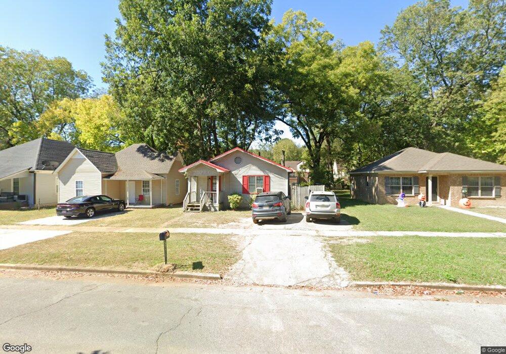
213 5th Ave SW Decatur, AL 35601
West Decatur NeighborhoodEstimated Value: $62,000 - $111,933
3
Beds
2
Baths
1,085
Sq Ft
$85/Sq Ft
Est. Value
About This Home
This home is located at 213 5th Ave SW, Decatur, AL 35601 and is currently estimated at $92,233, approximately $85 per square foot. 213 5th Ave SW is a home located in Morgan County with nearby schools including West Decatur Elementary School, Horizon High School, and Decatur Middle School.
Ownership History
Date
Name
Owned For
Owner Type
Purchase Details
Closed on
Jun 21, 2016
Sold by
Mccreless Nickey Frank
Bought by
Mccreless Holdings Llc
Current Estimated Value
Purchase Details
Closed on
Jul 12, 2011
Sold by
The United States Hud
Bought by
Mccreless Nickey Frank
Purchase Details
Closed on
Jul 18, 2005
Sold by
Gllen Thomas A and Gillen Kathleen M
Bought by
Wiggins Lloyd M
Home Financials for this Owner
Home Financials are based on the most recent Mortgage that was taken out on this home.
Original Mortgage
$42,335
Interest Rate
5.46%
Mortgage Type
FHA
Create a Home Valuation Report for This Property
The Home Valuation Report is an in-depth analysis detailing your home's value as well as a comparison with similar homes in the area
Home Values in the Area
Average Home Value in this Area
Purchase History
| Date | Buyer | Sale Price | Title Company |
|---|---|---|---|
| Mccreless Holdings Llc | $37,000 | None Available | |
| Mccreless Nickey Frank | $16,200 | None Available | |
| Wiggins Lloyd M | -- | None Available |
Source: Public Records
Mortgage History
| Date | Status | Borrower | Loan Amount |
|---|---|---|---|
| Previous Owner | Wiggins Lloyd M | $42,335 |
Source: Public Records
Tax History Compared to Growth
Tax History
| Year | Tax Paid | Tax Assessment Tax Assessment Total Assessment is a certain percentage of the fair market value that is determined by local assessors to be the total taxable value of land and additions on the property. | Land | Improvement |
|---|---|---|---|---|
| 2024 | $454 | $5,010 | $360 | $4,650 |
| 2023 | $454 | $10,020 | $720 | $9,300 |
| 2022 | $454 | $10,020 | $720 | $9,300 |
| 2021 | $384 | $8,480 | $720 | $7,760 |
| 2020 | $381 | $8,420 | $720 | $7,700 |
| 2019 | $381 | $8,420 | $0 | $0 |
| 2015 | $334 | $7,380 | $0 | $0 |
| 2014 | $334 | $7,380 | $0 | $0 |
| 2013 | -- | $7,960 | $0 | $0 |
Source: Public Records
Map
Nearby Homes
- 207 7th Ave SW
- 109 5th Ave NW
- 421 7th Ave SW
- 201 8th Ave SW
- 107 8th Ave NW
- 219 5th Ave NW
- 602 2nd St SW
- Lot 13 4th Ave NW
- 310 6th Ave NW
- 1016 Moulton St E
- 301 Oak St NE
- 606 14th Ave SW
- 207 Cain St NE
- 118 Church St
- 211 Prospect Dr SE
- 216 Cain St NE
- 406 Canal St NE
- 1007 Honeysuckle Ln SW
- 410 Sherman St SE
- 511 Line St NE
- 215 5th Ave SW
- 211 5th Ave SW
- 217 5th Ave SW
- 219 5th Ave SW
- 221 5th Ave SW
- 212 6th Ave SW
- 218 6th Ave SW
- 502 Gordon Dr SW
- 504 Gordon Dr SW
- 210 6th Ave SW
- 216 5th Ave SW
- 218 5th Ave SW
- 222 6th Ave SW
- 220 5th Ave SW
- 208 6th Ave SW
- 404 Gordon Dr SW
- 222 5th Ave SW
- 401 5th Ave SW
- 506 Gordon Dr SW
- 403 5th Ave SW