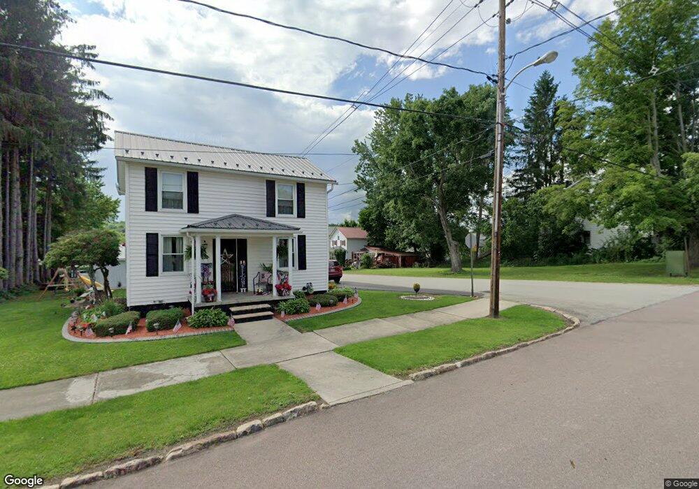
213 6th Ave Meyersdale, PA 15552
Estimated Value: $88,815 - $153,000
2
Beds
1
Bath
1,440
Sq Ft
$74/Sq Ft
Est. Value
About This Home
This home is located at 213 6th Ave, Meyersdale, PA 15552 and is currently estimated at $106,704, approximately $74 per square foot. 213 6th Ave is a home with nearby schools including Meyersdale Area Elementary School, Meyersdale Area Middle School, and Meyersdale Area High School.
Ownership History
Date
Name
Owned For
Owner Type
Purchase Details
Closed on
Jul 31, 2018
Sold by
Baughman Willard D
Bought by
Harvey Andy T
Current Estimated Value
Purchase Details
Closed on
Dec 6, 2006
Sold by
Baughman Willard D and Baughman Linda L
Bought by
Harvey Joseph G and Harvey Lori L
Home Financials for this Owner
Home Financials are based on the most recent Mortgage that was taken out on this home.
Original Mortgage
$12,000
Interest Rate
6.35%
Mortgage Type
Purchase Money Mortgage
Create a Home Valuation Report for This Property
The Home Valuation Report is an in-depth analysis detailing your home's value as well as a comparison with similar homes in the area
Home Values in the Area
Average Home Value in this Area
Purchase History
| Date | Buyer | Sale Price | Title Company |
|---|---|---|---|
| Harvey Andy T | $1,908 | None Available | |
| Harvey Joseph G | $12,000 | None Available |
Source: Public Records
Mortgage History
| Date | Status | Borrower | Loan Amount |
|---|---|---|---|
| Previous Owner | Harvey Joseph G | $12,000 |
Source: Public Records
Tax History Compared to Growth
Tax History
| Year | Tax Paid | Tax Assessment Tax Assessment Total Assessment is a certain percentage of the fair market value that is determined by local assessors to be the total taxable value of land and additions on the property. | Land | Improvement |
|---|---|---|---|---|
| 2025 | $845 | $15,310 | $0 | $0 |
| 2024 | $817 | $15,310 | $0 | $0 |
| 2023 | $769 | $15,310 | $0 | $0 |
| 2022 | $769 | $15,310 | $0 | $0 |
| 2021 | $769 | $15,310 | $0 | $0 |
| 2020 | $769 | $15,310 | $0 | $0 |
| 2019 | $769 | $15,310 | $0 | $0 |
| 2018 | $757 | $15,310 | $2,030 | $13,280 |
| 2017 | $757 | $15,310 | $2,030 | $13,280 |
| 2016 | -- | $15,310 | $2,030 | $13,280 |
| 2015 | -- | $15,300 | $2,025 | $13,275 |
| 2014 | -- | $15,300 | $2,025 | $13,275 |
Source: Public Records
Map
Nearby Homes
- 521 Thomas St
- 170 Eleventh Ave
- 116 Meyers Ave
- 134 Lincoln Ave
- 219 Large St
- 301 Meyers Ave
- 0 Keystone St
- 725 Grant Street Extension
- 475 Lincoln Ave
- 475 Lincoln St Extension
- 0 Schrock Dr
- 132 Sipple Dr
- 179 Jacobs Place
- 513 Jackson St
- 17 Grant St
- 161 Ord St
- 733 Saint Paul Rd
- 107 Grant St
- 000 Warrens Mill Rd
- 000 Warren's Mill Rd