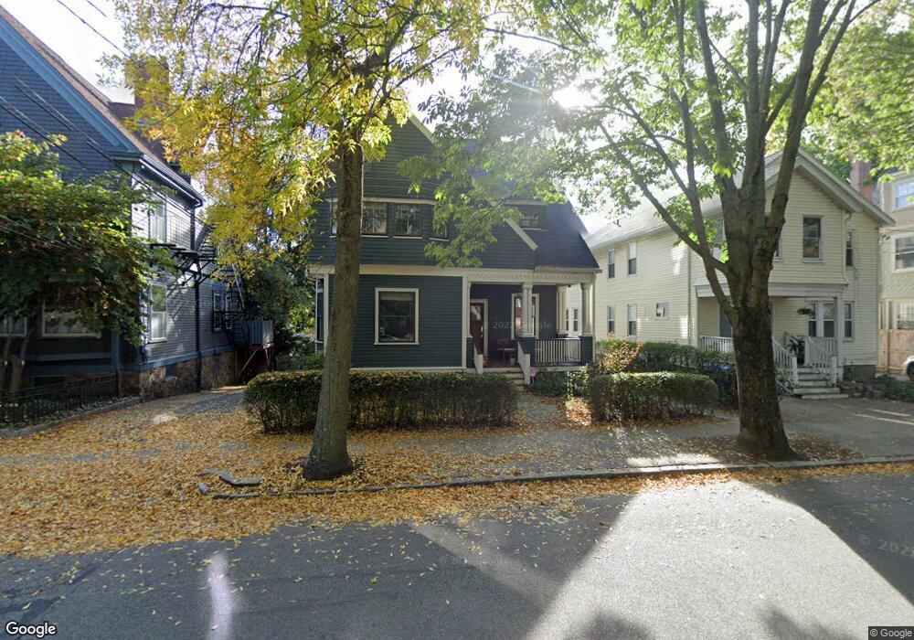
213 Aspinwall Ave Brookline, MA 02446
Brookline Village NeighborhoodEstimated Value: $2,926,247 - $3,078,000
3
Beds
4
Baths
3,314
Sq Ft
$898/Sq Ft
Est. Value
About This Home
This home is located at 213 Aspinwall Ave, Brookline, MA 02446 and is currently estimated at $2,977,562, approximately $898 per square foot. 213 Aspinwall Ave is a home located in Norfolk County with nearby schools including Amos A. Lawrence School, Brookline High School, and St. Mary of the Assumption Elementary School.
Ownership History
Date
Name
Owned For
Owner Type
Purchase Details
Closed on
Apr 8, 2019
Sold by
Teumer Jeffrey K and Teumer Nancy E
Bought by
Croteau Ryan and Budde Priya P
Current Estimated Value
Home Financials for this Owner
Home Financials are based on the most recent Mortgage that was taken out on this home.
Original Mortgage
$1,760,000
Outstanding Balance
$1,550,468
Interest Rate
4.4%
Mortgage Type
Purchase Money Mortgage
Estimated Equity
$1,427,094
Purchase Details
Closed on
Dec 29, 1993
Sold by
213 Aspinwall Rt
Bought by
Teumer Jeffrey K and Teumer Nancy E
Home Financials for this Owner
Home Financials are based on the most recent Mortgage that was taken out on this home.
Original Mortgage
$270,000
Interest Rate
7%
Mortgage Type
Purchase Money Mortgage
Create a Home Valuation Report for This Property
The Home Valuation Report is an in-depth analysis detailing your home's value as well as a comparison with similar homes in the area
Home Values in the Area
Average Home Value in this Area
Purchase History
| Date | Buyer | Sale Price | Title Company |
|---|---|---|---|
| Croteau Ryan | $2,200,000 | -- | |
| Teumer Jeffrey K | $300,000 | -- |
Source: Public Records
Mortgage History
| Date | Status | Borrower | Loan Amount |
|---|---|---|---|
| Open | Croteau Ryan | $1,760,000 | |
| Previous Owner | Teumer Jeffrey K | $200,000 | |
| Previous Owner | Teumer Jeffrey K | $414,400 | |
| Previous Owner | Teumer Jeffrey K | $417,000 | |
| Previous Owner | Teumer Jeffrey K | $270,000 |
Source: Public Records
Tax History
| Year | Tax Paid | Tax Assessment Tax Assessment Total Assessment is a certain percentage of the fair market value that is determined by local assessors to be the total taxable value of land and additions on the property. | Land | Improvement |
|---|---|---|---|---|
| 2025 | $26,781 | $2,713,400 | $1,184,500 | $1,528,900 |
| 2024 | $25,512 | $2,611,300 | $1,139,000 | $1,472,300 |
| 2023 | $23,051 | $2,312,000 | $941,500 | $1,370,500 |
| 2022 | $22,438 | $2,202,000 | $896,700 | $1,305,300 |
| 2021 | $20,750 | $2,117,300 | $862,200 | $1,255,100 |
| 2020 | $19,098 | $2,021,000 | $783,800 | $1,237,200 |
| 2019 | $18,035 | $1,924,800 | $746,500 | $1,178,300 |
| 2018 | $16,436 | $1,737,400 | $597,000 | $1,140,400 |
| 2017 | $16,193 | $1,639,000 | $563,200 | $1,075,800 |
| 2016 | $15,961 | $1,531,800 | $526,300 | $1,005,500 |
| 2015 | $14,812 | $1,386,900 | $447,200 | $939,700 |
| 2014 | $15,472 | $1,358,400 | $406,500 | $951,900 |
Source: Public Records
Map
Nearby Homes
- 216 Aspinwall Ave
- 216 Aspinwall Ave Unit 3
- 61 Toxteth St
- 106 Brook St
- 15 Kent Square
- 58 Kent St Unit 302
- 58 Kent St Unit 301
- 58 Kent St Unit 303
- 58 Kent St Unit 304
- 58 Kent St Unit 402
- 58 Kent St Unit 404
- 6 Parkway Rd Unit 6
- 48 Kent St Unit 5
- 14 Linden St Unit 8
- 37 Saint Paul St Unit 3
- 65 Francis St Unit A
- 15 Francis St Unit 16
- 57 Saint Paul St Unit 19
- 81 Francis St Unit 2
- 36 Saint Paul St Unit B
- 213 Aspinwall Ave
- 209 Aspinwall Ave
- 219 Aspinwall Ave
- 219 Aspinwall Ave Unit R
- 207 Aspinwall Ave
- 31 Brook St
- 223 Aspinwall Ave
- 203 Aspinwall Ave
- 37 Brook St
- 37 Brook St Unit 37 Brook St
- 37 Brook St Unit 1
- 37 Brook St Unit 12A
- 37 Brook St Unit 2
- 37 Brook St Unit 3
- 33 Brook St Unit 1
- 33 Brook St
- 220 Aspinwall Ave
- 27 Brook St
- 25 Brook St
- 208 Aspinwall Ave Unit B
Your Personal Tour Guide
Ask me questions while you tour the home.