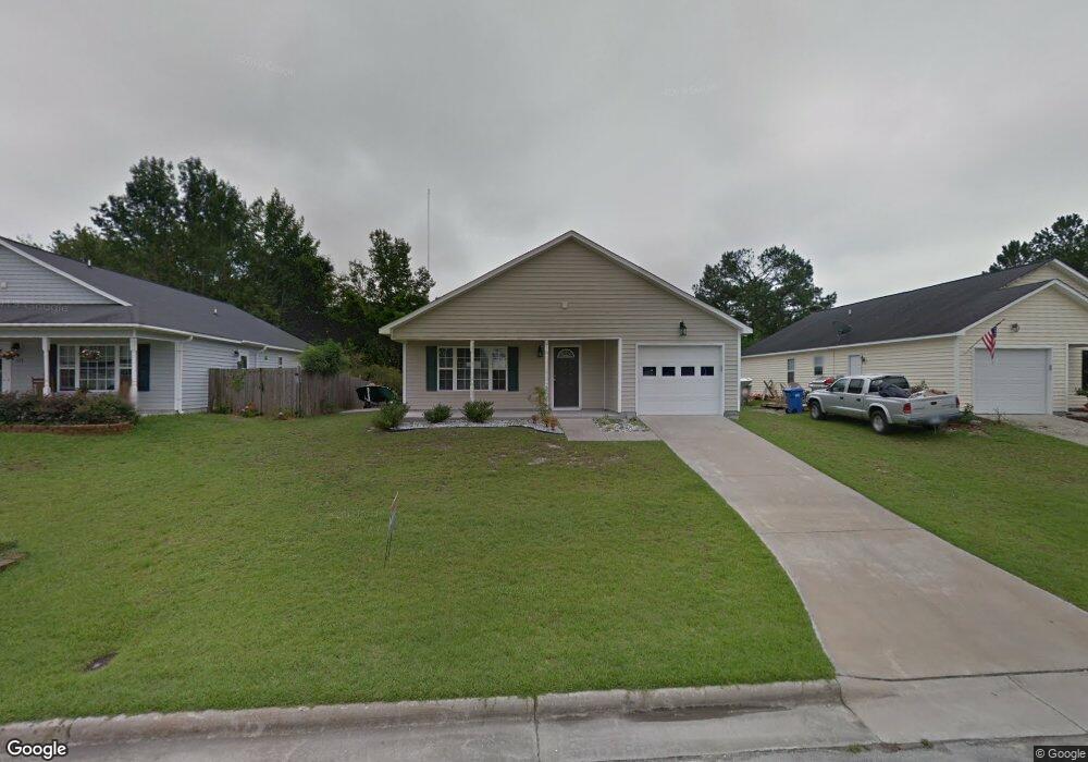
213 Attmore Dr New Bern, NC 28560
Estimated Value: $207,000 - $242,000
4
Beds
2
Baths
1,559
Sq Ft
$144/Sq Ft
Est. Value
About This Home
This home is located at 213 Attmore Dr, New Bern, NC 28560 and is currently estimated at $224,165, approximately $143 per square foot. 213 Attmore Dr is a home located in Craven County with nearby schools including Oaks Road Academy, H.J. MacDonald Middle School, and New Bern High School.
Ownership History
Date
Name
Owned For
Owner Type
Purchase Details
Closed on
Jul 14, 2022
Sold by
Mar and Mu
Bought by
Perez Victoriano Gonzalez
Current Estimated Value
Purchase Details
Closed on
Mar 27, 2013
Sold by
Equity Trust Co and Burt Ira Barbara T
Bought by
Mar Shee
Home Financials for this Owner
Home Financials are based on the most recent Mortgage that was taken out on this home.
Original Mortgage
$88,369
Interest Rate
3.25%
Mortgage Type
FHA
Purchase Details
Closed on
Dec 10, 2012
Sold by
Wells Fargo Bank Na
Bought by
Equity Trust Co
Purchase Details
Closed on
Feb 29, 2012
Sold by
Elster Elsie F
Bought by
Wells Fargo Bank N A
Purchase Details
Closed on
Oct 6, 2006
Sold by
Zaytoun & Raines Construction Co Inc
Bought by
Elster Elsie F
Home Financials for this Owner
Home Financials are based on the most recent Mortgage that was taken out on this home.
Original Mortgage
$110,960
Interest Rate
6.36%
Mortgage Type
New Conventional
Create a Home Valuation Report for This Property
The Home Valuation Report is an in-depth analysis detailing your home's value as well as a comparison with similar homes in the area
Home Values in the Area
Average Home Value in this Area
Purchase History
| Date | Buyer | Sale Price | Title Company |
|---|---|---|---|
| Perez Victoriano Gonzalez | $165,000 | Moeller Pa | |
| Mar Shee | $90,000 | None Available | |
| Equity Trust Co | $65,000 | None Available | |
| Wells Fargo Bank N A | $108,000 | None Available | |
| Elster Elsie F | $139,000 | None Available |
Source: Public Records
Mortgage History
| Date | Status | Borrower | Loan Amount |
|---|---|---|---|
| Previous Owner | Mar Shee | $88,369 | |
| Previous Owner | Elster Elsie F | $110,960 |
Source: Public Records
Tax History
| Year | Tax Paid | Tax Assessment Tax Assessment Total Assessment is a certain percentage of the fair market value that is determined by local assessors to be the total taxable value of land and additions on the property. | Land | Improvement |
|---|---|---|---|---|
| 2025 | $1,551 | $177,150 | $30,000 | $147,150 |
| 2024 | $1,551 | $177,150 | $30,000 | $147,150 |
| 2023 | $1,521 | $177,150 | $30,000 | $147,150 |
| 2022 | $1,196 | $108,970 | $22,500 | $86,470 |
| 2021 | $1,196 | $108,970 | $22,500 | $86,470 |
| 2020 | $1,184 | $108,970 | $22,500 | $86,470 |
| 2019 | $1,184 | $108,970 | $22,500 | $86,470 |
| 2018 | $1,125 | $108,970 | $22,500 | $86,470 |
| 2017 | $1,125 | $108,970 | $22,500 | $86,470 |
| 2016 | $1,125 | $139,990 | $25,000 | $114,990 |
| 2015 | $1,264 | $139,990 | $25,000 | $114,990 |
| 2014 | $1,264 | $139,990 | $25,000 | $114,990 |
Source: Public Records
Map
Nearby Homes
- 218 Attmore Dr
- 210 Glenburnie Dr
- 204 Glenburnie Dr
- 3611 Windy Trail
- 110 Jenny Lisa Ln
- Tbd Jenny Lisa Ln
- 219 Trappers Trail
- 107 Poplar St
- 201 Ellington St
- 2803 Oakland Ave
- 1507 Laurel St
- 109 Beech St
- 1413 Phillips Ave
- 1410 Phillips Ave
- 134 Meadow View Dr
- 1810 Wilmington St
- 113 Sweetbriar Ct
- 1804 River Dr
- 1708 National Ave
- 1308 Benfield Ave
Your Personal Tour Guide
Ask me questions while you tour the home.