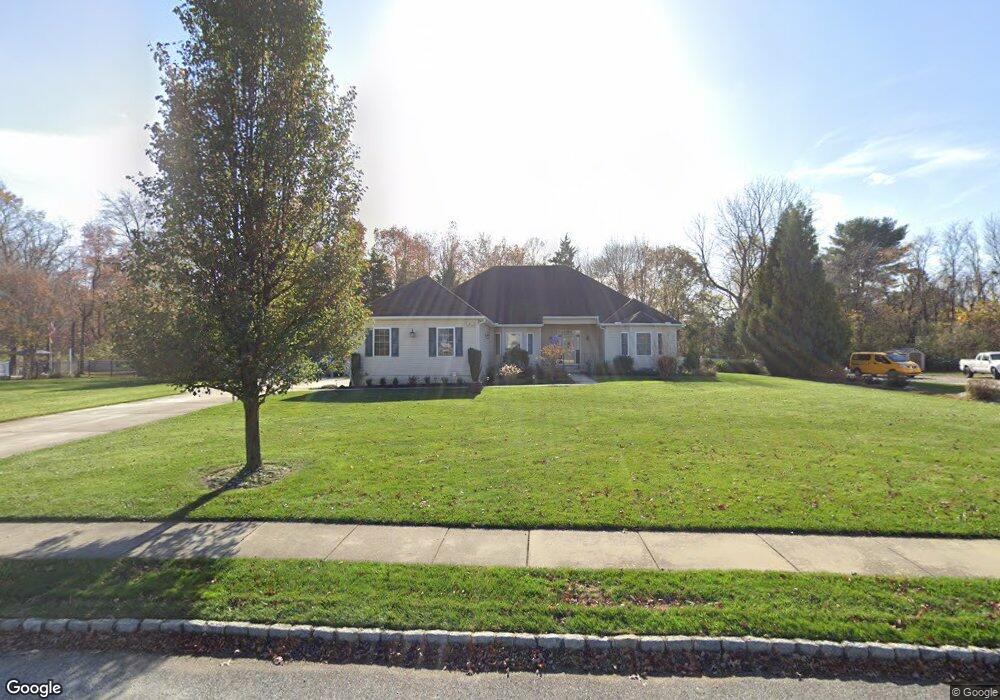
213 Barbara Ln Franklinville, NJ 08322
Franklin Township NeighborhoodEstimated Value: $352,000 - $634,000
--
Bed
--
Bath
2,229
Sq Ft
$218/Sq Ft
Est. Value
About This Home
This home is located at 213 Barbara Ln, Franklinville, NJ 08322 and is currently estimated at $485,533, approximately $217 per square foot. 213 Barbara Ln is a home located in Gloucester County with nearby schools including Delsea Regional Middle School, Delsea Regional High School, and St. Mary School.
Ownership History
Date
Name
Owned For
Owner Type
Purchase Details
Closed on
Aug 26, 2005
Sold by
Signature Homes At Autumn Estates Llc
Bought by
Mayhew James and Mayhew Patricia P
Current Estimated Value
Home Financials for this Owner
Home Financials are based on the most recent Mortgage that was taken out on this home.
Original Mortgage
$342,000
Interest Rate
5.79%
Mortgage Type
Fannie Mae Freddie Mac
Create a Home Valuation Report for This Property
The Home Valuation Report is an in-depth analysis detailing your home's value as well as a comparison with similar homes in the area
Home Values in the Area
Average Home Value in this Area
Purchase History
| Date | Buyer | Sale Price | Title Company |
|---|---|---|---|
| Mayhew James | $428,025 | Congress |
Source: Public Records
Mortgage History
| Date | Status | Borrower | Loan Amount |
|---|---|---|---|
| Previous Owner | Mayhew James | $342,000 |
Source: Public Records
Tax History Compared to Growth
Tax History
| Year | Tax Paid | Tax Assessment Tax Assessment Total Assessment is a certain percentage of the fair market value that is determined by local assessors to be the total taxable value of land and additions on the property. | Land | Improvement |
|---|---|---|---|---|
| 2025 | $10,612 | $277,300 | $48,000 | $229,300 |
| 2024 | $10,360 | $277,300 | $48,000 | $229,300 |
| 2023 | $10,360 | $277,300 | $48,000 | $229,300 |
| 2022 | $10,083 | $277,300 | $48,000 | $229,300 |
| 2021 | $9,936 | $277,300 | $48,000 | $229,300 |
| 2020 | $9,808 | $277,300 | $48,000 | $229,300 |
| 2019 | $9,672 | $277,300 | $48,000 | $229,300 |
| 2018 | $9,534 | $277,300 | $48,000 | $229,300 |
| 2017 | $9,323 | $277,300 | $48,000 | $229,300 |
| 2016 | $9,276 | $277,300 | $48,000 | $229,300 |
| 2015 | $8,907 | $277,300 | $48,000 | $229,300 |
| 2014 | $8,571 | $277,300 | $48,000 | $229,300 |
Source: Public Records
Map
Nearby Homes
- 613 Cedar Ave
- 3060 Williamstown Rd
- 1241 Clayton Rd
- 109 Holly Rd
- 271 Kille Rd
- 945 E Washington Ave
- 161 Deschler Blvd
- 611 Fries Mill Rd
- 201 Luray Dr
- 236 S Tuckahoe Rd
- 208 Ripley Ct
- 1037 Suffolk Dr
- 18 Fisler Dr
- 4516 Tuckahoe Rd
- 1825 Hessian Dr
- 1921 Janvier Rd
- 1704 Grant Ave
- 1642 Janvier Rd
- 442 Clearfield Ave
- 366 N Tuckahoe Rd
- 211 Barbara Ln
- 215 Barbara Ln
- 546 Kessel Ave
- 556 Kessel Ave
- 214 Barbara Ln
- 209 Barbara Ln
- 217 Barbara Ln
- 542 Kessel Ave
- 566 Kessel Ave
- 210 Barbara Ln
- 216 Barbara Ln
- 578 Kessel Ave
- 549 Kessel Ave
- 557 Kessel Ave
- 207 Barbara Ln
- 219 Barbara Ln
- 567 Kessel Ave
- 5 Christopher Ct
- 588 Kessel Ave
- 218 Barbara Ln