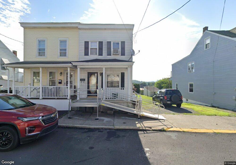
213 Broad St Unit 215 Saint Clair, PA 17970
Estimated Value: $88,000 - $140,000
2
Beds
2
Baths
1,083
Sq Ft
$101/Sq Ft
Est. Value
About This Home
This home is located at 213 Broad St Unit 215, Saint Clair, PA 17970 and is currently estimated at $109,184, approximately $100 per square foot. 213 Broad St Unit 215 is a home located in Schuylkill County with nearby schools including Saint Clair Area Elementary/Middle School, Gillingham Charter School, and ASSUMPTION BVM SCHOOL.
Ownership History
Date
Name
Owned For
Owner Type
Purchase Details
Closed on
Aug 23, 2016
Sold by
Tomlko Joshua
Bought by
Falbo Ronald
Current Estimated Value
Home Financials for this Owner
Home Financials are based on the most recent Mortgage that was taken out on this home.
Original Mortgage
$27,550
Outstanding Balance
$21,946
Interest Rate
3.43%
Mortgage Type
New Conventional
Estimated Equity
$87,238
Create a Home Valuation Report for This Property
The Home Valuation Report is an in-depth analysis detailing your home's value as well as a comparison with similar homes in the area
Home Values in the Area
Average Home Value in this Area
Purchase History
| Date | Buyer | Sale Price | Title Company |
|---|---|---|---|
| Falbo Ronald | $29,000 | None Available |
Source: Public Records
Mortgage History
| Date | Status | Borrower | Loan Amount |
|---|---|---|---|
| Open | Falbo Ronald | $27,550 |
Source: Public Records
Tax History Compared to Growth
Tax History
| Year | Tax Paid | Tax Assessment Tax Assessment Total Assessment is a certain percentage of the fair market value that is determined by local assessors to be the total taxable value of land and additions on the property. | Land | Improvement |
|---|---|---|---|---|
| 2025 | $1,004 | $14,700 | $4,800 | $9,900 |
| 2024 | $956 | $14,700 | $4,800 | $9,900 |
| 2023 | $956 | $14,700 | $4,800 | $9,900 |
| 2022 | $956 | $14,700 | $4,800 | $9,900 |
| 2021 | $965 | $14,700 | $4,800 | $9,900 |
| 2020 | $965 | $14,700 | $4,800 | $9,900 |
| 2018 | $947 | $14,700 | $4,800 | $9,900 |
| 2017 | $914 | $14,700 | $4,800 | $9,900 |
| 2015 | -- | $14,885 | $4,800 | $10,085 |
| 2011 | -- | $14,885 | $0 | $0 |
Source: Public Records
Map
Nearby Homes
- 249 Chestnut St
- 311 Broad St
- 309 Chestnut St
- 48 N 2nd St
- 122 S 3rd St
- 10 N Front St
- 8 S Front St
- 12 N Front St
- 101 S 2nd St
- 219 S 3rd St
- 26 S Nichols St
- 320 S Mill St
- 229 S Nichols St
- 438 S Front St
- Lot 30 Elmwood Ct
- 0 - Lot 10 Elmwood Ct Unit 10
- 762 Port Carbon Saint Clair Hwy
- 714 Port Carbon Saint Clair Hwy
- 0 Caroline Ave Unit PASK2022658
- 15 Marcello Dr