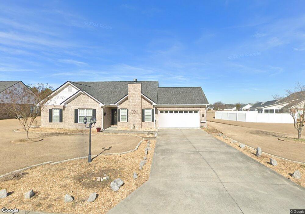
213 Brookstone Dr SW Calhoun, GA 30701
Estimated Value: $270,711 - $292,000
3
Beds
2
Baths
1,422
Sq Ft
$198/Sq Ft
Est. Value
About This Home
This home is located at 213 Brookstone Dr SW, Calhoun, GA 30701 and is currently estimated at $281,928, approximately $198 per square foot. 213 Brookstone Dr SW is a home located in Gordon County with nearby schools including Calhoun Primary School, Calhoun Elementary School, and Calhoun Middle School.
Ownership History
Date
Name
Owned For
Owner Type
Purchase Details
Closed on
Sep 12, 2025
Sold by
Duke Robert T
Bought by
Young Brian
Current Estimated Value
Purchase Details
Closed on
May 31, 2024
Sold by
Oneal Haley Jon
Bought by
Hc Oneal Properties Llc
Purchase Details
Closed on
Jan 17, 2024
Sold by
Duke Debbie S
Bought by
Duke Debbie S and Duke Robert T
Purchase Details
Closed on
Jan 1, 2024
Sold by
Duke Debbie S
Bought by
Duke Debbie S and Duke Robert T
Purchase Details
Closed on
Aug 15, 2005
Sold by
Brown Debbie S
Bought by
Duke Debbie S
Purchase Details
Closed on
Apr 2, 2004
Sold by
Calhoun Realty & Development Co Inc
Bought by
Brown Debbie S
Create a Home Valuation Report for This Property
The Home Valuation Report is an in-depth analysis detailing your home's value as well as a comparison with similar homes in the area
Home Values in the Area
Average Home Value in this Area
Purchase History
| Date | Buyer | Sale Price | Title Company |
|---|---|---|---|
| Young Brian | $235,000 | -- | |
| Hc Oneal Properties Llc | $110,000 | -- | |
| Duke Debbie S | -- | -- | |
| Duke Debbie S | -- | -- | |
| Duke Debbie S | -- | -- | |
| Brown Debbie S | $123,900 | -- |
Source: Public Records
Tax History Compared to Growth
Tax History
| Year | Tax Paid | Tax Assessment Tax Assessment Total Assessment is a certain percentage of the fair market value that is determined by local assessors to be the total taxable value of land and additions on the property. | Land | Improvement |
|---|---|---|---|---|
| 2024 | $2,600 | $92,480 | $5,200 | $87,280 |
| 2023 | $2,429 | $86,400 | $5,200 | $81,200 |
| 2022 | $768 | $80,720 | $5,200 | $75,520 |
| 2021 | $1,990 | $66,840 | $7,000 | $59,840 |
| 2020 | $1,862 | $62,040 | $7,000 | $55,040 |
| 2019 | $1,859 | $62,040 | $7,000 | $55,040 |
| 2018 | $554 | $57,520 | $7,000 | $50,520 |
| 2017 | $537 | $54,640 | $7,000 | $47,640 |
| 2016 | $538 | $54,640 | $7,000 | $47,640 |
| 2015 | $536 | $53,720 | $7,000 | $46,720 |
| 2014 | $507 | $51,531 | $7,000 | $44,531 |
Source: Public Records
Map
Nearby Homes
- 130 Brookstone Dr SW
- 137 Regency Row SW
- 121 Foxhall Dr SW
- 413 Beamer Rd SW
- 176 Village Way SW
- The Braselton II Plan at Fair Oak
- The Reynolds Plan at Fair Oak
- The Buford II Plan at Fair Oak
- The Lawson Plan at Fair Oak
- The Caldwell Plan at Fair Oak
- The Benson II Plan at Fair Oak
- The Greenbrier II Plan at Fair Oak
- 210 Madison Dr SW
- 0 Highway 53 Spur SW Unit 7529096
- 215 Wilson St
- 227 Mcconnell Rd
- 00 Belmont Dr
- 139 Red Oak Ln
- 100 Neal St
- 85 Professional Place Unit 14
- 215 Brookstone Dr SW
- 218 Brookstone Dr SW
- 211 Brookstone Dr SW
- 220 Brookstone Dr SW
- 310 Hillside Dr SW
- 217 Brookstone Dr SW
- 216 Brookstone Dr SW
- 308 Hillside Dr SW
- 222 Brookstone Dr SW
- 214 Brookstone Dr SW
- 209 Brookstone Dr SW
- 312 Hillside Dr SW
- 219 Brookstone Dr SW
- 212 Brookstone Dr SW
- 306 Hillside Dr SW
- 210 Brookstone Dr SW
- 224 Brookstone Dr SW
- 207 Brookstone Dr SW
- 221 Brookstone Dr SW
- 311 Hillside Dr SW