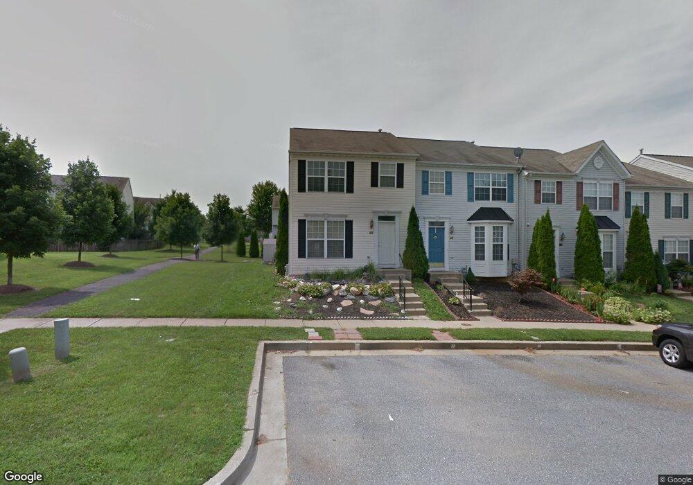
213 Browwood Rd Reisterstown, MD 21136
Estimated Value: $366,000 - $389,365
4
Beds
4
Baths
2,326
Sq Ft
$162/Sq Ft
Est. Value
About This Home
This home is located at 213 Browwood Rd, Reisterstown, MD 21136 and is currently estimated at $377,091, approximately $162 per square foot. 213 Browwood Rd is a home located in Baltimore County with nearby schools including Franklin Elementary School, Franklin Middle, and Franklin High.
Ownership History
Date
Name
Owned For
Owner Type
Purchase Details
Closed on
Oct 6, 2022
Sold by
Ishmukhartiedov Khayot
Bought by
Ishmukhamedov Khayot and Ishmukhamedova Kholida
Current Estimated Value
Purchase Details
Closed on
Jul 1, 2020
Sold by
Vazgiel Michael and Alkalay Limor
Bought by
Ishmukhamedov Khayot and Ishmukhamedova Hilola
Home Financials for this Owner
Home Financials are based on the most recent Mortgage that was taken out on this home.
Original Mortgage
$253,400
Interest Rate
3.1%
Mortgage Type
New Conventional
Purchase Details
Closed on
Jun 9, 2000
Sold by
Bob Ward At Baltimore County Llc
Bought by
Vazgiel Michael and Alkalay Lior
Purchase Details
Closed on
Sep 27, 1999
Sold by
Glyndon Development Llc
Bought by
Bob Ward At Baltimore County Llc
Create a Home Valuation Report for This Property
The Home Valuation Report is an in-depth analysis detailing your home's value as well as a comparison with similar homes in the area
Home Values in the Area
Average Home Value in this Area
Purchase History
| Date | Buyer | Sale Price | Title Company |
|---|---|---|---|
| Ishmukhamedov Khayot | -- | -- | |
| Ishmukhamedov Khayot | $277,277 | None Available | |
| Vazgiel Michael | $138,200 | -- | |
| Bob Ward At Baltimore County Llc | $205,590 | -- |
Source: Public Records
Mortgage History
| Date | Status | Borrower | Loan Amount |
|---|---|---|---|
| Previous Owner | Ishmukhamedov Khayot | $253,400 |
Source: Public Records
Tax History Compared to Growth
Tax History
| Year | Tax Paid | Tax Assessment Tax Assessment Total Assessment is a certain percentage of the fair market value that is determined by local assessors to be the total taxable value of land and additions on the property. | Land | Improvement |
|---|---|---|---|---|
| 2025 | $4,068 | $300,033 | -- | -- |
| 2024 | $4,068 | $274,500 | $63,000 | $211,500 |
| 2023 | $2,036 | $263,933 | $0 | $0 |
| 2022 | $4,098 | $253,367 | $0 | $0 |
| 2021 | $3,639 | $242,800 | $63,000 | $179,800 |
| 2020 | $3,894 | $237,067 | $0 | $0 |
| 2019 | $2,804 | $231,333 | $0 | $0 |
| 2018 | $3,708 | $225,600 | $63,000 | $162,600 |
| 2017 | $3,442 | $221,833 | $0 | $0 |
| 2016 | $2,719 | $218,067 | $0 | $0 |
| 2015 | $2,719 | $214,300 | $0 | $0 |
| 2014 | $2,719 | $214,300 | $0 | $0 |
Source: Public Records
Map
Nearby Homes
- 4 Wolf Ave
- 100 1st Ave
- 131 Westminster Rd
- 223 New Ave
- 7 Butler Rd
- 10 Pennyborough Ct
- 65A Bond Ave
- 123 Glyndon Trace Dr
- 259 E Chatsworth Ave
- 13943 B Old Hanover Rd
- 13943 D Old Hanover Rd
- 13943 C Old Hanover Rd
- 3 Meadow Mist Ct
- 120 Lamport Rd
- 15 Gloucester Ct
- 225 Highmeadow Rd
- 9 Norris Run Ct
- 341 Central Ave
- 926 Nicodemus Rd
- 701 Cockeys Mill Rd
- 213 Brownwood Rd
- 215 Brownwood Rd
- 217 Brownwood Rd
- 219 Brownwood Rd
- 211 Brownwood Rd
- 221 Brownwood Rd
- 221 Browwood Rd
- 209 Brownwood Rd
- 238 Pidco Rd
- 236 Pidco Rd
- 240 Pidco Rd
- 223 Brownwood Rd
- 223 Browwood Rd
- 207 Brownwood Rd
- 242 Pidco Rd
- 205 Browwood Rd
- 244 Pidco Rd
- 205 Brownwood Rd
- 234 Pidco Rd
- 225 Brownwood Rd