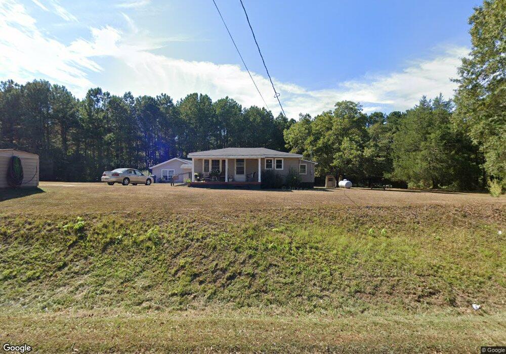
213 Cannafax Rd Barnesville, GA 30204
Estimated Value: $256,536 - $272,000
2
Beds
2
Baths
1,993
Sq Ft
$132/Sq Ft
Est. Value
About This Home
This home is located at 213 Cannafax Rd, Barnesville, GA 30204 and is currently estimated at $263,845, approximately $132 per square foot. 213 Cannafax Rd is a home located in Lamar County with nearby schools including Lamar County Primary School, Lamar County Elementary School, and Lamar County Middle School.
Ownership History
Date
Name
Owned For
Owner Type
Purchase Details
Closed on
Dec 6, 2022
Sold by
Stevans Edith W
Bought by
Stevans Edith W and Stevens Dewitt Clayton
Current Estimated Value
Purchase Details
Closed on
Sep 22, 2008
Sold by
Washington Ruth W
Bought by
Washington Ruth W and Stevens Edith W
Purchase Details
Closed on
Dec 18, 1987
Sold by
Washington Melvin E
Bought by
Washington Melvin E & Ruth W
Purchase Details
Closed on
Dec 1, 1985
Sold by
Washington George
Bought by
Washington Melvin
Create a Home Valuation Report for This Property
The Home Valuation Report is an in-depth analysis detailing your home's value as well as a comparison with similar homes in the area
Home Values in the Area
Average Home Value in this Area
Purchase History
| Date | Buyer | Sale Price | Title Company |
|---|---|---|---|
| Stevans Edith W | -- | -- | |
| Washington Ruth W | -- | -- | |
| Washington Melvin E & Ruth W | -- | -- | |
| Washington Melvin | -- | -- |
Source: Public Records
Tax History Compared to Growth
Tax History
| Year | Tax Paid | Tax Assessment Tax Assessment Total Assessment is a certain percentage of the fair market value that is determined by local assessors to be the total taxable value of land and additions on the property. | Land | Improvement |
|---|---|---|---|---|
| 2024 | $1,730 | $67,593 | $22,383 | $45,210 |
| 2023 | $1,788 | $64,767 | $22,383 | $42,384 |
| 2022 | $887 | $50,324 | $15,188 | $35,136 |
| 2021 | $610 | $38,522 | $11,278 | $27,244 |
| 2020 | $642 | $38,522 | $11,278 | $27,244 |
| 2019 | $644 | $38,522 | $11,278 | $27,244 |
| 2018 | $618 | $38,522 | $11,278 | $27,244 |
| 2017 | $744 | $38,522 | $11,278 | $27,244 |
| 2016 | $749 | $38,522 | $11,278 | $27,244 |
| 2015 | $747 | $38,522 | $11,278 | $27,244 |
| 2014 | $729 | $38,522 | $11,278 | $27,244 |
| 2013 | -- | $38,521 | $11,277 | $27,244 |
Source: Public Records
Map
Nearby Homes
- 0 Piedmont Rd Unit 10600733
- 1070 Highway 18 W
- 967 Five Points Rd
- 178 Barnesville Ave
- 0 Washington Cir
- 295 Grove St
- 13 Brown St
- 407 Westchester Dr
- 123 Needleleaf Ct
- 113 Heatherwood Ln
- 428 Elm St
- 135 Meansville Rd
- 245 Atlanta St
- 818 Cannafax Rd
- 115 Silver Dollar Rd
- 225 Atlanta St
- 125 Byrd St
- 0 Silver Dollar Rd Unit 10552561
- 34.61 ACRES Walker Rd
- 704 Old Milner Rd
- 217 Cannafax Rd
- 227 Cannafax Rd
- 865 Highway 18 W
- 897 Highway 18 W
- 873 Georgia 18
- 208 Cannafax Rd
- 179 Cannafax Rd
- 899 Highway 18 W
- 171 Cannafax Rd
- 254 Cannafax Rd
- 894 Highway 18 W
- 913 Highway 18 W
- 913 Highway 18 W
- 825 Highway 18 W
- 927 Georgia 18
- 927 Highway 18 W
- 1064 Five Points Rd
- 1068 Five Points Rd
- 179 Old Milner Rd
- 840 Highway 18 W