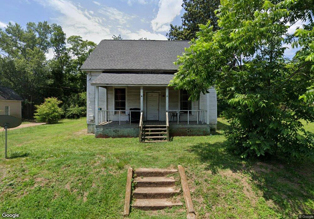
213 Cannon Dr SE Social Circle, GA 30025
Estimated Value: $121,000 - $239,000
--
Bed
--
Bath
1,262
Sq Ft
$147/Sq Ft
Est. Value
About This Home
This home is located at 213 Cannon Dr SE, Social Circle, GA 30025 and is currently estimated at $185,398, approximately $146 per square foot. 213 Cannon Dr SE is a home located in Walton County with nearby schools including Social Circle Primary School, Social Circle Elementary School, and Social Circle Middle School.
Ownership History
Date
Name
Owned For
Owner Type
Purchase Details
Closed on
Sep 16, 2015
Sold by
The Amsterdam Grp Llc
Bought by
Escobar Ricardo and Escobar Miriam
Current Estimated Value
Home Financials for this Owner
Home Financials are based on the most recent Mortgage that was taken out on this home.
Original Mortgage
$25,000
Interest Rate
3.97%
Mortgage Type
New Conventional
Purchase Details
Closed on
Dec 9, 2008
Sold by
Peters Louise K
Bought by
Amsterdam Group Llc
Home Financials for this Owner
Home Financials are based on the most recent Mortgage that was taken out on this home.
Original Mortgage
$36,000
Interest Rate
6.01%
Mortgage Type
New Conventional
Create a Home Valuation Report for This Property
The Home Valuation Report is an in-depth analysis detailing your home's value as well as a comparison with similar homes in the area
Home Values in the Area
Average Home Value in this Area
Purchase History
| Date | Buyer | Sale Price | Title Company |
|---|---|---|---|
| Escobar Ricardo | $30,000 | -- | |
| Amsterdam Group Llc | $40,000 | -- |
Source: Public Records
Mortgage History
| Date | Status | Borrower | Loan Amount |
|---|---|---|---|
| Closed | Escobar Ricardo | $25,000 | |
| Previous Owner | Amsterdam Group Llc | $36,000 |
Source: Public Records
Tax History Compared to Growth
Tax History
| Year | Tax Paid | Tax Assessment Tax Assessment Total Assessment is a certain percentage of the fair market value that is determined by local assessors to be the total taxable value of land and additions on the property. | Land | Improvement |
|---|---|---|---|---|
| 2024 | $1,382 | $38,840 | $16,000 | $22,840 |
| 2023 | $1,264 | $34,960 | $14,000 | $20,960 |
| 2022 | $282 | $27,120 | $8,000 | $19,120 |
| 2021 | $252 | $24,160 | $7,200 | $16,960 |
| 2020 | $256 | $24,000 | $7,200 | $16,800 |
| 2019 | $243 | $20,160 | $4,800 | $15,360 |
| 2018 | $220 | $20,160 | $4,800 | $15,360 |
| 2017 | $634 | $15,160 | $3,200 | $11,960 |
| 2016 | $136 | $13,360 | $3,200 | $10,160 |
| 2015 | $144 | $12,780 | $3,200 | $9,580 |
| 2014 | $142 | $11,980 | $3,200 | $8,780 |
Source: Public Records
Map
Nearby Homes
- 241 E Ash St
- 582 S Cherokee Rd
- Adrian Plan at Conner Springs
- Sinclair Plan at Conner Springs
- Shiloh Plan at Conner Springs
- Mira Plan at Conner Springs
- Hemingway Plan at Conner Springs
- Harding Plan at Conner Springs
- Tucker Front Porch Plan at Conner Springs
- 207 E Hightower Trail
- 177 ORWELL Drive
- 432 Chestnut St
- 135 N Dogwood Ave
- 127 Holly St NE
- 159 S Forest Ave
- 603 Lakewood Dr SW
- 178 Elder Dr SE
- 178 Elder Dr SE Unit 103
- 357 W Hightower Trail
- 304 Dogwood Ave
- 225 Cannon Dr SE
- 206 Misty Ln Unit A
- 206 Misty Ln Unit B
- 206 Misty Ln Unit A/B
- 209 Misty Ln Unit B
- 209 Misty Ln Unit A
- 209 Misty Ln Unit A/B
- 191 Cannon Dr SE
- 0 Taylor Ct Unit 3240889
- 0 Taylor Ct
- 302 Taylor Ct Unit A
- 302 Taylor Ct Unit B
- 302 Taylor Ct
- 214 Cannon Dr SE
- 202 Misty Ln Unit A
- 202 Misty Ln Unit B
- 202 Misty Ln Unit A,B
- 224 Cannon Dr SE
- 205 Misty Ln Unit B
- 205 Misty Ln Unit A