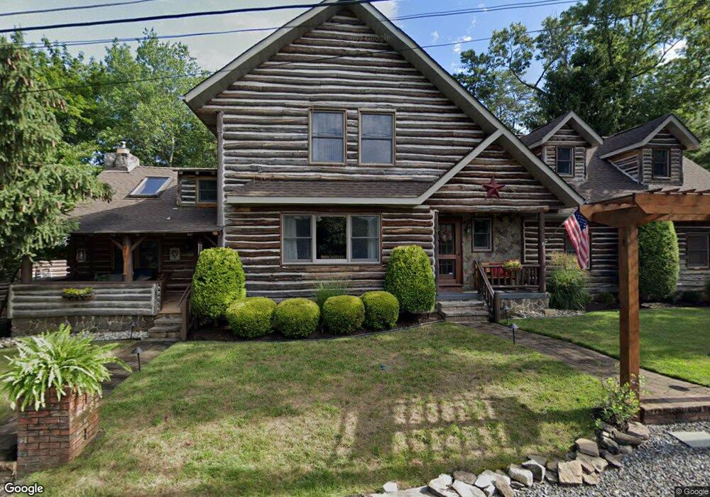
213 Chippewa Trail Medford, NJ 08055
Estimated Value: $800,355 - $994,000
4
Beds
3
Baths
3,042
Sq Ft
$290/Sq Ft
Est. Value
About This Home
This home is located at 213 Chippewa Trail, Medford, NJ 08055 and is currently estimated at $881,839, approximately $289 per square foot. 213 Chippewa Trail is a home located in Burlington County with nearby schools including Nokomis School, Neeta School, and Shawnee High School.
Ownership History
Date
Name
Owned For
Owner Type
Purchase Details
Closed on
Jul 18, 2008
Sold by
Mcbride John T and Mcbride Antonia
Bought by
Hurley Robert and Hurley Kristin A
Current Estimated Value
Home Financials for this Owner
Home Financials are based on the most recent Mortgage that was taken out on this home.
Original Mortgage
$416,000
Outstanding Balance
$273,763
Interest Rate
6.47%
Mortgage Type
Purchase Money Mortgage
Estimated Equity
$608,076
Purchase Details
Closed on
Jan 28, 2004
Sold by
Keenan John B
Bought by
Mcbride John T and Mcbride Antonia
Purchase Details
Closed on
Sep 30, 1997
Sold by
Schmidt William J and Schmidt Cecilia B
Bought by
Keenan John B
Home Financials for this Owner
Home Financials are based on the most recent Mortgage that was taken out on this home.
Original Mortgage
$125,614
Interest Rate
7.46%
Mortgage Type
FHA
Create a Home Valuation Report for This Property
The Home Valuation Report is an in-depth analysis detailing your home's value as well as a comparison with similar homes in the area
Home Values in the Area
Average Home Value in this Area
Purchase History
| Date | Buyer | Sale Price | Title Company |
|---|---|---|---|
| Hurley Robert | $520,000 | Foundation Title | |
| Mcbride John T | $222,000 | -- | |
| Keenan John B | $129,000 | Surety Title Corporation |
Source: Public Records
Mortgage History
| Date | Status | Borrower | Loan Amount |
|---|---|---|---|
| Open | Hurley Robert | $416,000 | |
| Previous Owner | Keenan John B | $125,614 |
Source: Public Records
Tax History Compared to Growth
Tax History
| Year | Tax Paid | Tax Assessment Tax Assessment Total Assessment is a certain percentage of the fair market value that is determined by local assessors to be the total taxable value of land and additions on the property. | Land | Improvement |
|---|---|---|---|---|
| 2025 | $15,854 | $417,000 | $81,700 | $335,300 |
| 2024 | $14,991 | $417,000 | $81,700 | $335,300 |
| 2023 | $14,991 | $417,000 | $81,700 | $335,300 |
| 2022 | $14,666 | $417,000 | $81,700 | $335,300 |
| 2021 | $14,278 | $417,000 | $81,700 | $335,300 |
| 2020 | $13,886 | $417,000 | $81,700 | $335,300 |
| 2019 | $13,861 | $417,000 | $81,700 | $335,300 |
| 2018 | $13,511 | $417,000 | $81,700 | $335,300 |
| 2017 | $12,902 | $417,000 | $81,700 | $335,300 |
| 2016 | $12,581 | $417,000 | $81,700 | $335,300 |
| 2015 | $12,502 | $417,000 | $81,700 | $335,300 |
| 2014 | $12,210 | $417,000 | $81,700 | $335,300 |
Source: Public Records
Map
Nearby Homes
- 56 Decotah Trail
- 19 Cayuga Trail
- 133 Stokes Rd
- 28 Shawnee Trail
- 114 Hiawatha Trail
- 81 Sagamore Trail
- 109 Mohawk Trail
- 125 Sitting Bull Trail
- 38 Lenape Trail
- 42 Lenape Trail
- 178 Nahma Trail
- 6 Rams Gate Ct
- 183 Nahma Trail
- 1322 Stokes Rd
- 65 Cutchogue Trail
- 37 Osage Trail
- 179 Chickahominy Trail
- 98 Nantucket Trail
- 14 Hiawatha Trail
- 9 Hawthorne Dr
- 207 Chippewa Trail
- 201 Chippewa Trail
- 214 Tonkawa Trail
- 199 Chippewa Trail
- 212 Chippewa Trail
- 206 Chippewa Trail
- 210 Chippewa Trail
- 204 Chippewa Trail
- 217 Tonkawa Trail
- 216 Chippewa Trail
- 219 Chippewa Trail
- 197 Chippewa Trail
- 202 Chippewa Trail
- 213 Tonkawa Trail
- 200 Chippewa Trail
- 198 Chippewa Trail
- 210 Tonkawa Trail
- 209 Tonkawa Trail
- 223 Chippewa Trail
- 194 Chippewa Trail