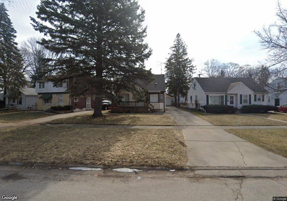
213 Commonwealth Ave Flint, MI 48503
College Cultural Neighborhood NeighborhoodEstimated Value: $96,000 - $120,000
3
Beds
2
Baths
1,367
Sq Ft
$78/Sq Ft
Est. Value
About This Home
This home is located at 213 Commonwealth Ave, Flint, MI 48503 and is currently estimated at $107,059, approximately $78 per square foot. 213 Commonwealth Ave is a home located in Genesee County with nearby schools including Pierce Elementary School, Flint Cultural Center Academy, and WAY Academy of Flint.
Ownership History
Date
Name
Owned For
Owner Type
Purchase Details
Closed on
Feb 8, 2023
Sold by
Logan Deborah A
Bought by
Dal Accounts Llc
Current Estimated Value
Purchase Details
Closed on
May 20, 2010
Sold by
Yberra Kellie and Palma Kellie
Bought by
Ruffin Deborah
Purchase Details
Closed on
Apr 28, 2010
Sold by
Palma Kellie
Bought by
Michigan State Housing Development Autho
Purchase Details
Closed on
May 18, 2001
Sold by
Mckay Matthew John and Mckay Lori M
Bought by
Palma Kellie
Create a Home Valuation Report for This Property
The Home Valuation Report is an in-depth analysis detailing your home's value as well as a comparison with similar homes in the area
Home Values in the Area
Average Home Value in this Area
Purchase History
| Date | Buyer | Sale Price | Title Company |
|---|---|---|---|
| Dal Accounts Llc | -- | -- | |
| Ruffin Deborah | $25,100 | None Available | |
| Michigan State Housing Development Autho | $88,771 | None Available | |
| Palma Kellie | $80,000 | Cislo Title Company |
Source: Public Records
Tax History
| Year | Tax Paid | Tax Assessment Tax Assessment Total Assessment is a certain percentage of the fair market value that is determined by local assessors to be the total taxable value of land and additions on the property. | Land | Improvement |
|---|---|---|---|---|
| 2025 | $3,410 | $42,800 | $0 | $0 |
| 2024 | $3,108 | $44,000 | $0 | $0 |
| 2023 | $1,276 | $35,800 | $0 | $0 |
| 2022 | $0 | $30,300 | $0 | $0 |
| 2021 | $1,296 | $29,700 | $0 | $0 |
| 2020 | $1,186 | $26,200 | $0 | $0 |
| 2019 | $1,154 | $19,500 | $0 | $0 |
| 2018 | $1,159 | $17,600 | $0 | $0 |
| 2017 | $1,127 | $0 | $0 | $0 |
| 2016 | $1,119 | $0 | $0 | $0 |
| 2015 | -- | $0 | $0 | $0 |
| 2014 | -- | $0 | $0 | $0 |
| 2012 | -- | $17,600 | $0 | $0 |
Source: Public Records
Map
Nearby Homes
- 434 Chalmers St
- 605 S Lynch St
- 2119 Mountain Ave
- 2605 Nebraska Ave
- 2013 E Court St
- 2301 Missouri Ave
- 2610 Pennsylvania Ave
- 2415 Pennsylvania Ave
- 2613 Pennsylvania Ave
- 1114 W Vernon Dr
- 1318 Cronk Ave
- 1216 Minnesota Ave
- 2601 Illinois Ave
- 1622 Arlington Ave
- 1210 Blanchard Ave
- 1510 S Franklin Ave
- 1609 Ohio Ave
- 2426 Broadway Blvd
- 1540 Illinois Ave
- 2002 Branch Rd
- 217 Commonwealth Ave
- 209 Commonwealth Ave
- 401 Greenfield Ave
- 205 Commonwealth Ave
- 405 Greenfield Ave
- 422 Chalmers St
- 414 Chalmers St
- 2602 Macomber St
- 409 Greenfield Ave
- 426 Chalmers St
- 410 Chalmers St
- 210 Commonwealth Ave
- 413 Greenfield Ave
- 2612 Macomber St
- 214 Commonwealth Ave
- 222 Commonwealth Ave
- 206 Commonwealth Ave
- 417 Greenfield Ave
- 202 Commonwealth Ave
- 231 Commonwealth Ave
Your Personal Tour Guide
Ask me questions while you tour the home.